Trail Walking Aiguebelette-le-Lac - l'épine d'Aiguelette - Photo
© OpenStreetMap contributors
Length
Length
7.5 km
Max alt
Max alt
960 m
Uphill gradient
Uphill gradient
407 m
Km-Effort
Km-Effort  
12.9 km
Min alt
Min alt
575 m
Downhill gradient
Downhill gradient
396 m
Boucle
Boucle
Yes
Creation date :
2021-08-11 08:14:47.522
Updated on :
2021-08-11 12:22:04.187

(0 Reviews)

Walking
Walking
3h38
Difficulty : Difficult

Scan this QR Code to open this trail in the SityTrail application

FREE GPS app for hiking

Logo SityTrail SityTrail

IGN / Geographical institutes

Download SityTrail from the App Store Download SityTrail from Google Play

Logo SityTrail SityTrail World

The world is yours!

Download SityTrail from the App Store Download SityTrail from Google Play Download SityTrail on Huawei AppGallery

About

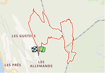
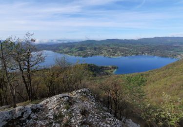
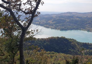
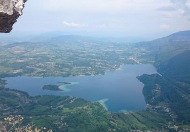
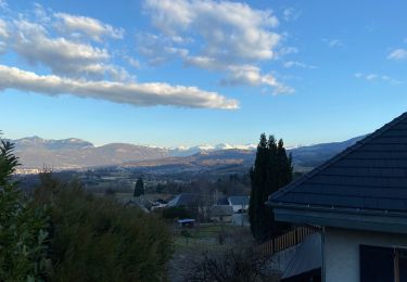
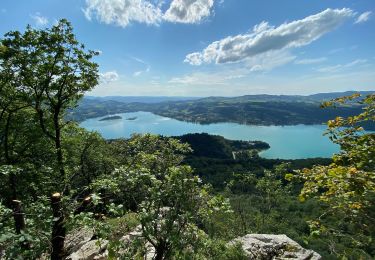
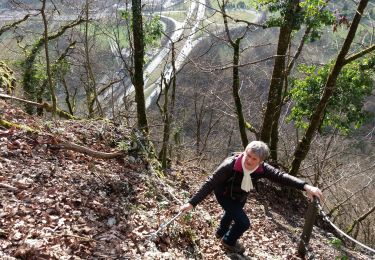
Trail Walking of 7.5 km to be discovered at Auvergne-Rhône-Alpes, Savoy, Aiguebelette-le-Lac. This trail is proposed by gwenola63.

Description

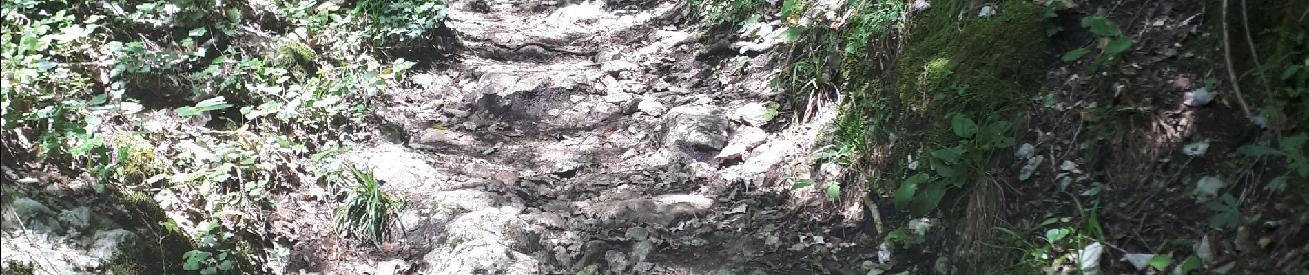
des parties parfois difficiles.

Elevation profile

Photos

Positioning

Country:
France
Region :
Auvergne-Rhône-Alpes
Department/Province :
Savoy
Municipality :
Aiguebelette-le-Lac
Location:
Unknown
Start:(UTM)
720282 ; 5047693 (31T) N.

Trails nearby

Trail Walking Aiguebelette-le-Lac - Mont grêle  - Photo
Walking
grattounette

Walking

Difficult
(2)
Aiguebelette-le-Lac, Auvergne-Rhône-Alpes, Savoy, France
17.8 km | 32 km-effort
8h 5min
Yes
Trail Trail La Motte-Servolex - Château Richard et croix du Signal  - Photo
Trail
nadd73

Trail

Medium
La Motte-Servolex, Auvergne-Rhône-Alpes, Savoy, France
11.1 km | 20 km-effort
2h 1min
Yes
Trail Walking Aiguebelette-le-Lac - Mont Grêle  - Photo
Walking
Zasa

Walking

Medium
Aiguebelette-le-Lac, Auvergne-Rhône-Alpes, Savoy, France
16.3 km | 30 km-effort
5h 0min
Yes
Trail Walking Aiguebelette-le-Lac - Belvédère du Rocher du Corbeau - Photo
Walking
GuyVachet

Walking

Difficult
(1)
Aiguebelette-le-Lac, Auvergne-Rhône-Alpes, Savoy, France
5 km | 9.3 km-effort
2h 7min
Yes
Trail Walking Aiguebelette-le-Lac - aiguebelette, col du crucifix - Photo
Walking
francislassauce

Walking

Difficult
Aiguebelette-le-Lac, Auvergne-Rhône-Alpes, Savoy, France
9.8 km | 17.4 km-effort
4h 14min
Yes
Trail Walking Saint-Thibaud-de-Couz - Mont Grèle - Photo
Walking
Michel_Martin

Walking

Medium
Saint-Thibaud-de-Couz, Auvergne-Rhône-Alpes, Savoy, France
12.1 km | 24 km-effort
4h 30min
Yes
Trail Walking Saint-Sulpice - Col du Crucifix par St Sulpice - Photo
Walking
brigittesontag

Walking

Medium
Saint-Sulpice, Auvergne-Rhône-Alpes, Savoy, France
5.5 km | 10.5 km-effort
2h 40min
Yes
Trail Walking Aiguebelette-le-Lac - L’épine et le lac d’Aiguebelette  - Photo
Walking
choubaka77

Walking

Difficult
(1)
Aiguebelette-le-Lac, Auvergne-Rhône-Alpes, Savoy, France
9.9 km | 17.2 km-effort
3h 37min
Yes
Trail Walking Nances - MONTAGNE DE L'EPINE: COTES DE NANCES - Photo
Walking
djeepee74

Walking

Difficult
Nances, Auvergne-Rhône-Alpes, Savoy, France
12.7 km | 21 km-effort
4h 30min
Yes


Close
My subscriptions