


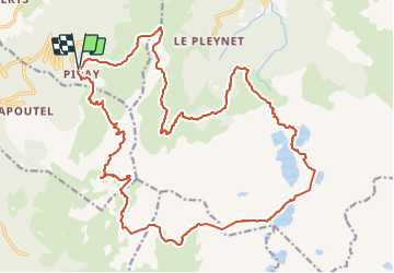


12.4 km | 21 km-effort

User


FREE GPS app for hiking
 SityTrail
IGN / Geographical institutes
SityTrail World
The world is yours!
Trail On foot of 29 km to be discovered at Auvergne-Rhône-Alpes, Isère, Theys. This trail is proposed by yann07.
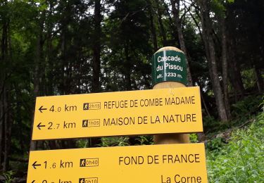
Sur 2 ou 3 jours 1er Bivouac au lac blanc 6 heures
2 eme jour 9 h
Variante le 2 eme bivouac peut être au sommet des sept Laux restera 2h30 heures pour redescendre


Walking
Walking

Mountain bike
Walking
Walking

Other activity
Walking
Walking
Walking