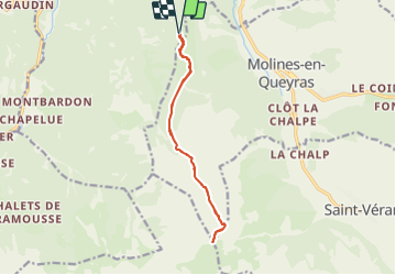
19.1 km | 36 km-effort
05-pointe-du-Rasis-13km-760m-aout21
SyMA
User
Length
13.2 km
Max alt
2831 m
Uphill gradient
758 m
Km-Effort
23 km
Min alt
2140 m
Downhill gradient
758 m
Boucle
Yes
Creation date :
2021-08-13 07:31:00.851
Updated on :
2021-08-16 14:48:20.64
5h32
Difficulty : Difficult
FREE GPS app for hiking
About
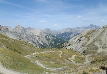
Trail Walking of 13.2 km to be discovered at Provence-Alpes-Côte d'Azur, Hautes-Alpes, Château-Ville-Vieille. This trail is proposed by SyMA.
Description
Départ sous Sommet Bucher
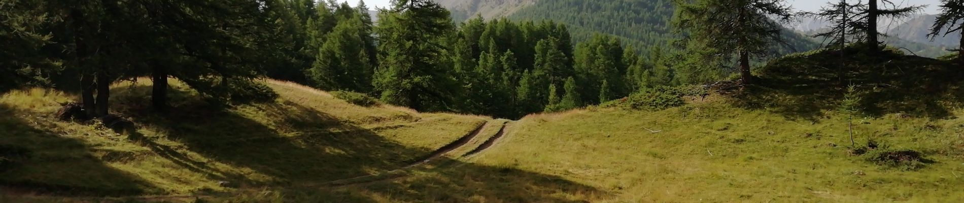
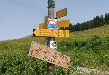
route d'accès juste praticable...
Positioning
Country:
France
Region :
Provence-Alpes-Côte d'Azur
Department/Province :
Hautes-Alpes
Municipality :
Château-Ville-Vieille
Location:
Unknown
Start:(Dec)
Start:(UTM)
326735 ; 4956253 (32T) N.
Comments
Trails nearby
Queyras j1
Walking
Medium
(1)
Château-Ville-Vieille,
Provence-Alpes-Côte d'Azur,
Hautes-Alpes,
France
8h 6min
No
Pic de Château Renard 2989 m
Walking
Medium
(1)
Saint-Véran,
Provence-Alpes-Côte d'Azur,
Hautes-Alpes,
France
6.9 km | 16.1 km-effort
2h 43min
No
boucle St Veran - Refuge de la blanche
Walking
Medium
(1)
Saint-Véran,
Provence-Alpes-Côte d'Azur,
Hautes-Alpes,
France
19.3 km | 28 km-effort
5h 15min
Yes
Tour du Queyras
Mountain bike
Very difficult
(1)
Château-Ville-Vieille,
Provence-Alpes-Côte d'Azur,
Hautes-Alpes,
France
32 km | 50 km-effort
3h 0min
Yes
les alpages de Furfande
Walking
Easy
Arvieux,
Provence-Alpes-Côte d'Azur,
Hautes-Alpes,
France
17 km | 29 km-effort
6h 57min
Yes
Ville-vieille - Ceillac
Walking
Medium
Château-Ville-Vieille,
Provence-Alpes-Côte d'Azur,
Hautes-Alpes,
France
17.4 km | 31 km-effort
6h 51min
No
saint véranda les hameaux le champ et le raux
Walking
Easy
Saint-Véran,
Provence-Alpes-Côte d'Azur,
Hautes-Alpes,
France
4.9 km | 7.9 km-effort
1h 44min
No
Saint Véran - Col de Chamoussière - Pic de Caramantran - Refuge de la Blanche
Snowshoes
Difficult
Saint-Véran,
Provence-Alpes-Côte d'Azur,
Hautes-Alpes,
France
22 km | 38 km-effort
5h 30min
Yes
pointe des marcelettes
Touring skiing
Difficult
Saint-Véran,
Provence-Alpes-Côte d'Azur,
Hautes-Alpes,
France
9.3 km | 23 km-effort
2h 41min
No