Trail Walking Arrens-Marsous - ARRENS MARSOUS Le Turon des aulhes    2906361 - Photo

ARRENS MARSOUS Le Turon des aulhes 2906361

 marmotte65
marmotte65

User GUIDE

© OpenStreetMap contributors
Length
Length
9.5 km
Max alt
Max alt
1353 m
Uphill gradient
Uphill gradient
519 m
Km-Effort
Km-Effort  
16.4 km
Min alt
Min alt
861 m
Downhill gradient
Downhill gradient
519 m
Boucle
Boucle
Yes
Creation date :
2021-08-20 07:19:24.813
Updated on :
2021-08-20 15:39:29.641

(1 Reviews)

Walking
Walking
5h55
Difficulty : Medium

Scan this QR Code to open this trail in the SityTrail application

FREE GPS app for hiking

Logo SityTrail SityTrail

IGN / Geographical institutes

Download SityTrail from the App Store Download SityTrail from Google Play

Logo SityTrail SityTrail World

The world is yours!

Download SityTrail from the App Store Download SityTrail from Google Play Download SityTrail on Huawei AppGallery

About

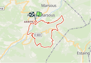
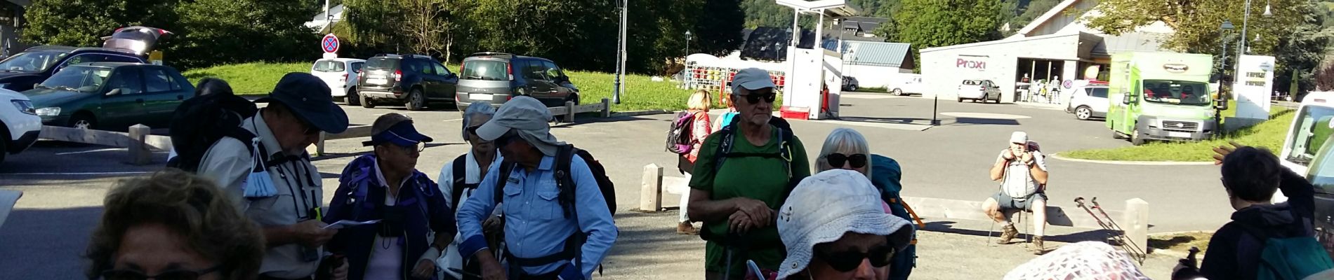
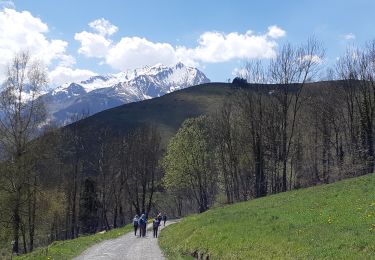
Trail Walking of 9.5 km to be discovered at Occitania, Hautespyrenees, Arrens-Marsous. This trail is proposed by marmotte65.

Description

Cette belle randonnée de 6h pauses et PN compris,  vous laisse savourer une belle et rude montée a l'ombre et un panorama a couper le souffle dur le Gabizos la pointe de surgate et autres pics pyreneens

Elevation profile

Photos

Positioning

Country:
France
Region :
Occitania
Department/Province :
Hautespyrenees
Municipality :
Arrens-Marsous
Location:
Unknown
Start:(UTM)
727531 ; 4759840 (30T) N.

Comments

Please log in to post a review or rate the element


Trails nearby

Trail Walking Arcizans-Dessus - la fontaine de Nabias - Photo
Walking
bernardbelmas

Walking

Very easy
(1)
Arcizans-Dessus, Occitania, Hautespyrenees, France
4.2 km | 6.8 km-effort
1h 40min
Yes
Trail Snowshoes Aucun - Le Soum de Berducou - Photo
Snowshoes
tracegps

Snowshoes

Medium
(1)
Aucun, Occitania, Hautespyrenees, France
5.3 km | 9.6 km-effort
3h 15min
Yes
Trail Walking Estaing - Les Viellettes - Estaing - Photo
Walking
tracegps

Walking

Difficult
(1)
Estaing, Occitania, Hautespyrenees, France
13.1 km | 24 km-effort
4h 0min
Yes
Trail Walking Gaillagos - GAILLAGOS / Couret / Couraduque en boucle reco G3 - Photo
Walking
GUIDE
marmotte65

Walking

Difficult
Gaillagos, Occitania, Hautespyrenees, France
8.4 km | 14.3 km-effort
2h 30min
Yes
Trail On foot Aucun - AUCUN Couraduque  Le Berbeillet autrement G3 2976337 - Photo
On foot
GUIDE
marmotte65

On foot

Easy
Aucun, Occitania, Hautespyrenees, France
9.5 km | 14.2 km-effort
2h 13min
Yes
Trail Winter sports Aucun - couraduc soulor - Photo
Winter sports
ehresmann

Winter sports

Difficult
(1)
Aucun, Occitania, Hautespyrenees, France
34 km | 45 km-effort
2h 31min
Yes
Trail Winter sports Aucun - Bazes soulor - Photo
Winter sports
ehresmann

Winter sports

Medium
(1)
Aucun, Occitania, Hautespyrenees, France
25 km | 34 km-effort
2h 4min
Yes
Trail Walking Arrens-Marsous - col de soulor, lac de soum, col de bazes, col de soulor  - Photo
Walking
fbienmuller

Walking

Medium
Arrens-Marsous, Occitania, Hautespyrenees, France
16.4 km | 23 km-effort
5h 20min
Yes
Trail Walking Gaillagos - GAILLAGOS Col de Couret Couraduque en boucle G3 du 21/04/2023
Walking
GUIDE
marmotte65

Walking

Difficult
Gaillagos, Occitania, Hautespyrenees, France
8.2 km | 14.2 km-effort
2h 46min
Yes


Close
My subscriptions