AMPFERSBACH

jcschubnel
User
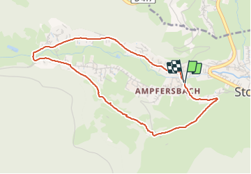

Length
4.2 km

Max alt
554 m

Uphill gradient
101 m
Km-Effort
5.6 km

Min alt
462 m

Downhill gradient
101 m
Boucle
Yes
Creation date :
2021-09-05 12:33:40.325
Updated on :
2021-09-05 16:04:10.436
1h29
Difficulty : Easy

FREE GPS app for hiking
 SityTrail
IGN / Geographical institutes
SityTrail Plus
The world is yours!
About
Trail Walking of 4.2 km to be discovered at Grand Est, Haut-Rhin, Stosswihr. This trail is proposed by jcschubnel.
Positioning
Country:
France
Region :
Grand Est
Department/Province :
Haut-Rhin
Municipality :
Stosswihr
Location:
Unknown
Start:(Dec)
Start:(UTM)
358233 ; 5323937 (32U) N.
Comments