Trail Walking Soyans - Soyans 17km - Photo
 thonyc
thonyc

User GUIDE

© OpenStreetMap contributors
Length
Length
15.5 km
Max alt
Max alt
527 m
Uphill gradient
Uphill gradient
397 m
Km-Effort
Km-Effort  
21 km
Min alt
Min alt
284 m
Downhill gradient
Downhill gradient
396 m
Boucle
Boucle
Yes
Creation date :
2021-10-07 14:00:11.228
Updated on :
2021-10-15 18:51:18.274

(1 Reviews)

Walking
Walking
5h00
Difficulty : Medium

Scan this QR Code to open this trail in the SityTrail application

FREE GPS app for hiking

Logo SityTrail SityTrail

IGN / Geographical institutes

Download SityTrail from the App Store Download SityTrail from Google Play

Logo SityTrail SityTrail World

The world is yours!

Download SityTrail from the App Store Download SityTrail from Google Play Download SityTrail on Huawei AppGallery

About

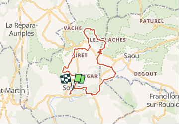
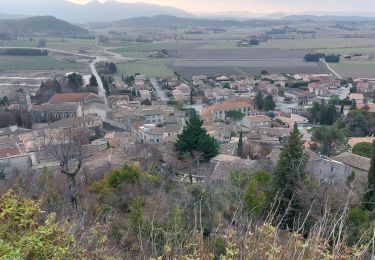
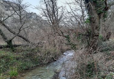
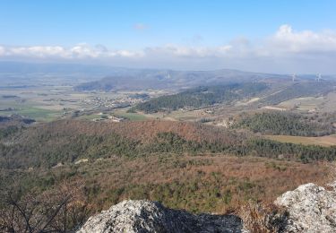
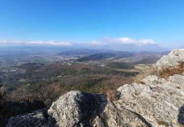
Trail Walking of 15.5 km to be discovered at Auvergne-Rhône-Alpes, Drôme, Soyans. This trail is proposed by thonyc.

Description

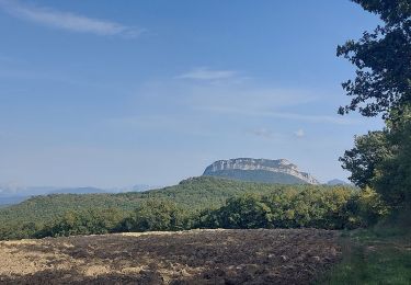
Parcours très diversifié offrant de belles vues sur la plaine et sur Rochecolombe.
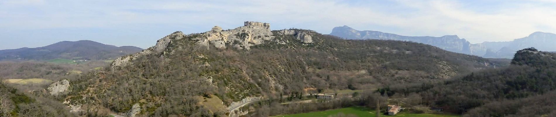
Beau village fortifié

Elevation profile

Photos

Positioning

Country:
France
Region :
Auvergne-Rhône-Alpes
Department/Province :
Drôme
Municipality :
Soyans
Location:
Unknown
Start:(UTM)
660418 ; 4943717 (31T) N.

Comments

Please log in to post a review or rate the element


Trails nearby

Trail Walking Puy-Saint-Martin - 2022-09-27_14h04m59_10644793 - Photo
Walking
chancha

Walking

Medium
(3)
Puy-Saint-Martin, Auvergne-Rhône-Alpes, Drôme, France
7.1 km | 10.5 km-effort
2h 22min
Yes
Trail Walking Saou - roche Colombe - Photo
Walking
bob2023

Walking

Medium
(1)
Saou, Auvergne-Rhône-Alpes, Drôme, France
10.9 km | 16.8 km-effort
3h 58min
Yes
Trail Walking Puy-Saint-Martin - Puy st Martin les Ours 8km - Photo
Walking
chancha

Walking

Easy
(1)
Puy-Saint-Martin, Auvergne-Rhône-Alpes, Drôme, France
7.7 km | 11.6 km-effort
3h 4min
Yes
Trail Walking Puy-Saint-Martin - Puy St Martin Chevriere-Saudon 16 km - Photo
Walking
chancha

Walking

Medium
(1)
Puy-Saint-Martin, Auvergne-Rhône-Alpes, Drôme, France
16 km | 22 km-effort
6h 35min
Yes
Trail Walking Saou - Saou Lestang 7 km. - Photo
Walking
chancha

Walking

Medium
(1)
Saou, Auvergne-Rhône-Alpes, Drôme, France
6.6 km | 8.7 km-effort
1h 59min
Yes
Trail Walking Piégros-la-Clastre - Pas de Lauzen Col de la Chaudière - Photo
Walking
denis.benoit

Walking

Very difficult
(1)
Piégros-la-Clastre, Auvergne-Rhône-Alpes, Drôme, France
19.6 km | 42 km-effort
7h 36min
No
Trail Walking Saou - Entre Roc et Estang - Photo
Walking
tracegps

Walking

Medium
(1)
Saou, Auvergne-Rhône-Alpes, Drôme, France
5.2 km | 7.5 km-effort
1h 15min
Yes
Trail Walking Manas - SityTrail - Puy St Martin La Pigne-Saudon 8,5km - Photo
Walking
GUIDE
thonyc

Walking

Medium
Manas, Auvergne-Rhône-Alpes, Drôme, France
13.9 km | 21 km-effort
4h 30min
Yes
Trail Walking Manas - Manas-Pied Bazi-Ste Euphémie 6,5km - Photo
Walking
GUIDE
thonyc

Walking

Medium
Manas, Auvergne-Rhône-Alpes, Drôme, France
6.3 km | 10.3 km-effort
3h 7min
Yes


Close
My subscriptions