


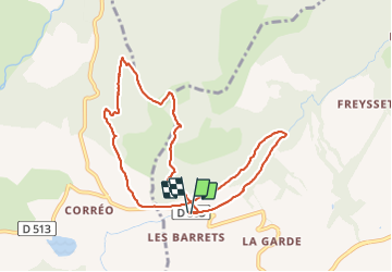

8.6 km | 18.5 km-effort


User


FREE GPS app for hiking
 SityTrail
IGN / Geographical institutes
SityTrail World
The world is yours!
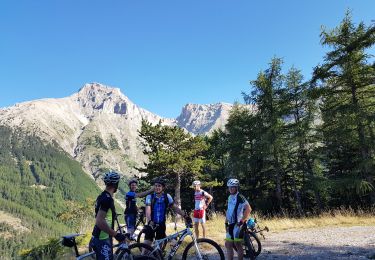
Trail Walking of 9.5 km to be discovered at Provence-Alpes-Côte d'Azur, Hautes-Alpes, Gap. This trail is proposed by rigol05.
Sortie du 26-10-2021
Itinéraire varié mais très caillouteux, deux belles montées, la première pour atteindre le Replat et la seconde jusqu'à la crête. Du sommet suivre la trace en crête sur environ 500m puis sur la droite, plonger dans la combe. Au départ le sentier n'est pas bien marqué avant de trouver une bonne trace puis un sentier ramenant au parking. Au départ de la randonnée, la boucle par le Replat sert à allonger la distance circuit.

Walking
Walking

Mountain bike
On foot
Running

Mountain bike

Mountain bike
Mountain bike

Walking