Trail Walking Sospel - Circuit du Cuore - Photo
 domi06
domi06

User

© OpenStreetMap contributors
Length
Length
13.7 km
Max alt
Max alt
1085 m
Uphill gradient
Uphill gradient
914 m
Km-Effort
Km-Effort  
26 km
Min alt
Min alt
329 m
Downhill gradient
Downhill gradient
916 m
Boucle
Boucle
Yes
Creation date :
2021-12-11 14:57:21.66
Updated on :
2021-12-13 14:11:24.306

(0 Reviews)

Walking
Walking
5h53
Difficulty : Medium

Scan this QR Code to open this trail in the SityTrail application

FREE GPS app for hiking

Logo SityTrail SityTrail

IGN / Geographical institutes

Download SityTrail from the App Store Download SityTrail from Google Play

Logo SityTrail SityTrail World

The world is yours!

Download SityTrail from the App Store Download SityTrail from Google Play Download SityTrail on Huawei AppGallery

About

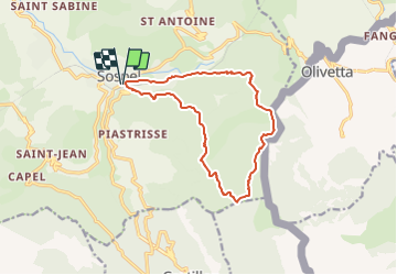
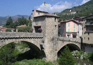
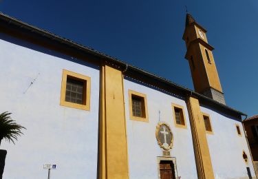
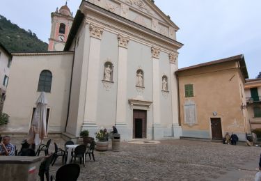
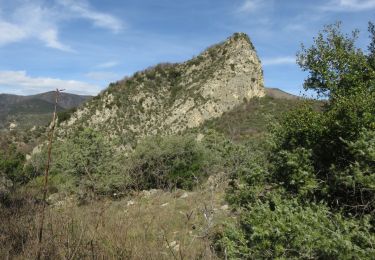
Trail Walking of 13.7 km to be discovered at Provence-Alpes-Côte d'Azur, Maritime Alps, Sospel. This trail is proposed by domi06.

Description

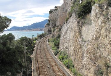
Franchir la voie ferrée et suivre la route de la piscine (b.106), puis une large piste (GR52) ; couper bientôt une boucle de la piste qui contourne les ruines de Castès, puis la suivre de nouveau jusqu’à une épingle (600 m) pour prendre le chemin du col du Razet.
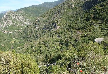
Passer aux ruines de l’Albaréa (630 m - b.107) et s’élever par un bon sentier dans la forêt homonyme en franchissant plusieurs vallons.
Du col du Razet (1 032 m - b.90), bifurquer à gauche (Nord-Est) pour gagner le col de Cuore par un chemin en balcon ; on atteint ainsi la borne-frontière de 1927, implantée près d’une ruine (1 022 m - b.90a).
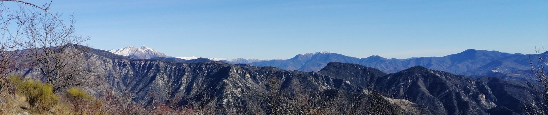
Contourner ensuite la tête de Cuore pour s’élever parmi les genêts jusqu’au Pas de Cuore (1 021 m - b.90b) marqué d’une autre borne ; une courte montée mène au sommet du Cuore (1 095 m) que coiffe une troisième borne.
La descente emprunte un sentier plus étroit et rocailleux jusqu’au col de Haute (830 m), puis de Basse Bergevine (720 m) ; l’itinéraire longe alors les barres rocheuses de Diaurus avant de plonger vers la Bévéra et le quartier de Suès (b.90c).
Traverser la voie ferrée, puis regagner Sospel par une petite route tangentielle (b.103).
Cotation E4/T3/R3

Elevation profile

Photos

Positioning

Country:
France
Region :
Provence-Alpes-Côte d'Azur
Department/Province :
Maritime Alps
Municipality :
Sospel
Location:
Unknown
Start:(UTM)
375553 ; 4859330 (32T) N.

Trails nearby

Trail On foot Sospel - Circuit du Cuore - Photo
On foot
PRO

On foot

Medium
Sospel, Provence-Alpes-Côte d'Azur, Maritime Alps, France
13.7 km | 26 km-effort
5h 54min
Yes
Trail On foot Sospel - Tour du mont Grazian - Photo
On foot
PRO

On foot

Easy
Sospel, Provence-Alpes-Côte d'Azur, Maritime Alps, France
12.1 km | 19.3 km-effort
4h 23min
Yes
Trail On foot Sospel - Boucle du mont Agaisen - Photo
On foot
PRO

On foot

Easy
Sospel, Provence-Alpes-Côte d'Azur, Maritime Alps, France
8.7 km | 14.1 km-effort
3h 12min
Yes
Trail On foot Ventimiglia - AM0 - ALPI MARE 0 - Photo
On foot
PRO

On foot

Easy
Ventimiglia, Liguria, Imperia, Italy
9.7 km | 13.8 km-effort
3h 8min
No
Trail Walking Sospel - 06 - Moyen Pays - 46. Tour du Mont Grazian - Photo
Walking
kamell21

Walking

Medium
(1)
Sospel, Provence-Alpes-Côte d'Azur, Maritime Alps, France
11.9 km | 19 km-effort
Unknown
Yes
Trail Walking Sospel - Sospel à Airole - Photo
Walking
patsure

Walking

Medium
Sospel, Provence-Alpes-Côte d'Azur, Maritime Alps, France
16.1 km | 23 km-effort
4h 58min
No
Trail Walking Castillon - Castillon : Mt Ours - Photo
Walking
ETMU5496

Walking

Medium
Castillon, Provence-Alpes-Côte d'Azur, Maritime Alps, France
16.7 km | 29 km-effort
4h 22min
Yes
Trail Walking Castillon - Du col de Castillon pour la crête du Mt Razet - Photo
Walking
GrouGary

Walking

Medium
Castillon, Provence-Alpes-Côte d'Azur, Maritime Alps, France
8.1 km | 15.7 km-effort
3h 13min
Yes
Trail Walking Sospel - Cime de Penas - Photo
Walking
aris

Walking

Medium
Sospel, Provence-Alpes-Côte d'Azur, Maritime Alps, France
11 km | 21 km-effort
6h 38min
Yes


Close
My subscriptions