


ski

Lucile Cano
User

Length
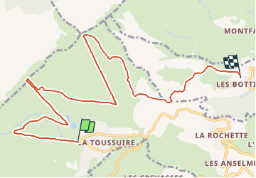
11.4 km

Max alt
2185 m

Uphill gradient
922 m
Km-Effort
25 km

Min alt
1295 m

Downhill gradient
1336 m
Boucle
No
Creation date :
2021-12-20 12:55:28.477
Updated on :
2021-12-20 13:58:10.334
1h02
Difficulty : Very easy

FREE GPS app for hiking
 SityTrail
IGN / Geographical institutes
SityTrail Plus
The world is yours!
About
Trail Alpine skiing of 11.4 km to be discovered at Auvergne-Rhône-Alpes, Savoy, Fontcouverte-la-Toussuire. This trail is proposed by Lucile Cano.
Positioning
Country:
France
Region :
Auvergne-Rhône-Alpes
Department/Province :
Savoy
Municipality :
Fontcouverte-la-Toussuire
Location:
Unknown
Start:(Dec)
Start:(UTM)
284685 ; 5015038 (32T) N.
Comments