Trail Walking Xonrupt-Longemer - Sentier du tour du lac de Gérardmer - Photo

Sentier du tour du lac de Gérardmer

« L’heure de la fin des découvertes ne sonne jamais. » Colette GUIDE+

© OpenStreetMap contributors
Length
Length
5.2 km
Max alt
Max alt
764 m
Uphill gradient
Uphill gradient
69 m
Km-Effort
Km-Effort  
6.2 km
Min alt
Min alt
732 m
Downhill gradient
Downhill gradient
69 m
Boucle
Boucle
Yes
Creation date :
2021-12-22 12:12:00.808
Updated on :
2022-01-20 10:22:17.728

(0 Reviews)

Walking
Walking
1h24
Difficulty : Medium

Scan this QR Code to open this trail in the SityTrail application

FREE GPS app for hiking

Logo SityTrail SityTrail

IGN / Geographical institutes

Download SityTrail from the App Store Download SityTrail from Google Play

Logo SityTrail SityTrail World

The world is yours!

Download SityTrail from the App Store Download SityTrail from Google Play Download SityTrail on Huawei AppGallery

About

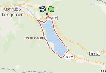
Trail Walking of 5.2 km to be discovered at Grand Est, Vosges, Xonrupt-Longemer. This trail is proposed by Au fil de nos découvertes.

Description

🅿️ Départ et Parking: Avenue du Maréchal De Lattre de Tassigny

88400 Gerardmer

Se diriger vers le lac pour commencer le tour. Nous avons débuté notre tour en partant vers la gauche. ⬅️

Suivre la balise « sentier du tour du lac »

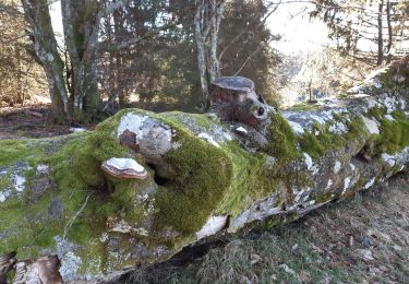
Le début de la promenade est faisable en chaise roulante, poussette ou à vélo, la suite ne l’est pas. Car il faut marcher sur des racines, des cailloux, etc..

Plusieurs endroits pour pic-niquer. 🥪

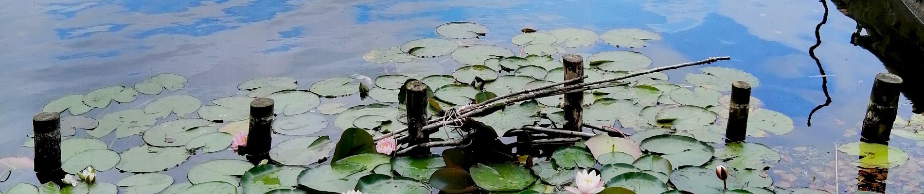
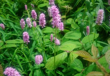
Divers panneaux explicatifs sur la faune et la flore. 🦆🐟🌿

Possibilité de locations de bateaux, pédalos, etc 🛶⛵

Plages pour se baigner. 🏖️

Chiens autorisés en laisse. 🐩🐶🐕

Convient vraiment aux enfants 🧑🧒

N'hésitez pas à aller faire un tour sur notre site internet et nos réseaux :
www.aufildenosdecouvertes.com
www.facebook.com/aufildenosdecouvertes
https://www.instagram.com/au_fil_de_nos_decouvertes/

Elevation profile

Photos

Positioning

Country:
France
Region :
Grand Est
Department/Province :
Vosges
Municipality :
Xonrupt-Longemer
Location:
Unknown
Start:(UTM)
347104 ; 5327194 (32U) N.

Trails nearby

Trail Walking La Bresse - Lac de Lispach et sentier Dielaine  - Photo
Walking
zazie

Walking

Medium
(1)
La Bresse, Grand Est, Vosges, France
9.7 km | 14.9 km-effort
2h 30min
Yes
Trail Walking La Bresse - Les 5 lacs autour du Hohneck - Photo
Walking
tiene

Walking

Very difficult
(1)
La Bresse, Grand Est, Vosges, France
21 km | 36 km-effort
7h 21min
Yes
Trail Walking La Bresse - lac de Lispach - Photo
Walking
fedinois1

Walking

Easy
(1)
La Bresse, Grand Est, Vosges, France
10.4 km | 14.1 km-effort
4h 6min
Yes
Trail Walking La Bresse - lac de Lispach - Photo
Walking
fedinois1

Walking

Easy
(3)
La Bresse, Grand Est, Vosges, France
10.4 km | 14.1 km-effort
4h 6min
Yes
Trail Walking Ban-sur-Meurthe-Clefcy - La vallée de Belbriette - Ban-sur-Meurthe-Clefcy - Photo
Walking
tracegps

Walking

Medium
(2)
Ban-sur-Meurthe-Clefcy, Grand Est, Vosges, France
9.8 km | 12.6 km-effort
2h 30min
Yes
Trail Walking Gérardmer - gerardmer - la mauselaine . tête grauvelin . Roche boquet . croix claudé . hautes Vannes . la mauselaine  - Photo
Walking
stef789

Walking

Very easy
(1)
Gérardmer, Grand Est, Vosges, France
11.3 km | 16.2 km-effort
3h 42min
Yes
Trail Walking Xonrupt-Longemer - 23-08-17 Lac Longemer - Lispach - Photo
Walking
annefrance70

Walking

Medium
(1)
Xonrupt-Longemer, Grand Est, Vosges, France
7 km | 12.1 km-effort
2h 13min
Yes
Trail Snowshoes Le Valtin - raquettes  - Photo
Snowshoes
vathi54

Snowshoes

Very easy
(1)
Le Valtin, Grand Est, Vosges, France
6.6 km | 9.4 km-effort
3h 8min
No
Trail Walking La Bresse - Lac de Lispach  - Photo
Walking
Bruca

Walking

Easy
(1)
La Bresse, Grand Est, Vosges, France
2.1 km | 2.4 km-effort
44min
Yes


Close
My subscriptions