Trail Walking Annesse-et-Beaulieu - Gravelle - Photo
 CC.RIDER
CC.RIDER

User

© OpenStreetMap contributors
Length
Length
11.5 km
Max alt
Max alt
124 m
Uphill gradient
Uphill gradient
149 m
Km-Effort
Km-Effort  
13.5 km
Min alt
Min alt
69 m
Downhill gradient
Downhill gradient
149 m
Boucle
Boucle
Yes
Creation date :
2021-12-30 18:42:11.601
Updated on :
2021-12-30 18:45:33.272

(0 Reviews)

Walking
Walking
3h04
Difficulty : Difficult

Scan this QR Code to open this trail in the SityTrail application

FREE GPS app for hiking

Logo SityTrail SityTrail

IGN / Geographical institutes

Download SityTrail from the App Store Download SityTrail from Google Play

Logo SityTrail SityTrail World

The world is yours!

Download SityTrail from the App Store Download SityTrail from Google Play Download SityTrail on Huawei AppGallery

About

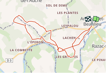
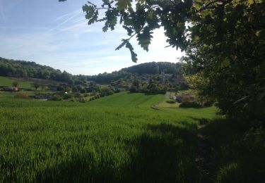
Trail Walking of 11.5 km to be discovered at New Aquitaine, Dordogne, Annesse-et-Beaulieu. This trail is proposed by CC.RIDER.

Description

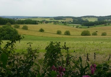
Jolie rando entre deux méandres de l'Isle.

Elevation profile

Photos

Positioning

Country:
France
Region :
New Aquitaine
Department/Province :
Dordogne
Municipality :
Annesse-et-Beaulieu
Location:
Unknown
Start:(UTM)
310770 ; 5005023 (31T) N.

Trails nearby

Trail Walking Saint-Astier - GR654 ST ASTIER BERGERAC PINEL - Photo
Walking
kmedone

Walking

Difficult
(3)
Saint-Astier, New Aquitaine, Dordogne, France
122 km | 150 km-effort
31h 13min
No
Trail Walking Coursac - boucle des 3 lavoirs - Photo
Walking
fab0202

Walking

Easy
Coursac, New Aquitaine, Dordogne, France
9 km | 12.3 km-effort
1h 46min
No
Trail Nordic walking Coursac - Coursac  - Photo
Nordic walking
Xavier Van Becelaere

Nordic walking

Very easy
(1)
Coursac, New Aquitaine, Dordogne, France
9.9 km | 13 km-effort
2h 23min
Yes
Trail Walking Annesse-et-Beaulieu - Boucle de Gravelle - Photo
Walking
CC.RIDER

Walking

Difficult
Annesse-et-Beaulieu, New Aquitaine, Dordogne, France
13.1 km | 16.2 km-effort
3h 40min
Yes
Trail Walking Razac-sur-l'Isle - Boucle de Razac sur l'Isle - Photo
Walking
CC.RIDER

Walking

Difficult
Razac-sur-l'Isle, New Aquitaine, Dordogne, France
13.2 km | 16.3 km-effort
3h 41min
Yes
Trail Walking Léguillac-de-l'Auche - Leguillac 12km - Photo
Walking
amelie14

Walking

Medium
Léguillac-de-l'Auche, New Aquitaine, Dordogne, France
12.1 km | 16.1 km-effort
2h 45min
Yes
Trail Walking Chancelade - Boucle de la Terrassonnie - Photo
Walking
swp648

Walking

Easy
Chancelade, New Aquitaine, Dordogne, France
11.2 km | 14.7 km-effort
3h 37min
Yes
Trail Walking Léguillac-de-l'Auche - 24 Léguillac de l'Auche - Photo
Walking
Patxito

Walking

Easy
Léguillac-de-l'Auche, New Aquitaine, Dordogne, France
13.8 km | 18 km-effort
3h 57min
Yes
Trail Walking Coursac - boucle coursac - Photo
Walking
fab0202

Walking

Easy
Coursac, New Aquitaine, Dordogne, France
10.1 km | 13.5 km-effort
2h 10min
Yes


Close
My subscriptions