Trail Walking Urrugne - Ibardin Ziburumendi, Yasola forêt de Bera  Gartzin - Photo

Ibardin Ziburumendi, Yasola forêt de Bera Gartzin

 DECHAMPD
DECHAMPD

User

© OpenStreetMap contributors
Length
Length
12.1 km
Max alt
Max alt
462 m
Uphill gradient
Uphill gradient
564 m
Km-Effort
Km-Effort  
19.6 km
Min alt
Min alt
117 m
Downhill gradient
Downhill gradient
564 m
Boucle
Boucle
Yes
Creation date :
2022-01-03 07:16:20.0
Updated on :
2022-01-08 17:44:36.374

(0 Reviews)

Walking
Walking
4h00
Difficulty : Medium

Scan this QR Code to open this trail in the SityTrail application

FREE GPS app for hiking

Logo SityTrail SityTrail

IGN / Geographical institutes

Download SityTrail from the App Store Download SityTrail from Google Play

Logo SityTrail SityTrail World

The world is yours!

Download SityTrail from the App Store Download SityTrail from Google Play Download SityTrail on Huawei AppGallery

About

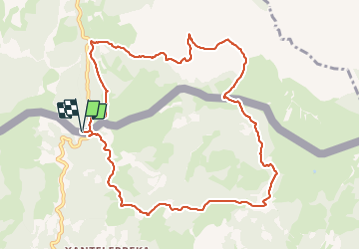
Trail Walking of 12.1 km to be discovered at New Aquitaine, Pyrénées-Atlantiques, Urrugne. This trail is proposed by DECHAMPD.

Description

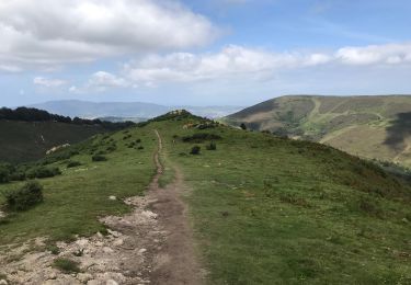
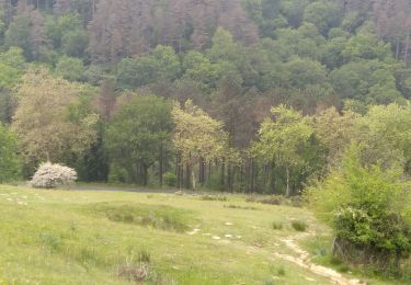
Nous ferons une boucle, à cheval sur la frontière, en passant au pied de la Rhune et sur les hauteurs de Vera. Durant les trois quarts du circuit, nous marcherons en Navarre. Depuis le col d'Ibardin (317m), la redoute des Emigrés (384m), Mokoa (244m), nous suivrons le  GR10, après avoir traversé l'Intzoloko erreko 120m (très petit pont) nous grimperons en direction de Ziburumendi (411m), descente vres Deskargoto (272), Yasola  benta(386m), la forêt de Bera Mugerri, Basasagar, LizarnabarraMilitarren Barrakola (317 m), Gartzin. Arrivée aux ventas Ibardin.

Elevation profile

Photos

Positioning

Country:
France
Region :
New Aquitaine
Department/Province :
Pyrénées-Atlantiques
Municipality :
Urrugne
Location:
Unknown
Start:(UTM)
606576 ; 4796030 (30T) N.

Trails nearby

Trail Walking Ascain - ascain Sare ascain - Photo
Walking
RayFab

Walking

Medium
(1)
Ascain, New Aquitaine, Pyrénées-Atlantiques, France
18.8 km | 27 km-effort
4h 39min
Yes
Trail Walking Biriatou - Biriatou et lac Poiriers - Photo
Walking
RVMASSON

Walking

Medium
(1)
Biriatou, New Aquitaine, Pyrénées-Atlantiques, France
10.1 km | 17.1 km-effort
3h 45min
Yes
Trail Walking Urrugne - Montagne de Ciboure - Trabenea - Photo
Walking
tracegps

Walking

Medium
(2)
Urrugne, New Aquitaine, Pyrénées-Atlantiques, France
8.6 km | 13.3 km-effort
2h 30min
Yes
Trail Walking Urrugne - rhune - Photo
Walking
phil331

Walking

Medium
(1)
Urrugne, New Aquitaine, Pyrénées-Atlantiques, France
11.9 km | 24 km-effort
4h 43min
Yes
Trail Mountain bike Urrugne - 64-Olhette-20110417 - Photo
Mountain bike
Gus64

Mountain bike

Difficult
(2)
Urrugne, New Aquitaine, Pyrénées-Atlantiques, France
33 km | 49 km-effort
3h 30min
Yes
Trail Walking Ascain - la rhune depuis olhette - Photo
Walking
jcaudron

Walking

Medium
(2)
Ascain, New Aquitaine, Pyrénées-Atlantiques, France
9.8 km | 20 km-effort
Unknown
Yes
Trail Walking Urrugne - La Rhune en boucle - Photo
Walking
jaja64

Walking

Difficult
Urrugne, New Aquitaine, Pyrénées-Atlantiques, France
12.6 km | 24 km-effort
5h 29min
Yes
Trail Mountain bike Ascain - Ibardin 10/8/23 - Photo
Mountain bike
CEFAMALI

Mountain bike

Ascain, New Aquitaine, Pyrénées-Atlantiques, France
40 km | 58 km-effort
3h 52min
No
Trail Walking Urrugne - Sentier des mulets  - Photo
Walking
RayFab

Walking

Medium
Urrugne, New Aquitaine, Pyrénées-Atlantiques, France
9 km | 14 km-effort
2h 40min
Yes


Close
My subscriptions