Trail Walking Irun - JFT YB Étape 24 22-5-2014  - Photo
 jeff2
jeff2

User

© OpenStreetMap contributors
Length
Length
30 km
Max alt
Max alt
286 m
Uphill gradient
Uphill gradient
879 m
Km-Effort
Km-Effort  
42 km
Min alt
Min alt
-5 m
Downhill gradient
Downhill gradient
877 m
Boucle
Boucle
No
Creation date :
2014-12-10 00:00:00.0
Updated on :
2014-12-10 00:00:00.0

(0 Reviews)

Walking
Walking
6h56
Difficulty : Medium

Scan this QR Code to open this trail in the SityTrail application

FREE GPS app for hiking

Logo SityTrail SityTrail

IGN / Geographical institutes

Download SityTrail from the App Store Download SityTrail from Google Play

Logo SityTrail SityTrail World

The world is yours!

Download SityTrail from the App Store Download SityTrail from Google Play Download SityTrail on Huawei AppGallery

About

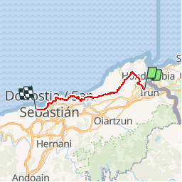
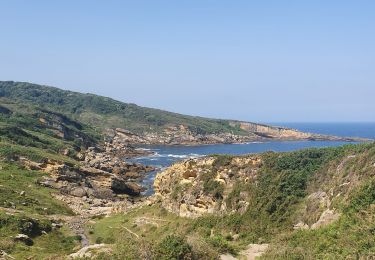
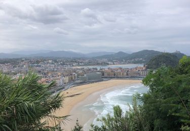
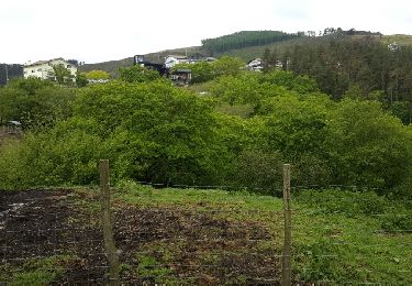
Trail Walking of 30 km to be discovered at Autonomous Community of the Basque Country, Gipuzkoa, Irun. This trail is proposed by jeff2.

Description

Irun à St Sébastien

Elevation profile

Photos

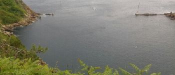
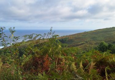
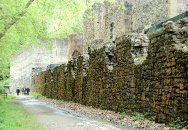
31 photos in total. Please click on a photo to see them all in the gallery.

Points of interest

Point of interest Pasaia - . Point 22 - Photo
jeff2
PASAIA 
Point of interest San Sebastián - Point 24 - Photo
jeff2
SAN SEBASTIÁN 

Positioning

Country:
Spain
Region :
Autonomous Community of the Basque Country
Department/Province :
Gipuzkoa
Municipality :
Irun
Location:
Unknown
Start:(UTM)
597357 ; 4799574 (30T) N.

Trails nearby

Trail Walking Hondarribia/Fontarrabie - Jaizkibel - Chemin côtier - Cap du Figuier - Notre-Dame de Guadalupe - Photo
Walking
georgein

Walking

Very easy
(3)
Hondarribia/Fontarrabie, Autonomous Community of the Basque Country, Gipuzkoa, Spain
13.7 km | 18.9 km-effort
3h 59min
Yes
Trail Walking Irun - Ibarla - Cascade d'Aitzondo - Ermitage san Martzial 2024 01 21 - Photo
Walking
DECHAMPD

Walking

Very difficult
Irun, Autonomous Community of the Basque Country, Gipuzkoa, Spain
12.1 km | 19.7 km-effort
4h 28min
Yes
Trail Walking Hondarribia/Fontarrabie - Pasaia les vallées des couleurs - Photo
Walking
ChristopheLefauconnier

Walking

Difficult
Hondarribia/Fontarrabie, Autonomous Community of the Basque Country, Gipuzkoa, Spain
11.9 km | 18 km-effort
4h 34min
Yes
Trail On foot Irun - SL-GI 1006 Cascada de Aitzondo - Photo
On foot
PRO

On foot

Easy
Irun, Autonomous Community of the Basque Country, Gipuzkoa, Spain
6 km | 8.4 km-effort
1h 54min
Yes
Trail Walking Hondarribia/Fontarrabie - hondarribia cap figuier - Photo
Walking
marchev

Walking

Medium
Hondarribia/Fontarrabie, Autonomous Community of the Basque Country, Gipuzkoa, Spain
15.1 km | 21 km-effort
5h 15min
Yes
Trail Walking Irun - Ibarla - Cascade d'Aitzondo - Ermitage san Martzial 2020 01 21 - Photo
Walking
DECHAMPD

Walking

Irun, Autonomous Community of the Basque Country, Gipuzkoa, Spain
13 km | 21 km-effort
5h 4min
Yes
Trail Walking Hendaye - Hendaye Saint Sébastien GR121 Sentier du littoral - Photo
Walking
jaja64

Walking

Easy
Hendaye, New Aquitaine, Pyrénées-Atlantiques, France
54 km | 71 km-effort
5h 54min
Yes
Trail Walking Hendaye - Hendaye - Photo
Walking
Isabelle07

Walking

Easy
(1)
Hendaye, New Aquitaine, Pyrénées-Atlantiques, France
8.4 km | 10.1 km-effort
2h 16min
Yes
Trail Other activity Hendaye - TDP N°1 HENDAYE OLHETTE  - Photo
Other activity
jeff2

Other activity

Very easy
Hendaye, New Aquitaine, Pyrénées-Atlantiques, France
24 km | 38 km-effort
7h 15min
No


Close
My subscriptions