Trail Walking Lurs - ganagobie - Photo
 MicDul
MicDul

User

© OpenStreetMap contributors
Length
Length
15.9 km
Max alt
Max alt
710 m
Uphill gradient
Uphill gradient
552 m
Km-Effort
Km-Effort  
23 km
Min alt
Min alt
385 m
Downhill gradient
Downhill gradient
557 m
Boucle
Boucle
Yes
Creation date :
2022-01-08 14:32:48.271
Updated on :
2022-01-08 15:44:31.638

(0 Reviews)

Walking
Walking
5h17
Difficulty : Very difficult

Scan this QR Code to open this trail in the SityTrail application

FREE GPS app for hiking

Logo SityTrail SityTrail

IGN / Geographical institutes

Download SityTrail from the App Store Download SityTrail from Google Play

Logo SityTrail SityTrail World

The world is yours!

Download SityTrail from the App Store Download SityTrail from Google Play Download SityTrail on Huawei AppGallery

About

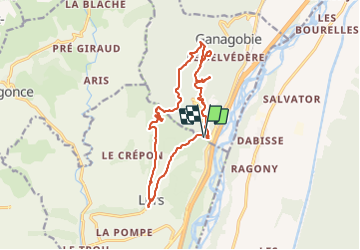
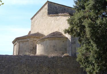
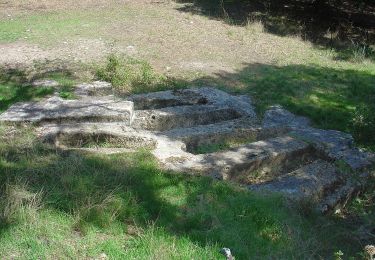
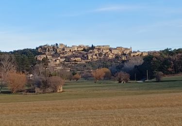
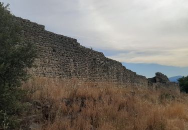
Trail Walking of 15.9 km to be discovered at Provence-Alpes-Côte d'Azur, Alpes-de-Haute-Provence, Lurs. This trail is proposed by MicDul.

Description

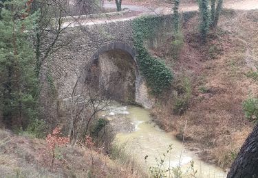
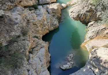
Parking et départ de la randonnée : Pont ancien sur le Ravin de Buès, dit Pont romain

Elevation profile

Photos

Positioning

Country:
France
Region :
Provence-Alpes-Côte d'Azur
Department/Province :
Alpes-de-Haute-Provence
Municipality :
Lurs
Location:
Unknown
Start:(UTM)
733230 ; 4874289 (31T) N.

Trails nearby

Trail Walking Ganagobie - Plateau de Ganagobie - Photo
Walking
tracegps

Walking

Medium
(2)
Ganagobie, Provence-Alpes-Côte d'Azur, Alpes-de-Haute-Provence, France
7.6 km | 10.9 km-effort
3h 0min
Yes
Trail Mountain bike Lurs - Lurs/Tour de la Beaume - Photo
Mountain bike
remizzi

Mountain bike

Medium
(2)
Lurs, Provence-Alpes-Côte d'Azur, Alpes-de-Haute-Provence, France
18.5 km | 24 km-effort
2h 40min
Yes
Trail Walking Ganagobie - 2024-02-27 Ganagobie  - Photo
Walking
GUIDE
Kargil

Walking

Easy
Ganagobie, Provence-Alpes-Côte d'Azur, Alpes-de-Haute-Provence, France
10.2 km | 15.1 km-effort
3h 25min
Yes
Trail Walking Les Mées - les mees . Apollinaire par le sentier des oliviers  - Photo
Walking
Roger

Walking

Medium
Les Mées, Provence-Alpes-Côte d'Azur, Alpes-de-Haute-Provence, France
10.3 km | 14.7 km-effort
3h 10min
Yes
Trail Walking Lurs - lurs à pierrerue.  Le chemin de compostelle  - Photo
Walking
Roger

Walking

Medium
Lurs, Provence-Alpes-Côte d'Azur, Alpes-de-Haute-Provence, France
8.8 km | 11.2 km-effort
2h 32min
Yes
Trail On foot Ganagobie - PR - Photo
On foot
PRO

On foot

Easy
Ganagobie, Provence-Alpes-Côte d'Azur, Alpes-de-Haute-Provence, France
3.6 km | 5.8 km-effort
1h 19min
No
Trail On foot Ganagobie - La Forêt du Prieuré - Photo
On foot
PRO

On foot

Easy
Ganagobie, Provence-Alpes-Côte d'Azur, Alpes-de-Haute-Provence, France
10.2 km | 15.3 km-effort
3h 28min
No
Trail Walking Lurs - LURS  Visite et tour de Lurs o l m s  - Photo
Walking
RobinMicheline

Walking

Medium
(2)
Lurs, Provence-Alpes-Côte d'Azur, Alpes-de-Haute-Provence, France
11.1 km | 15.6 km-effort
3h 17min
Yes
Trail Walking Ganagobie - GANAGOBIE  . Tour par le bas . Visite Ganagobie  o  m s  - Photo
Walking
RobinMicheline

Walking

Medium
(1)
Ganagobie, Provence-Alpes-Côte d'Azur, Alpes-de-Haute-Provence, France
14.6 km | 21 km-effort
3h 55min
Yes


Close
My subscriptions