


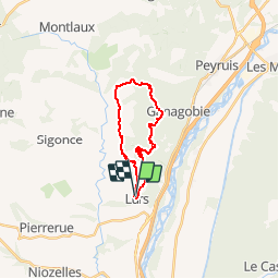

7.6 km | 10.9 km-effort


User


FREE GPS app for hiking
 SityTrail
IGN / Geographical institutes
SityTrail World
The world is yours!
Trail Mountain bike of 18.5 km to be discovered at Provence-Alpes-Côte d'Azur, Alpes-de-Haute-Provence, Lurs. This trail is proposed by remizzi.
Circuit roulant (surtout la 2 eme partie composée de gros chemins)

Walking
Walking
Walking
On foot
On foot

Walking
Walking
Walking
Walking
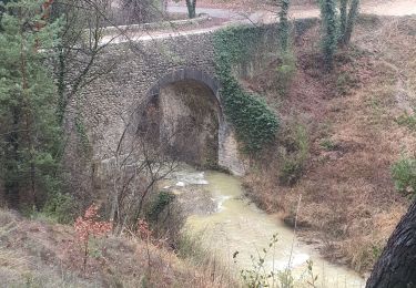
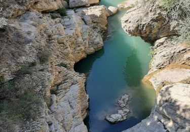
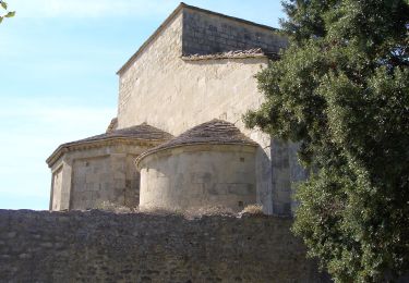
très beau parcours à faire de préférence par temps sec !
très beau parcours à faire de préférence par temps sec !