Trail Touring skiing Bourg-Saint-Maurice - Le grand Châtelet Est en boucle - Photo

Le grand Châtelet Est en boucle

 nadd73
nadd73

User

© OpenStreetMap contributors
Length
Length
14.9 km
Max alt
Max alt
2491 m
Uphill gradient
Uphill gradient
1291 m
Km-Effort
Km-Effort  
32 km
Min alt
Min alt
1292 m
Downhill gradient
Downhill gradient
1284 m
Boucle
Boucle
Yes
Creation date :
2022-01-24 08:52:27.629
Updated on :
2022-01-24 17:14:28.993

(0 Reviews)

Touring skiing
Touring skiing
6h00
Difficulty : Medium

Scan this QR Code to open this trail in the SityTrail application

FREE GPS app for hiking

Logo SityTrail SityTrail

IGN / Geographical institutes

Download SityTrail from the App Store Download SityTrail from Google Play

Logo SityTrail SityTrail World

The world is yours!

Download SityTrail from the App Store Download SityTrail from Google Play Download SityTrail on Huawei AppGallery

About

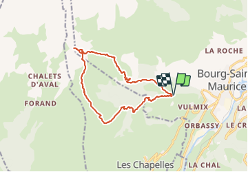
Trail Touring skiing of 14.9 km to be discovered at Auvergne-Rhône-Alpes, Savoy, Bourg-Saint-Maurice. This trail is proposed by nadd73.

Description

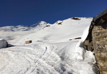
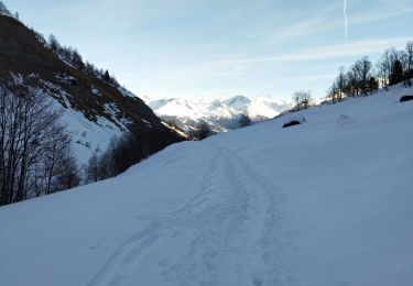
Départ de la Thuile Vulmix. Chemin forestier d'Arbonne. Un peu après la traversée du torrent. J'ai mis les skis sur le sac car c'était bien raide et pas toujours enneigé et cela jusqu'au bas du chalet de Secheron. Pour monter le couloir il est préférable de mettre les crampons. Bonne neige dans l'ensemble sauf le bas très trafollé.
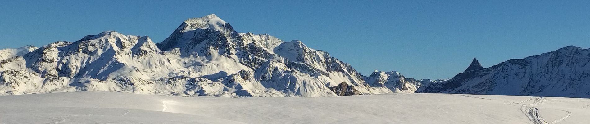
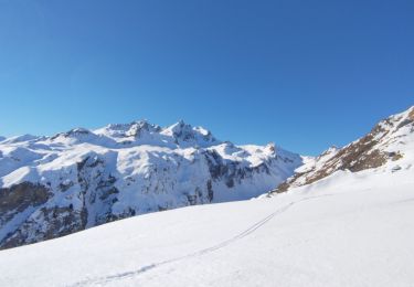
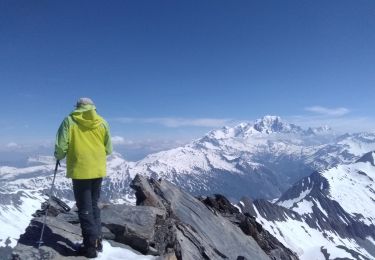
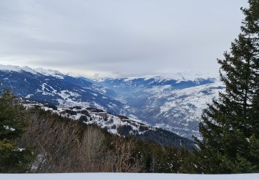
Belle vue sur le mont Pourri. la pointe de l'Aliet. le mont blanc, Le Roignais, la pointe de la combe neuve et La Leisette.

Elevation profile

Photos

Positioning

Country:
France
Region :
Auvergne-Rhône-Alpes
Department/Province :
Savoy
Municipality :
Bourg-Saint-Maurice
Location:
Unknown
Start:(UTM)
323995 ; 5053529 (32T) N.

Trails nearby

Trail Walking Landry - Landry... Circuit des Poussettes - Photo
Walking
Mimicrea

Walking

(1)
Landry, Auvergne-Rhône-Alpes, Savoy, France
4.6 km | 6.2 km-effort
2h 50min
No
Trail Walking La Plagne-Tarentaise - Les Fours  - Photo
Walking
jpduc

Walking

Easy
(2)
La Plagne-Tarentaise, Auvergne-Rhône-Alpes, Savoy, France
8.4 km | 11.7 km-effort
2h 50min
Yes
Trail Walking Bourg-Saint-Maurice - Le sentier balcon des sources de l'Arbonne - Photo
Walking
Maryma

Walking

Difficult
(1)
Bourg-Saint-Maurice, Auvergne-Rhône-Alpes, Savoy, France
14.1 km | 24 km-effort
5h 26min
Yes
Trail Touring skiing Bourg-Saint-Maurice - petite Aiguille de Praina - Photo
Touring skiing
nadd73

Touring skiing

Easy
Bourg-Saint-Maurice, Auvergne-Rhône-Alpes, Savoy, France
11.2 km | 26 km-effort
4h 25min
Yes
Trail Touring skiing Bourg-Saint-Maurice - La Torche en boucle  - Photo
Touring skiing
nadd73

Touring skiing

Medium
Bourg-Saint-Maurice, Auvergne-Rhône-Alpes, Savoy, France
17.6 km | 35 km-effort
5h 45min
Yes
Trail Touring skiing Bourg-Saint-Maurice - Aiguille de Praina - Photo
Touring skiing
nadd73

Touring skiing

Easy
Bourg-Saint-Maurice, Auvergne-Rhône-Alpes, Savoy, France
12.3 km | 29 km-effort
4h 40min
Yes
Trail Touring skiing Bourg-Saint-Maurice - pointe de la combe neuve et Roc de l'enfer - Photo
Touring skiing
nadd73

Touring skiing

Medium
Bourg-Saint-Maurice, Auvergne-Rhône-Alpes, Savoy, France
13.3 km | 30 km-effort
7h 16min
Yes
Trail Touring skiing Bourg-Saint-Maurice - Arcs Le Chantel vers Peisy Vallandry (Boucle) - Photo
Touring skiing
GUIDE
lhomme.ph

Touring skiing

Medium
Bourg-Saint-Maurice, Auvergne-Rhône-Alpes, Savoy, France
6.6 km | 10 km-effort
3h 28min
Yes
Trail Snowshoes Bourg-Saint-Maurice - Les Arcs Chantel vers l'Altiport en boucle  - Photo
Snowshoes
GUIDE
lhomme.ph

Snowshoes

Easy
Bourg-Saint-Maurice, Auvergne-Rhône-Alpes, Savoy, France
4.9 km | 8.6 km-effort
2h 38min
Yes


Close
My subscriptions