Trail On foot Pradelles-Cabardès - Pradelles,roc de l'aigle,cabrespine,pradelles - Photo

Pradelles,roc de l'aigle,cabrespine,pradelles

 Dupleix
Dupleix

User

© OpenStreetMap contributors
Length
Length
15.3 km
Max alt
Max alt
873 m
Uphill gradient
Uphill gradient
625 m
Km-Effort
Km-Effort  
24 km
Min alt
Min alt
313 m
Downhill gradient
Downhill gradient
624 m
Boucle
Boucle
Yes
Creation date :
2022-01-24 18:34:06.416
Updated on :
2022-01-24 18:40:20.294

(0 Reviews)

On foot
On foot
5h50
Difficulty : Difficult

Scan this QR Code to open this trail in the SityTrail application

FREE GPS app for hiking

Logo SityTrail SityTrail

IGN / Geographical institutes

Download SityTrail from the App Store Download SityTrail from Google Play

Logo SityTrail SityTrail World

The world is yours!

Download SityTrail from the App Store Download SityTrail from Google Play Download SityTrail on Huawei AppGallery

About

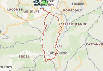
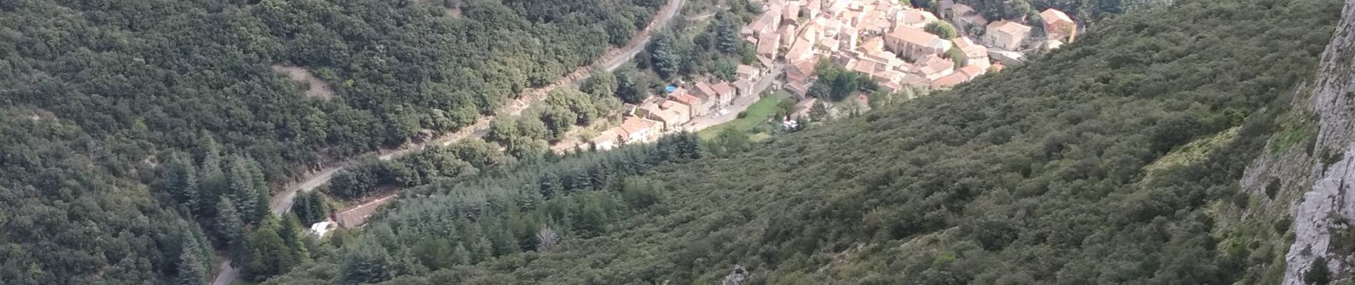
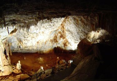
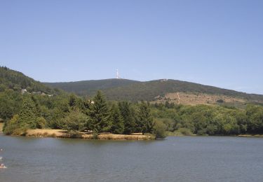
Trail On foot of 15.3 km to be discovered at Occitania, Aude, Pradelles-Cabardès. This trail is proposed by Dupleix.

Description

Boucle au depart de pradelles cabardès par la voie romaine avec les purennees en fo'd  d'ecran et des paysages vertigineux.

Elevation profile

Photos

Positioning

Country:
France
Region :
Occitania
Department/Province :
Aude
Municipality :
Pradelles-Cabardès
Location:
Unknown
Start:(UTM)
454653 ; 4805592 (31T) N.

Trails nearby

Trail Walking Castans - Boucle des ruisseaux - Castans - Photo
Walking
tracegps

Walking

Medium
(5)
Castans, Occitania, Aude, France
6.4 km | 10 km-effort
4h 0min
Yes
Trail On foot Cabrespine - Les Villages Perchés - Photo
On foot
PRO

On foot

Easy
Cabrespine, Occitania, Aude, France
8.3 km | 14.7 km-effort
3h 21min
No
Trail On foot Pradelles-Cabardès - Les Villages Perchés - Photo
On foot
PRO

On foot

Medium
Pradelles-Cabardès, Occitania, Aude, France
19.4 km | 29 km-effort
6h 34min
No
Trail On foot Labastide-Esparbairenque - Les Villages Perchés - Photo
On foot
PRO

On foot

Difficult
Labastide-Esparbairenque, Occitania, Aude, France
24 km | 38 km-effort
8h 32min
Yes
Trail On foot Pradelles-Cabardès - Les Villages Perchés - Photo
On foot
PRO

On foot

Medium
Pradelles-Cabardès, Occitania, Aude, France
19.2 km | 26 km-effort
5h 53min
No
Trail On foot Cabrespine - Boucle du Gouffre de Cabrespine - Photo
On foot
PRO

On foot

Easy
Cabrespine, Occitania, Aude, France
4.9 km | 8.7 km-effort
1h 59min
No
Trail On foot Pradelles-Cabardès - Pradelles Cabardes . Le Pic de Nore, le sentier du Roc Nouret. - Photo
On foot
caccini

On foot

Easy
(1)
Pradelles-Cabardès, Occitania, Aude, France
10.4 km | 16.4 km-effort
3h 44min
Yes
Trail On foot Roquefère - Labastide-Espabïrenque, Prat Viel, Picarot haut - Photo
On foot
mikaou.t

On foot

Medium
(1)
Roquefère, Occitania, Aude, France
10.2 km | 15.6 km-effort
3h 0min
Yes
Trail Walking Villeneuve-Minervois - pujol de bosc castanviel - Photo
Walking
henribatut

Walking

Easy
Villeneuve-Minervois, Occitania, Aude, France
15.9 km | 23 km-effort
5h 20min
Yes


Close
My subscriptions