Trail On foot Erquelinnes - Chemin de terre et de Sambre - Photo

Chemin de terre et de Sambre

Randonnées du CGT GUIDE+

© OpenStreetMap contributors
Length
Length
8.4 km
Max alt
Max alt
162 m
Uphill gradient
Uphill gradient
78 m
Km-Effort
Km-Effort  
9.4 km
Min alt
Min alt
118 m
Downhill gradient
Downhill gradient
80 m
Boucle
Boucle
Yes
Creation date :
2022-02-08 11:22:05.308
Updated on :
2022-02-21 10:03:12.668

(0 Reviews)

On foot
On foot
2h08
Difficulty : Easy

Scan this QR Code to open this trail in the SityTrail application

FREE GPS app for hiking

Logo SityTrail SityTrail

IGN / Geographical institutes

Download SityTrail from the App Store Download SityTrail from Google Play

Logo SityTrail SityTrail World

The world is yours!

Download SityTrail from the App Store Download SityTrail from Google Play Download SityTrail on Huawei AppGallery

About

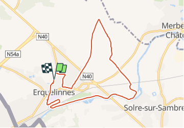
Trail On foot of 8.4 km to be discovered at Wallonia, Hainaut, Erquelinnes. This trail is proposed by Commissariat général au Tourisme.

Description

Trail created by Pays des Lacs.


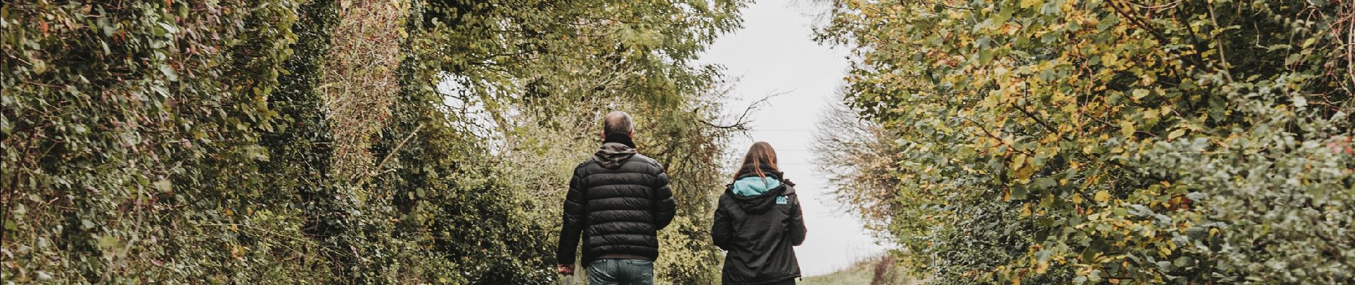
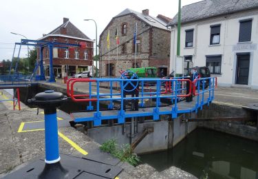
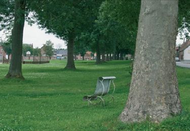
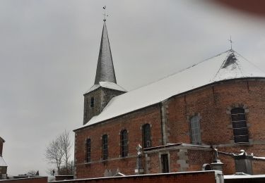
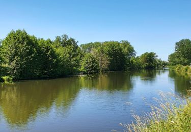
A stone’s throw from the French border, enjoy this gem of the Haute Sambre and its magnificent rural landscapes, the Hantes and the Thure rivers, its woodlands and its rich and remarkable monuments. The Church of Saint-Georges, a semi-classical building with a Roman choir dating to the 12th century, contains beautifully distinctive features, such as the Bonne-Espérance coat of arms, a stone dated 1716, an image of Christ carved into oak, and more. The Erquelinnes military cemetery has a large memorial lawn for WWI soldiers, including 66 soldiers from England, 4 from France and 11 from Germany. At the end of the route, you will follow the Sambre river. A harbour basin is found right before the border. The ambiance of the pleasure boats waiting for their next outing invite you to unwind.


Elevation profile

Photos

Positioning

Country:
Belgium
Region :
Wallonia
Department/Province :
Hainaut
Municipality :
Erquelinnes
Location:
Unknown
Start:(UTM)
579901 ; 5574008 (31U) N.

Trails nearby

Trail Walking Merbes-le-Château - GG-Ht-05_Labuissière - Landelies - Photo
Walking
PRO

Walking

Very difficult
(1)
Merbes-le-Château, Wallonia, Hainaut, Belgium
21 km | 26 km-effort
5h 33min
No
Trail Walking Merbes-le-Château - RB-Ha-12 - Dans le parc naturel des Hauts-Pays - Photo
Walking
PRO

Walking

Very difficult
(2)
Merbes-le-Château, Wallonia, Hainaut, Belgium
23 km | 27 km-effort
6h 6min
Yes
Trail Walking Merbes-le-Château - De Merbes-le-Château à Labuissière - Photo
Walking
GUIDE
Desrumaux

Walking

Easy
(2)
Merbes-le-Château, Wallonia, Hainaut, Belgium
13.2 km | 14.8 km-effort
3h 15min
Yes
Trail Walking Estinnes - Rouveroy neige 10km - Photo
Walking
Alain Dufrasne

Walking

Medium
(1)
Estinnes, Wallonia, Hainaut, Belgium
9.9 km | 10.7 km-effort
1h 56min
Yes
Trail Nordic walking Erquelinnes - 6560-05 - Hantes-Wihéries - 9,9km - 104m - Photo
Nordic walking

Nordic walking

Very easy
(1)
Erquelinnes, Wallonia, Hainaut, Belgium
9.9 km | 11.3 km-effort
Unknown
Yes
Trail On foot Erquelinnes - Promenade de la Haute Sambre - Photo
On foot
GUIDE+

On foot

Easy
Erquelinnes, Wallonia, Hainaut, Belgium
9 km | 10.2 km-effort
2h 18min
Yes
Trail On foot Erquelinnes - Sur les traces de la frontière hollandaise - Photo
On foot
GUIDE+

On foot

Easy
Erquelinnes, Wallonia, Hainaut, Belgium
6.9 km | 8.2 km-effort
1h 51min
Yes
Trail On foot Merbes-le-Château - Promenade de l’Éclusier - Photo
On foot
GUIDE+

On foot

Easy
Merbes-le-Château, Wallonia, Hainaut, Belgium
5.8 km | 6.5 km-effort
1h 29min
Yes
Trail Walking Merbes-le-Château - De Merbes-le-Château à Labuissière - Photo
Walking
GUIDE
Desrumaux

Walking

Difficult
Merbes-le-Château, Wallonia, Hainaut, Belgium
11.1 km | 12.7 km-effort
4h 1min
Yes


Close
My subscriptions