Trail On foot Lescun - Cabane du Boué asp48 - Photo

Tous les sentiers balisés d’Europe GUIDE+

© OpenStreetMap contributors
Length
Length
3.7 km
Max alt
Max alt
1487 m
Uphill gradient
Uphill gradient
165 m
Km-Effort
Km-Effort  
5.7 km
Min alt
Min alt
1372 m
Downhill gradient
Downhill gradient
84 m
Boucle
Boucle
No
Signpost
Signpost
Creation date :
2022-02-14 22:06:30.42
Updated on :
2022-03-02 08:55:59.236

(0 Reviews)

On foot
On foot
1h17
Difficulty : Easy

Scan this QR Code to open this trail in the SityTrail application

FREE GPS app for hiking

Logo SityTrail SityTrail

IGN / Geographical institutes

Download SityTrail from the App Store Download SityTrail from Google Play

Logo SityTrail SityTrail Plus

The world is yours!

Download SityTrail from the App Store Download SityTrail from Google Play Download SityTrail on Huawei AppGallery

About

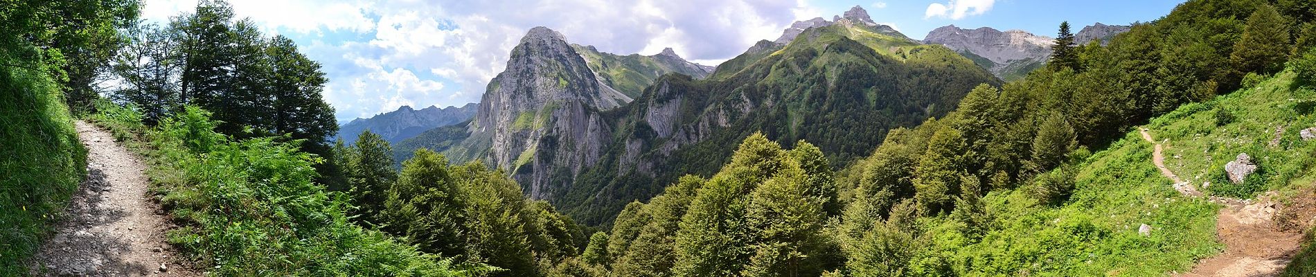
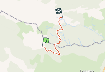
Trail On foot of 3.7 km to be discovered at New Aquitaine, Pyrénées-Atlantiques, Lescun. This trail is proposed by SityTrail - itinéraires balisés pédestres.

Description

Trail created by Communauté de Communes du Haut-Béarn.

Randonnée facile 2h00 aller-retour

Symbol: bar


Website: https://umap.openstreetmap.fr/fr/map/sentiers-de-la-vallee-daspe_163874#15/42.9502/-0.6485

Elevation profile

Photos

Positioning

Country:
France
Region :
New Aquitaine
Department/Province :
Pyrénées-Atlantiques
Municipality :
Lescun
Location:
Unknown
Start:(UTM)
690794 ; 4757534 (30T) N.


Close
My subscriptions