Trail On foot Saint-Julien-du-Verdon - Belvédère du Pidanoux - Photo

Tous les sentiers balisés d’Europe PRO

© OpenStreetMap contributors
Length
Length
7.5 km
Max alt
Max alt
1222 m
Uphill gradient
Uphill gradient
312 m
Km-Effort
Km-Effort  
11.7 km
Min alt
Min alt
915 m
Downhill gradient
Downhill gradient
312 m
Boucle
Boucle
Yes
Signpost
Signpost
Creation date :
2022-02-15 18:52:36.6
Updated on :
2022-03-02 21:58:20.519

(0 Reviews)

On foot
On foot
2h39
Difficulty : Easy

Scan this QR Code to open this trail in the SityTrail application

FREE GPS app for hiking

Logo SityTrail SityTrail

IGN / Geographical institutes

Download SityTrail from the App Store Download SityTrail from Google Play

Logo SityTrail SityTrail World

The world is yours!

Download SityTrail from the App Store Download SityTrail from Google Play Download SityTrail on Huawei AppGallery

About

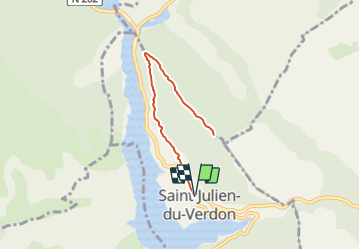
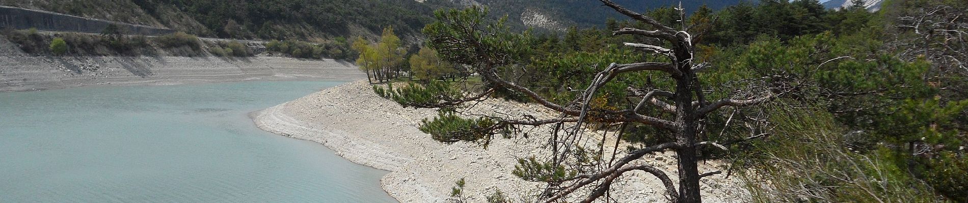
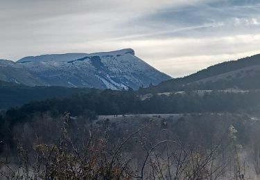
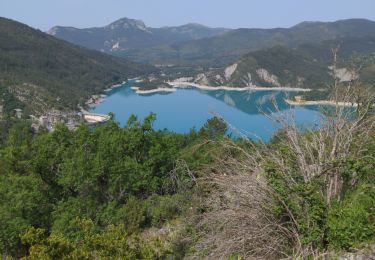
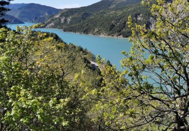
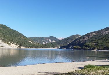
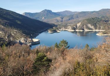
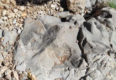
Trail On foot of 7.5 km to be discovered at Provence-Alpes-Côte d'Azur, Alpes-de-Haute-Provence, Saint-Julien-du-Verdon. This trail is proposed by SityTrail - itinéraires balisés pédestres.

Description

Trail created by Département des Alpes-de-Haute-Provence.


Website: https://www.rando-alpes-haute-provence.fr/randonnee-pedestre/belvedere-du-pidanoux/

Photos

Positioning

Country:
France
Region :
Provence-Alpes-Côte d'Azur
Department/Province :
Alpes-de-Haute-Provence
Municipality :
Saint-Julien-du-Verdon
Location:
Unknown
Start:(UTM)
302623 ; 4865388 (32T) N.

Trails nearby

Trail Walking Castellane - La Baume-Ruines du Vieux Courchons - Photo
Walking
Salomi

Walking

Difficult
(1)
Castellane, Provence-Alpes-Côte d'Azur, Alpes-de-Haute-Provence, France
12.2 km | 18.5 km-effort
4h 11min
Yes
Trail Walking Saint-André-les-Alpes - SAINT ANDRE LES ALPES . COURCHONS O S - Photo
Walking
RobinMicheline

Walking

Medium
(1)
Saint-André-les-Alpes, Provence-Alpes-Côte d'Azur, Alpes-de-Haute-Provence, France
13.7 km | 22 km-effort
4h 12min
Yes
Trail Walking Demandolx - le hameau de ville - Photo
Walking
pln30

Walking

Easy
Demandolx, Provence-Alpes-Côte d'Azur, Alpes-de-Haute-Provence, France
4.3 km | 7.8 km-effort
2h 2min
Yes
Trail Walking Saint-Julien-du-Verdon - St Julien du Verdon-Pidanoux - Photo
Walking
MIKARANDO

Walking

Medium
Saint-Julien-du-Verdon, Provence-Alpes-Côte d'Azur, Alpes-de-Haute-Provence, France
5.5 km | 9.2 km-effort
1h 31min
No
Trail Other activity Vergons - vergons par col de l iscle - Photo
Other activity
slivoide

Other activity

Very easy
(1)
Vergons, Provence-Alpes-Côte d'Azur, Alpes-de-Haute-Provence, France
28 km | 44 km-effort
2h 30min
Yes
Trail Walking Saint-André-les-Alpes - Dimanche 14 avril 2024 - Photo
Walking
Sylvain-06

Walking

Medium
Saint-André-les-Alpes, Provence-Alpes-Côte d'Azur, Alpes-de-Haute-Provence, France
15.1 km | 20 km-effort
7h 54min
Yes
Trail Walking Demandolx - Demandolx cremon 1000m 16kms  - Photo
Walking
Danielba

Walking

Very difficult
Demandolx, Provence-Alpes-Côte d'Azur, Alpes-de-Haute-Provence, France
14.8 km | 27 km-effort
8h 5min
Yes
Trail Walking Castellane - Mandarom l'acide castillion - Photo
Walking
hueco

Walking

Medium
Castellane, Provence-Alpes-Côte d'Azur, Alpes-de-Haute-Provence, France
13.5 km | 20 km-effort
4h 4min
Yes
Trail Mountain bike Castellane - Grande Traversée des PréAlpes à VTT : La Baume - Chaudanne - Photo
Mountain bike
tracegps

Mountain bike

Difficult
Castellane, Provence-Alpes-Côte d'Azur, Alpes-de-Haute-Provence, France
9.6 km | 12.4 km-effort
1h 0min
No


Close
My subscriptions