Trail Mountain bike Metz - Randonnée des Lavoirs 2013 - Metz - Photo

Randonnée des Lavoirs 2013 - Metz

 tracegps
tracegps

User

© OpenStreetMap contributors
Length
Length
22 km
Max alt
Max alt
341 m
Uphill gradient
Uphill gradient
399 m
Km-Effort
Km-Effort  
28 km
Min alt
Min alt
160 m
Downhill gradient
Downhill gradient
400 m
Boucle
Boucle
Yes
Creation date :
2014-12-10 00:00:00.0
Updated on :
2014-12-10 00:00:00.0

(0 Reviews)

Mountain bike
Mountain bike
1h30
Difficulty : Medium

Scan this QR Code to open this trail in the SityTrail application

FREE GPS app for hiking

Logo SityTrail SityTrail

IGN / Geographical institutes

Download SityTrail from the App Store Download SityTrail from Google Play

Logo SityTrail SityTrail World

The world is yours!

Download SityTrail from the App Store Download SityTrail from Google Play Download SityTrail on Huawei AppGallery

About

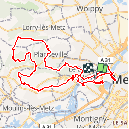
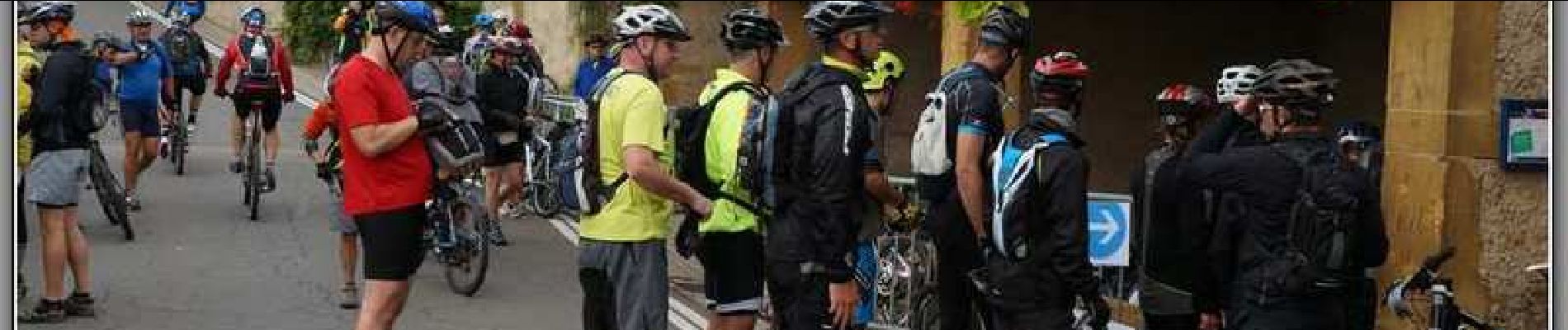
Trail Mountain bike of 22 km to be discovered at Grand Est, Moselle, Metz. This trail is proposed by tracegps.

Description

Parcours VTT de 22km, à partir de Metz, boucle autour du mont St Quentin. Circuit proposé dans le cadre de la Randonnée des Lavoirs 2013.

Elevation profile

Photos

Positioning

Country:
France
Region :
Grand Est
Department/Province :
Moselle
Municipality :
Metz
Location:
Unknown
Start:(UTM)
292474 ; 5444654 (32U) N.

Trails nearby

Trail Walking Plappeville - Saint Quentin - Photo
Walking
edmondnagel

Walking

Medium
(1)
Plappeville, Grand Est, Moselle, France
6.9 km | 9.2 km-effort
1h 59min
Yes
Trail Walking Plappeville - Autour du fort de Plappeville. - Photo
Walking
edmondnagel

Walking

Easy
(1)
Plappeville, Grand Est, Moselle, France
8.9 km | 11 km-effort
2h 55min
Yes
Trail On foot Metz - Circuit des sentiers de Queuleu - Photo
On foot
PRO

On foot

Easy
Metz, Grand Est, Moselle, France
4.5 km | 5.2 km-effort
1h 10min
Yes
Trail On foot Lessy - Circuit de Plappeville - Photo
On foot
PRO

On foot

Easy
Lessy, Grand Est, Moselle, France
8.5 km | 11.2 km-effort
2h 32min
Yes
Trail On foot Scy-Chazelles - Circuit Robert Schuman - Photo
On foot
PRO

On foot

Easy
Scy-Chazelles, Grand Est, Moselle, France
3.5 km | 5 km-effort
1h 7min
No
Trail On foot Scy-Chazelles - Circuit du Tour du Mont St Quentin - Photo
On foot
PRO

On foot

Easy
Scy-Chazelles, Grand Est, Moselle, France
4.9 km | 6.7 km-effort
1h 31min
No
Trail Walking Metz - 20210723 - METZ - Promenade des remparts - 6 Km - Photo
Walking
GUIDE
pierreh01

Walking

Very easy
Metz, Grand Est, Moselle, France
5.7 km | 6.6 km-effort
1h 45min
Yes
Trail Walking Saulny - plesnois - Photo
Walking
pistou

Walking

Medium
(2)
Saulny, Grand Est, Moselle, France
5.8 km | 7.9 km-effort
1h 24min
Yes
Trail Mountain bike Metz - MetzGare-PAM - Photo
Mountain bike
PhilippeC54

Mountain bike

Easy
(1)
Metz, Grand Est, Moselle, France
30 km | 33 km-effort
Unknown
No


Close
My subscriptions