Trail Walking Collorgues - Château de Castelnau - Collorgues - Photo

Château de Castelnau - Collorgues

 tracegps
tracegps

User

© OpenStreetMap contributors
Length
Length
14.1 km
Max alt
Max alt
202 m
Uphill gradient
Uphill gradient
239 m
Km-Effort
Km-Effort  
17.3 km
Min alt
Min alt
83 m
Downhill gradient
Downhill gradient
240 m
Boucle
Boucle
Yes
Creation date :
2014-12-10 00:00:00.0
Updated on :
2014-12-10 00:00:00.0

(1 Reviews)

Walking
Walking
4h00
Difficulty : Medium

Scan this QR Code to open this trail in the SityTrail application

FREE GPS app for hiking

Logo SityTrail SityTrail

IGN / Geographical institutes

Download SityTrail from the App Store Download SityTrail from Google Play

Logo SityTrail SityTrail World

The world is yours!

Download SityTrail from the App Store Download SityTrail from Google Play Download SityTrail on Huawei AppGallery

About

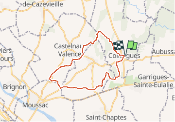
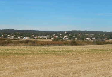
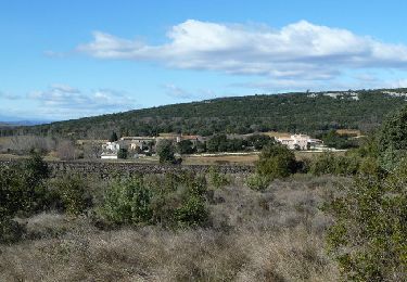
Trail Walking of 14.1 km to be discovered at Occitania, Gard, Collorgues. This trail is proposed by tracegps.

Description

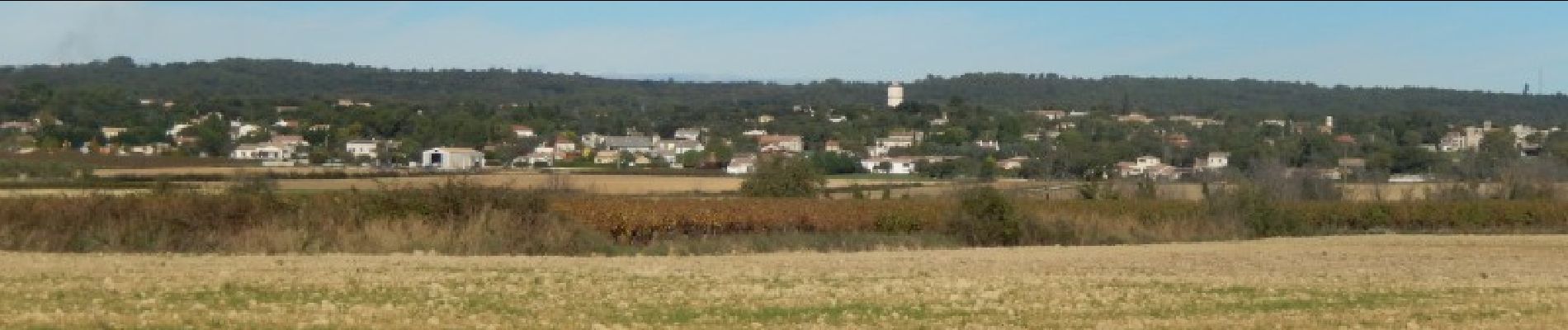
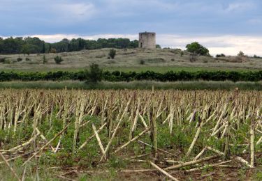
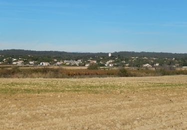
Alternance de cultures et de bois. Belles vues au nord sur le mont Bouquet et au sud sur la plaine de St Chaptes. Une ancienne éolienne du 19éme siècle (l'écologie ce n'est pas nouveau!) voir l'historique au passage. On peut allonger la rando par une boucle en passant devant le château Castelnau et retour par Les Mazes, balisage jaune. Quelques sources ou "font" sur le parcours. Suivez vos GPS pour une bonne rando.

Elevation profile

Photos

Positioning

Country:
France
Region :
Occitania
Department/Province :
Gard
Municipality :
Collorgues
Location:
Unknown
Start:(UTM)
603561 ; 4873215 (31T) N.

Comments

Please log in to post a review or rate the element


belle promenade variée


Trails nearby

Trail Walking Collorgues - Collorgues dalles  - Photo
Walking
caroline116

Walking

Very easy
(1)
Collorgues, Occitania, Gard, France
7.9 km | 9.7 km-effort
46min
Yes
Trail Walking Collorgues - Aubussargues 2ème parcours - Photo
Walking
caroline116

Walking

Medium
(1)
Collorgues, Occitania, Gard, France
7 km | 8.8 km-effort
1h 50min
Yes
Trail Walking Collorgues - Aubussargues 2ème parcours - Photo
Walking
caroline116

Walking

Medium
(1)
Collorgues, Occitania, Gard, France
7 km | 8.8 km-effort
1h 50min
Yes
Trail Walking Saint-Chaptes - Rome-16-StChaptes-LaCalmette-20150903 - Photo
Walking
patrickdanilo

Walking

Easy
Saint-Chaptes, Occitania, Gard, France
18.8 km | 23 km-effort
4h 53min
No
Trail Mountain bike Collorgues - Château de Castelnau - Collorgues - Photo
Mountain bike
tracegps

Mountain bike

Easy
Collorgues, Occitania, Gard, France
14.1 km | 17.3 km-effort
1h 30min
Yes
Trail Walking Collorgues - Sainte Eulalie - Collorgues - Photo
Walking
tracegps

Walking

Medium
Collorgues, Occitania, Gard, France
14.8 km | 17.5 km-effort
4h 30min
Yes
Trail Walking Foissac - L'Arque de Baron - Foissac - Photo
Walking
tracegps

Walking

Medium
Foissac, Occitania, Gard, France
14.4 km | 17.6 km-effort
4h 0min
Yes
Trail Walking Bourdic - BOURDIC - Photo
Walking
bernardgouttiere

Walking

Easy
Bourdic, Occitania, Gard, France
13.3 km | 14.6 km-effort
4h 7min
Yes
Trail Mountain bike Saint-Chaptes - Boulanger St. Chapte - Photo
Mountain bike
andremusin

Mountain bike

Easy
Saint-Chaptes, Occitania, Gard, France
4.1 km | 4.6 km-effort
23min
No


Close
My subscriptions