Trail Walking Fouquières-lès-Béthune - Le sentier des 2 riviéres -  Fouquières lez Béthune - Photo

Le sentier des 2 riviéres - Fouquières lez Béthune

 tracegps
tracegps

User

© OpenStreetMap contributors
Length
Length
8.2 km
Max alt
Max alt
62 m
Uphill gradient
Uphill gradient
56 m
Km-Effort
Km-Effort  
8.9 km
Min alt
Min alt
23 m
Downhill gradient
Downhill gradient
56 m
Boucle
Boucle
Yes
Creation date :
2014-12-10 00:00:00.0
Updated on :
2014-12-10 00:00:00.0

(0 Reviews)

Walking
Walking
2h04
Difficulty : Medium

Scan this QR Code to open this trail in the SityTrail application

FREE GPS app for hiking

Logo SityTrail SityTrail

IGN / Geographical institutes

Download SityTrail from the App Store Download SityTrail from Google Play

Logo SityTrail SityTrail World

The world is yours!

Download SityTrail from the App Store Download SityTrail from Google Play Download SityTrail on Huawei AppGallery

About

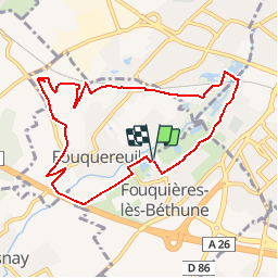
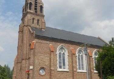
Trail Walking of 8.2 km to be discovered at Hauts-de-France, Pas-de-Calais, Fouquières-lès-Béthune. This trail is proposed by tracegps.

Description

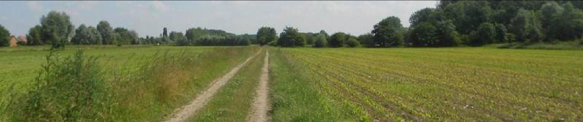
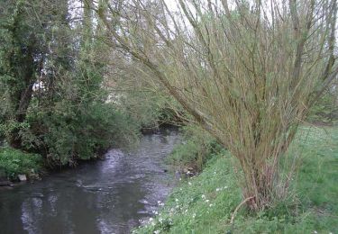
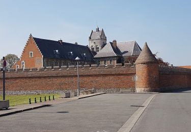
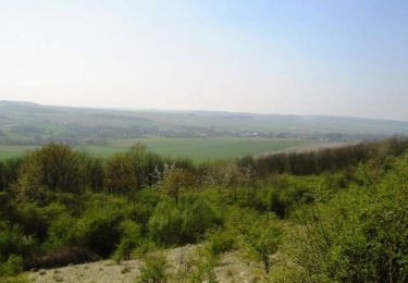
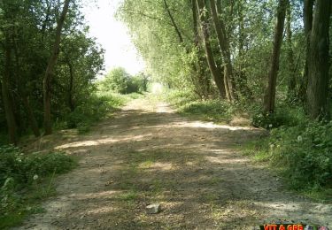
Sans présenter de réelle difficulté, il s'adresse aux randonneurs équipés de bonnes chaussures et désireux de s'oxygéner dans un territoire rural. Sur tout le parcours, vous serez accompagnés par 2 éléments: l'eau et la nature sauvage. Étangs, marais, rivières, ruisseaux sont omniprésents. Petits sentiers arborés, marais, cavaliers, chemins à travers champs, terril offrent une échappée aux paysages variés. Le sentier permet d'observer des végétations spécifiques tantôt spontanées (marais) tantôt initiées par l'homme (terril requalifié). La mine devient tangible: avec le terril de Fouquereuil vous découvrez un site de stockage mais non d’exploitation. Départ de l'espace Guy Emerton, rue Basse à Fouquières-lez-Béthune. Retrouvez le circuit sur le site de la Communauté de Communes de Noeux-les-Mines et ses environs.

Elevation profile

Photos

Positioning

Country:
France
Region :
Hauts-de-France
Department/Province :
Pas-de-Calais
Municipality :
Fouquières-lès-Béthune
Location:
Unknown
Start:(Dec)
Start:(UTM)
472316 ; 5596315 (31U) N.

Trails nearby

Trail Walking Béthune - Le sentier de Catorive. -  Béthune - Photo
Walking
tracegps

Walking

Medium
(2)
Béthune, Hauts-de-France, Pas-de-Calais, France
8.3 km | 9 km-effort
2h 0min
Yes
Trail Walking Béthune - Béthune - Photo
Walking
Marie-Claire-mcp

Walking

Very easy
Béthune, Hauts-de-France, Pas-de-Calais, France
5.6 km | 6.2 km-effort
2h 7min
Yes
Trail Walking Vaudricourt - Sentier des paysages - Vaudricourt - Photo
Walking
tracegps

Walking

Easy
(2)
Vaudricourt, Hauts-de-France, Pas-de-Calais, France
6.4 km | 7 km-effort
1h 34min
Yes
Trail Walking Lapugnoy - Le sentier d'Ecques -  Lapugnoy - Photo
Walking
tracegps

Walking

Medium
(3)
Lapugnoy, Hauts-de-France, Pas-de-Calais, France
12.1 km | 14.1 km-effort
3h 0min
Yes
Trail Walking Nœux-les-Mines - Noeux les mines  - Photo
Walking
jpblimond

Walking

Medium
Nœux-les-Mines, Hauts-de-France, Pas-de-Calais, France
18.9 km | 21 km-effort
4h 44min
Yes
Trail Walking Fouquereuil - Fouquereuil  8.1 km  - Photo
Walking
Blourouce

Walking

Medium
Fouquereuil, Hauts-de-France, Pas-de-Calais, France
7.8 km | 8.9 km-effort
2h 8min
Yes
Trail Mountain bike Houchin - L'Houchinoise 2008 - Photo
Mountain bike
tracegps

Mountain bike

Medium
Houchin, Hauts-de-France, Pas-de-Calais, France
31 km | 35 km-effort
3h 0min
Yes
Trail Mountain bike Annezin - Rando Busnes départ Annezin  - Photo
Mountain bike
tracegps

Mountain bike

Medium
Annezin, Hauts-de-France, Pas-de-Calais, France
45 km | 49 km-effort
3h 0min
Yes
Trail Walking Verquigneul - verquignieul  - Photo
Walking
Chene62

Walking

Very easy
Verquigneul, Hauts-de-France, Pas-de-Calais, France
9.6 km | 10.6 km-effort
1h 55min
Yes


Close
My subscriptions