Trail Walking Saint-Martin-la-Plaine - rando autour de St Martin la plaine,  - Photo

rando autour de St Martin la plaine,

© OpenStreetMap contributors
Length
Length
10.4 km
Max alt
Max alt
606 m
Uphill gradient
Uphill gradient
237 m
Km-Effort
Km-Effort  
13.6 km
Min alt
Min alt
424 m
Downhill gradient
Downhill gradient
236 m
Boucle
Boucle
Yes
Creation date :
2022-04-09 07:33:35.188
Updated on :
2022-04-09 11:02:18.427

(0 Reviews)

Walking
Walking
3h06
Difficulty : Easy

Scan this QR Code to open this trail in the SityTrail application

FREE GPS app for hiking

Logo SityTrail SityTrail

IGN / Geographical institutes

Download SityTrail from the App Store Download SityTrail from Google Play

Logo SityTrail SityTrail World

The world is yours!

Download SityTrail from the App Store Download SityTrail from Google Play Download SityTrail on Huawei AppGallery

About

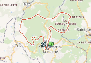
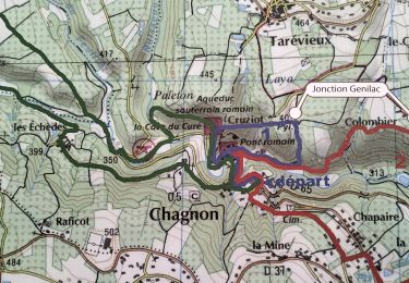
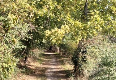
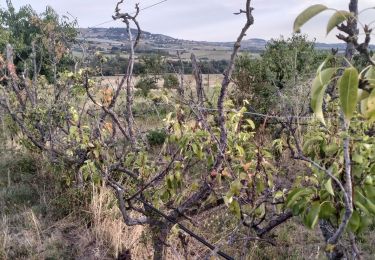
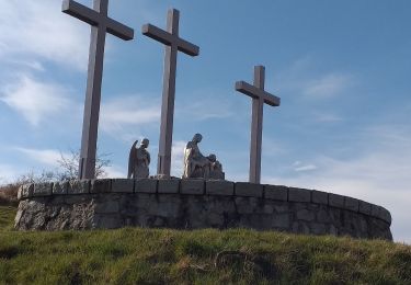
Trail Walking of 10.4 km to be discovered at Auvergne-Rhône-Alpes, Loire, Saint-Martin-la-Plaine. This trail is proposed by mimi69670.

Description

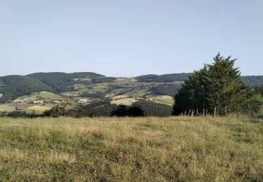
Départ de St Martin la Plaine, grimpez sur les crets et points de vue sur le Pilât et par temps clair, la chaîne des Alpes

Elevation profile

Photos

Positioning

Country:
France
Region :
Auvergne-Rhône-Alpes
Department/Province :
Loire
Municipality :
Saint-Martin-la-Plaine
Location:
Unknown
Start:(UTM)
624175 ; 5044856 (31T) N.

Trails nearby

Trail Walking La Grand-Croix - MOYENNE MARCHE - Photo
Walking
CLERJON

Walking

Very easy
(1)
La Grand-Croix, Auvergne-Rhône-Alpes, Loire, France
3.8 km | 5 km-effort
1h 1min
Yes
Trail Walking Chagnon - 42_Chagnon_13km470m - Photo
Walking
SyMA

Walking

Medium
Chagnon, Auvergne-Rhône-Alpes, Loire, France
13.1 km | 19.3 km-effort
2h 58min
Yes
Trail Walking Saint-Joseph - 42-st-joseph-10km-320m - Photo
Walking
SyMA

Walking

Easy
Saint-Joseph, Auvergne-Rhône-Alpes, Loire, France
10.5 km | 14.8 km-effort
2h 50min
Yes
Trail Walking Chabanière - 69-st-maurice-dargoire2-19km-580m - Photo
Walking
SyMA

Walking

Difficult
Chabanière, Auvergne-Rhône-Alpes, Rhône, France
19.2 km | 27 km-effort
5h 47min
Yes
Trail Walking Chabanière - 69_st_maurice_dargeoire_12km_300m - Photo
Walking
SyMA

Walking

Medium
Chabanière, Auvergne-Rhône-Alpes, Rhône, France
11.6 km | 15.5 km-effort
3h 31min
Yes
Trail Walking Saint-Martin-la-Plaine - 42-martinlaplaine-12km450m - Photo
Walking
SyMA

Walking

Difficult
Saint-Martin-la-Plaine, Auvergne-Rhône-Alpes, Loire, France
12.9 km | 18.9 km-effort
4h 17min
Yes
Trail Walking Cellieu - Cellier Valfleurie - Photo
Walking
PhilDomDoxa

Walking

Medium
Cellieu, Auvergne-Rhône-Alpes, Loire, France
19.3 km | 29 km-effort
4h 37min
No
Trail Walking Cellieu - cellieu partiel pournphotos - Photo
Walking
PhilDomDoxa

Walking

Medium
Cellieu, Auvergne-Rhône-Alpes, Loire, France
11 km | 17.9 km-effort
2h 37min
No
Trail Walking Cellieu - Cellieu - Photo
Walking
algecko

Walking

Medium
(1)
Cellieu, Auvergne-Rhône-Alpes, Loire, France
19.2 km | 28 km-effort
6h 29min
Yes


Close
My subscriptions