Trail Walking Chabanière - 69-st-maurice-dargoire2-19km-580m - Photo

69-st-maurice-dargoire2-19km-580m

 SyMA
SyMA

User

© OpenStreetMap contributors
Length
Length
19.2 km
Max alt
Max alt
781 m
Uphill gradient
Uphill gradient
583 m
Km-Effort
Km-Effort  
27 km
Min alt
Min alt
389 m
Downhill gradient
Downhill gradient
582 m
Boucle
Boucle
Yes
Creation date :
2023-09-28 07:47:42.463
Updated on :
2023-09-28 19:17:27.669

(0 Reviews)

Walking
Walking
5h47
Difficulty : Difficult

Scan this QR Code to open this trail in the SityTrail application

FREE GPS app for hiking

Logo SityTrail SityTrail

IGN / Geographical institutes

Download SityTrail from the App Store Download SityTrail from Google Play

Logo SityTrail SityTrail World

The world is yours!

Download SityTrail from the App Store Download SityTrail from Google Play Download SityTrail on Huawei AppGallery

About

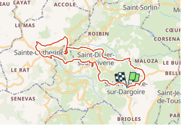
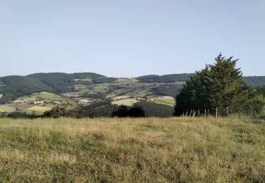
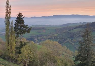
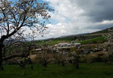
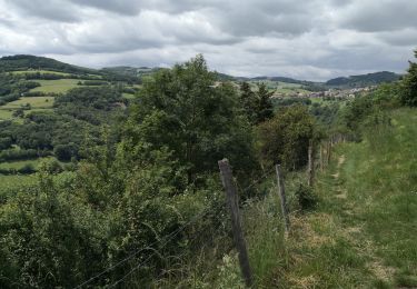
Trail Walking of 19.2 km to be discovered at Auvergne-Rhône-Alpes, Rhône, Chabanière. This trail is proposed by SyMA.

Description

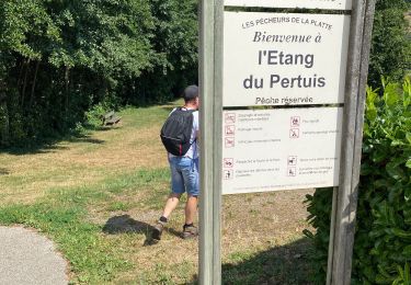
Départ parking de ST Maurice
passage à Riverie et Ste Catherine

Elevation profile

Photos

Positioning

Country:
France
Region :
Auvergne-Rhône-Alpes
Department/Province :
Rhône
Municipality :
Chabanière
Location:
Saint-Maurice-sur-Dargoire
Start:(UTM)
627181 ; 5048882 (31T) N.

Trails nearby

Trail Walking Mornant - Mornant-Lac de la Madone à St Sorlin - Photo
Walking
Sigmut

Walking

Medium
(1)
Mornant, Auvergne-Rhône-Alpes, Rhône, France
7.3 km | 9.5 km-effort
1h 28min
Yes
Trail Walking Trèves - Chemin de Fer à Trèves - Photo
Walking
tracegps

Walking

Medium
(1)
Trèves, Auvergne-Rhône-Alpes, Rhône, France
4.5 km | 6.8 km-effort
1h 30min
Yes
Trail Walking Saint-Joseph - 42-st-joseph-10km-320m - Photo
Walking
SyMA

Walking

Easy
Saint-Joseph, Auvergne-Rhône-Alpes, Loire, France
10.5 km | 14.8 km-effort
2h 50min
Yes
Trail Walking Chabanière - 69_st_maurice_dargeoire_12km_300m - Photo
Walking
SyMA

Walking

Medium
Chabanière, Auvergne-Rhône-Alpes, Rhône, France
11.6 km | 15.5 km-effort
3h 31min
Yes
Trail Walking Saint-Martin-la-Plaine - 42-martinlaplaine-12km450m - Photo
Walking
SyMA

Walking

Difficult
Saint-Martin-la-Plaine, Auvergne-Rhône-Alpes, Loire, France
12.9 km | 18.9 km-effort
4h 17min
Yes
Trail Walking Riverie - Riverie - Tour au dessus de Riverie - Photo
Walking
Sigmut

Walking

Medium
Riverie, Auvergne-Rhône-Alpes, Rhône, France
5.7 km | 7.8 km-effort
2h 4min
Yes
Trail Walking Saint-Martin-la-Plaine - rando autour de St Martin la plaine,  - Photo
Walking
mimi69670

Walking

Easy
Saint-Martin-la-Plaine, Auvergne-Rhône-Alpes, Loire, France
10.4 km | 13.6 km-effort
3h 6min
Yes
Trail Walking Saint-Martin-la-Plaine - 20200723...De St-Martin-la-Plaine à Ste Catherine - Photo
Walking
galain

Walking

Medium
Saint-Martin-la-Plaine, Auvergne-Rhône-Alpes, Loire, France
26 km | 36 km-effort
6h 11min
Yes
Trail Walking Riverie - Tour de Riverie - Photo
Walking
Sigmut

Walking

Very easy
Riverie, Auvergne-Rhône-Alpes, Rhône, France
5.5 km | 8.2 km-effort
3h 1min
Yes


Close
My subscriptions