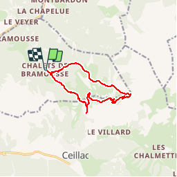
13.4 km | 26 km-effort
Col Fromage depuis les Chalets de Bramousse
GAPIAN43
User
Length
11.4 km
Max alt
2558 m
Uphill gradient
768 m
Km-Effort
22 km
Min alt
1846 m
Downhill gradient
774 m
Boucle
Yes
Creation date :
2014-12-10 00:00:00.0
Updated on :
2014-12-10 00:00:00.0
4h22
Difficulty : Medium
FREE GPS app for hiking
About
Trail Walking of 11.4 km to be discovered at Provence-Alpes-Côte d'Azur, Hautes-Alpes, Guillestre. This trail is proposed by GAPIAN43.
Description
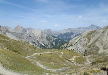
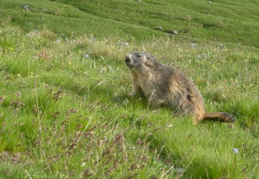
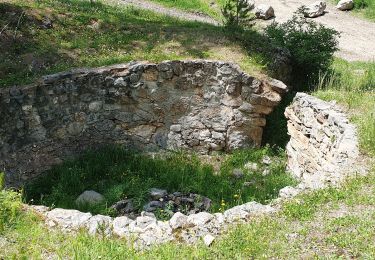
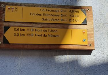
Col Fromage et Col de Bramousse depuis les chalets en passant par l'observatoire
Positioning
Country:
France
Region :
Provence-Alpes-Côte d'Azur
Department/Province :
Hautes-Alpes
Municipality :
Guillestre
Location:
Unknown
Start:(Dec)
Start:(UTM)
322806 ; 4951862 (32T) N.
Comments
Trails nearby
Crêtes de Chambrettes
Walking
Medium
(1)
Ceillac,
Provence-Alpes-Côte d'Azur,
Hautes-Alpes,
France
5h 53min
Yes
05 Tour Font Sancte - étape 1
Walking
Very difficult
(1)
Ceillac,
Provence-Alpes-Côte d'Azur,
Hautes-Alpes,
France
16.5 km | 36 km-effort
8h 9min
No
les alpages de Furfande
Walking
Easy
Arvieux,
Provence-Alpes-Côte d'Azur,
Hautes-Alpes,
France
17 km | 29 km-effort
6h 57min
Yes
Ceillac - St Véran
Walking
Medium
Ceillac,
Provence-Alpes-Côte d'Azur,
Hautes-Alpes,
France
13.5 km | 28 km-effort
7h 22min
No
la pointe de la Saume (traversée)
Walking
Difficult
Ceillac,
Provence-Alpes-Côte d'Azur,
Hautes-Alpes,
France
15 km | 34 km-effort
6h 43min
No
#1 Queyras 3j étape 1 Ceillac - Lac de Roue
Walking
Very difficult
Ceillac,
Provence-Alpes-Côte d'Azur,
Hautes-Alpes,
France
16.7 km | 33 km-effort
7h 34min
No
Arvieux Randonnée
Walking
Very difficult
Ceillac,
Provence-Alpes-Côte d'Azur,
Hautes-Alpes,
France
138 km | 250 km-effort
56h 55min
Yes
circuit des fours à chaux
Walking
Easy
Ceillac,
Provence-Alpes-Côte d'Azur,
Hautes-Alpes,
France
7 km | 9.3 km-effort
2h 27min
No
col fromage retour par la route des cairns
Walking
Medium
Ceillac,
Provence-Alpes-Côte d'Azur,
Hautes-Alpes,
France
10.5 km | 19.3 km-effort
3h 49min
No