Trail Walking Mallefougasse-Augès - col Bas depuis mallefougasse - Photo
 Roger
Roger

User

© OpenStreetMap contributors
Length
Length
9.2 km
Max alt
Max alt
738 m
Uphill gradient
Uphill gradient
235 m
Km-Effort
Km-Effort  
12.4 km
Min alt
Min alt
571 m
Downhill gradient
Downhill gradient
233 m
Boucle
Boucle
Yes
Creation date :
2022-05-06 07:57:52.041
Updated on :
2022-05-06 12:25:57.402

(0 Reviews)

Walking
Walking
3h01
Difficulty : Medium

Scan this QR Code to open this trail in the SityTrail application

FREE GPS app for hiking

Logo SityTrail SityTrail

IGN / Geographical institutes

Download SityTrail from the App Store Download SityTrail from Google Play

Logo SityTrail SityTrail World

The world is yours!

Download SityTrail from the App Store Download SityTrail from Google Play Download SityTrail on Huawei AppGallery

About

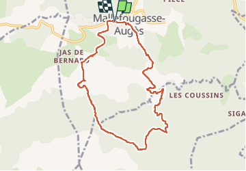
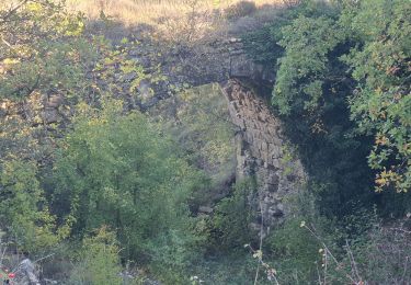
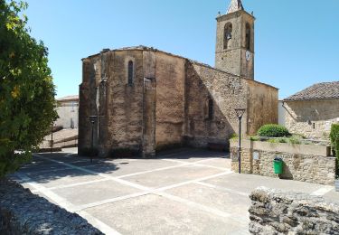
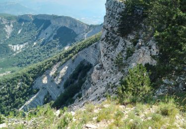
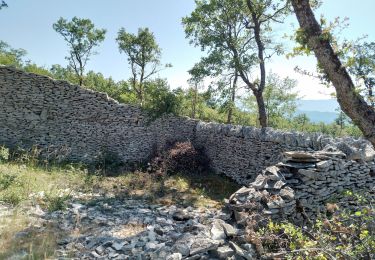
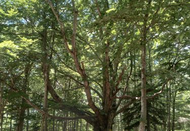
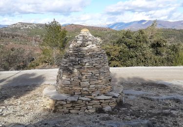
Trail Walking of 9.2 km to be discovered at Provence-Alpes-Côte d'Azur, Alpes-de-Haute-Provence, Mallefougasse-Augès. This trail is proposed by Roger .

Description

jolie randonnée  ,mais attention aux risque d incendie l ete

Elevation profile

Photos

Positioning

Country:
France
Region :
Provence-Alpes-Côte d'Azur
Department/Province :
Alpes-de-Haute-Provence
Municipality :
Mallefougasse-Augès
Location:
Mallefougasse
Start:(UTM)
731865 ; 4883328 (31T) N.

Trails nearby

Trail Walking Châteauneuf-Val-Saint-Donat - Bergeries en pierres sèches - Châteauneuf Val Saint Donat - Photo
Walking
tracegps

Walking

Medium
(2)
Châteauneuf-Val-Saint-Donat, Provence-Alpes-Côte d'Azur, Alpes-de-Haute-Provence, France
7.6 km | 11.2 km-effort
2h 19min
Yes
Trail Running Peyruis - trail 29 07 2013 - Photo
Running
zapi

Running

Medium
(1)
Peyruis, Provence-Alpes-Côte d'Azur, Alpes-de-Haute-Provence, France
13.5 km | 20 km-effort
1h 27min
Yes
Trail Walking Montlaux - montlaux.lablache - Photo
Walking
Roger

Walking

Medium
Montlaux, Provence-Alpes-Côte d'Azur, Alpes-de-Haute-Provence, France
8.4 km | 11.8 km-effort
3h 6min
Yes
Trail Walking Montfort - 2023-11-07 Tour de la Louviere et Chapelle Saint Donat - Photo
Walking
GUIDE
Kargil

Walking

Medium
Montfort, Provence-Alpes-Côte d'Azur, Alpes-de-Haute-Provence, France
12.9 km | 16.7 km-effort
3h 47min
Yes
Trail Walking Cruis - cruis la ronde des jas . - Photo
Walking
Roger

Walking

Medium
Cruis, Provence-Alpes-Côte d'Azur, Alpes-de-Haute-Provence, France
11.4 km | 18.1 km-effort
3h 39min
Yes
Trail Walking Châteauneuf-Val-Saint-Donat - château neuf val St donat. Le pas de richaud - Photo
Walking
Roger

Walking

Difficult
Châteauneuf-Val-Saint-Donat, Provence-Alpes-Côte d'Azur, Alpes-de-Haute-Provence, France
12.2 km | 22 km-effort
4h 54min
Yes
Trail Walking Châteauneuf-Val-Saint-Donat - château neuf, val St donat - Photo
Walking
Roger

Walking

Medium
Châteauneuf-Val-Saint-Donat, Provence-Alpes-Côte d'Azur, Alpes-de-Haute-Provence, France
6.8 km | 10 km-effort
2h 40min
Yes
Trail Walking Cruis - cruis.  Le jas neuf .Le cairn 2000 - Photo
Walking
Roger

Walking

Difficult
Cruis, Provence-Alpes-Côte d'Azur, Alpes-de-Haute-Provence, France
15.1 km | 25 km-effort
5h 22min
Yes
Trail Walking Montfort - MONTFORT.  Voie Royale . Chapelle saint Donat . Trou de l Hermite  o .t  - Photo
Walking
RobinMicheline

Walking

Medium
(1)
Montfort, Provence-Alpes-Côte d'Azur, Alpes-de-Haute-Provence, France
11.8 km | 15.3 km-effort
2h 59min
No


Close
My subscriptions