Trail Walking Saint-Pierre-d'Entremont - St Meme pas de la mort - Photo
 cousam
cousam

User

© OpenStreetMap contributors
Length
Length
9.4 km
Max alt
Max alt
1551 m
Uphill gradient
Uphill gradient
1225 m
Km-Effort
Km-Effort  
26 km
Min alt
Min alt
863 m
Downhill gradient
Downhill gradient
1224 m
Boucle
Boucle
Yes
Creation date :
2022-05-10 08:00:28.405
Updated on :
2022-05-10 18:37:19.904

(0 Reviews)

Walking
Walking
5h52
Difficulty : Very difficult

Scan this QR Code to open this trail in the SityTrail application

FREE GPS app for hiking

Logo SityTrail SityTrail

IGN / Geographical institutes

Download SityTrail from the App Store Download SityTrail from Google Play

Logo SityTrail SityTrail World

The world is yours!

Download SityTrail from the App Store Download SityTrail from Google Play Download SityTrail on Huawei AppGallery

About

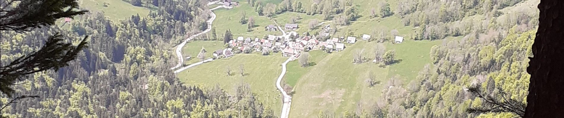
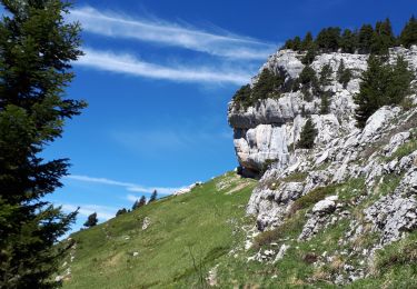
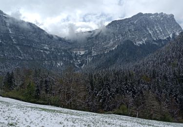
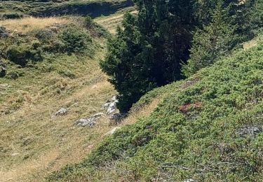
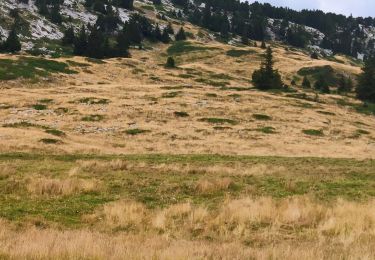
Trail Walking of 9.4 km to be discovered at Auvergne-Rhône-Alpes, Savoy, Saint-Pierre-d'Entremont. This trail is proposed by cousam.

Description

Source du Guiers et le pas de la mort  ( hard)

Elevation profile

Photos

Positioning

Country:
France
Region :
Auvergne-Rhône-Alpes
Department/Province :
Savoy
Municipality :
Saint-Pierre-d'Entremont
Location:
Unknown
Start:(UTM)
726217 ; 5031548 (31T) N.

Trails nearby

Trail Walking Saint-Pierre-d'Entremont - chartreuse varvats fouda blanc pinet - Photo
Walking
randochu

Walking

Difficult
(1)
Saint-Pierre-d'Entremont, Auvergne-Rhône-Alpes, Savoy, France
14.4 km | 27 km-effort
5h 27min
Yes
Trail Walking Saint-Pierre-d'Entremont - Le Grand Som 2026m, depuis Saint-Philibert - Photo
Walking
tracegps

Walking

Difficult
(1)
Saint-Pierre-d'Entremont, Auvergne-Rhône-Alpes, Isère, France
11.2 km | 25 km-effort
7h 0min
Yes
Trail Walking Sainte-Marie-du-Mont - Les Belles Ombres - Sangle et Rochers - Sainte Marie du Mont - Photo
Walking
tracegps

Walking

Medium
(1)
Sainte-Marie-du-Mont, Auvergne-Rhône-Alpes, Isère, France
8.6 km | 16.2 km-effort
5h 0min
Yes
Trail Snowshoes Saint-Pierre-d'Entremont - La Croix de l'Alpe depuis les Varvats - Photo
Snowshoes
tracegps

Snowshoes

Medium
(1)
Saint-Pierre-d'Entremont, Auvergne-Rhône-Alpes, Savoy, France
12 km | 24 km-effort
5h 0min
Yes
Trail Walking Saint-Pierre-d'Entremont - Roche Veyrand par les Clapiers, 1429m - Photo
Walking
tracegps

Walking

Difficult
(1)
Saint-Pierre-d'Entremont, Auvergne-Rhône-Alpes, Savoy, France
4.8 km | 14.3 km-effort
4h 10min
Yes
Trail Walking Saint-Vincent-de-Mercuze - Grande cascade de Montalieu - Photo
Walking
ouargla

Walking

Medium
(1)
Saint-Vincent-de-Mercuze, Auvergne-Rhône-Alpes, Isère, France
8.5 km | 13.5 km-effort
2h 33min
Yes
Trail Walking Saint-Pierre-d'Entremont - Cirque de Saint Même depuis Saint Pierre d'Entremont - Photo
Walking
chuck

Walking

Medium
Saint-Pierre-d'Entremont, Auvergne-Rhône-Alpes, Isère, France
10.9 km | 17.2 km-effort
4h 22min
Yes
Trail Walking Entremont-le-Vieux - la Plagne le Pinet :en boucle partielle à  partir de la bifurcation GR9 et montée au Pinet - Photo
Walking
Valgaudemar

Walking

Medium
Entremont-le-Vieux, Auvergne-Rhône-Alpes, Savoy, France
12.9 km | 24 km-effort
3h 39min
Yes
Trail Walking Entremont-le-Vieux - 29 juillet 2023 mont Pinet et rocher de la Fita  - Photo
Walking
Parodie69

Walking

Difficult
Entremont-le-Vieux, Auvergne-Rhône-Alpes, Savoy, France
17.5 km | 30 km-effort
6h 24min
Yes


Close
My subscriptions