Trail Walking Lus-la-Croix-Haute - Antécime de La Toussière - Photo
© OpenStreetMap contributors
Length
Length
8.6 km
Max alt
Max alt
1651 m
Uphill gradient
Uphill gradient
663 m
Km-Effort
Km-Effort  
17.4 km
Min alt
Min alt
998 m
Downhill gradient
Downhill gradient
664 m
Boucle
Boucle
Yes
Creation date :
2022-05-19 07:13:23.9
Updated on :
2022-05-20 06:52:51.205

(0 Reviews)

Walking
Walking
5h44
Difficulty : Difficult

Scan this QR Code to open this trail in the SityTrail application

FREE GPS app for hiking

Logo SityTrail SityTrail

IGN / Geographical institutes

Download SityTrail from the App Store Download SityTrail from Google Play

Logo SityTrail SityTrail World

The world is yours!

Download SityTrail from the App Store Download SityTrail from Google Play Download SityTrail on Huawei AppGallery

About

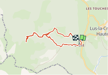
Trail Walking of 8.6 km to be discovered at Auvergne-Rhône-Alpes, Drôme, Lus-la-Croix-Haute. This trail is proposed by GuyVachet.

Description

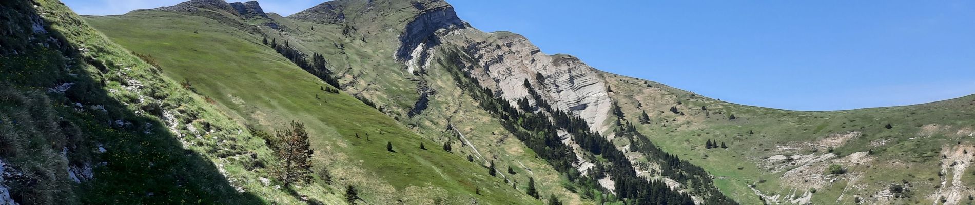
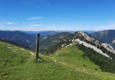
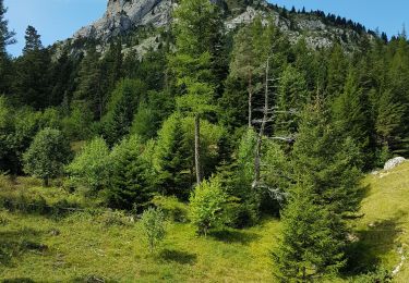
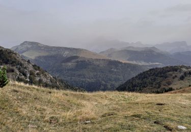
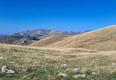
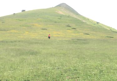
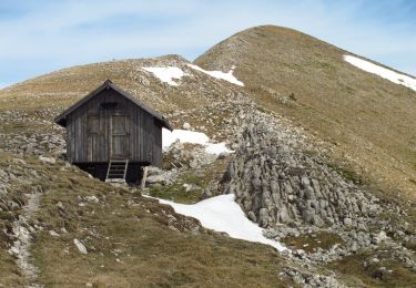
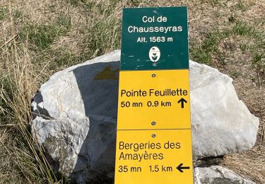
En fait, il restait 100m de dénivelé pour arriver à cette antécime mais la vue était bien dégagée pour profiter notamment du Dévoluy. La montée ombragée suit les gorges de la Toussière et peu après la bifurcation pour le Col Navite, ne pas manquer la ruine d'une commanderie des templiers. Au col, passage à découvert avant une montée raide pour l'Antécime qui commence en forêt en suivant les cairns. Retour pour agrémenter par une variante qui passe par la Toussièrette (ruines).

Elevation profile

Photos

Positioning

Country:
France
Region :
Auvergne-Rhône-Alpes
Department/Province :
Drôme
Municipality :
Lus-la-Croix-Haute
Location:
Unknown
Start:(UTM)
713457 ; 4948712 (31T) N.

Trails nearby

Trail Walking Glandage - Grimone-Le Jocou 12km - Photo
Walking
GUIDE
thonyc

Walking

Difficult
Glandage, Auvergne-Rhône-Alpes, Drôme, France
12 km | 24 km-effort
6h 0min
Yes
Trail Walking Lus-la-Croix-Haute - R48 - Gorges des Amayères - Photo
Walking
GUIDE+

Walking

Easy
Lus-la-Croix-Haute, Auvergne-Rhône-Alpes, Drôme, France
10.3 km | 17.5 km-effort
3h 1min
No
Trail Walking Lus-la-Croix-Haute - Le Rognon - Photo
Walking
GAPIAN43

Walking

Medium
(1)
Lus-la-Croix-Haute, Auvergne-Rhône-Alpes, Drôme, France
12.3 km | 22 km-effort
4h 33min
Yes
Trail Walking Saint-Julien-en-Beauchêne - ST JULIEN EN BEAUCHENE- VAUNIERES - Photo
Walking
BLANCHET

Walking

Medium
(1)
Saint-Julien-en-Beauchêne, Provence-Alpes-Côte d'Azur, Hautes-Alpes, France
9.4 km | 18.4 km-effort
3h 59min
No
Trail Walking Glandage - Le Jocou 2 - Photo
Walking
Marco05

Walking

Difficult
Glandage, Auvergne-Rhône-Alpes, Drôme, France
8.5 km | 18.1 km-effort
4h 0min
Yes
Trail Walking Lus-la-Croix-Haute - Pointe Feuillette - Photo
Walking
Marco05

Walking

Difficult
Lus-la-Croix-Haute, Auvergne-Rhône-Alpes, Drôme, France
10.5 km | 20 km-effort
4h 36min
Yes
Trail Walking Lus-la-Croix-Haute - Pointe feuillette  - Photo
Walking
ajd26

Walking

Medium
Lus-la-Croix-Haute, Auvergne-Rhône-Alpes, Drôme, France
11.4 km | 21 km-effort
4h 52min
Yes
Trail Walking Glandage - 2022-09-05_12h23m25_Le Jocou-col de Seysse 12km.gpx (2).xml - Photo
Walking
chancha

Walking

Very difficult
Glandage, Auvergne-Rhône-Alpes, Drôme, France
11.6 km | 24 km-effort
5h 27min
Yes
Trail Walking Lus-la-Croix-Haute - MAS REBUFAT - POINTE FEUILLETTE  - Photo
Walking
RD78-38

Walking

Medium
Lus-la-Croix-Haute, Auvergne-Rhône-Alpes, Drôme, France
11.7 km | 20 km-effort
3h 33min
Yes


Close
My subscriptions