Trail Walking Monestier-d'Ambel - croix de la plaigni - Photo
© OpenStreetMap contributors
Length
Length
13.2 km
Max alt
Max alt
1580 m
Uphill gradient
Uphill gradient
847 m
Km-Effort
Km-Effort  
25 km
Min alt
Min alt
760 m
Downhill gradient
Downhill gradient
874 m
Boucle
Boucle
No
Creation date :
2022-05-29 10:12:12.246
Updated on :
2022-05-29 14:30:35.1

(0 Reviews)

Walking
Walking
4h02
Difficulty : Easy

Scan this QR Code to open this trail in the SityTrail application

FREE GPS app for hiking

Logo SityTrail SityTrail

IGN / Geographical institutes

Download SityTrail from the App Store Download SityTrail from Google Play

Logo SityTrail SityTrail World

The world is yours!

Download SityTrail from the App Store Download SityTrail from Google Play Download SityTrail on Huawei AppGallery

About

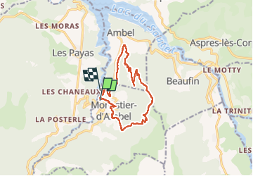
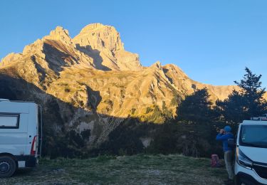
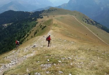
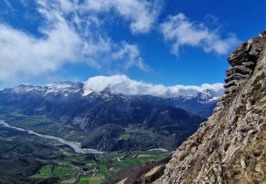
Trail Walking of 13.2 km to be discovered at Auvergne-Rhône-Alpes, Isère, Monestier-d'Ambel. This trail is proposed by bailleulherve.

Description

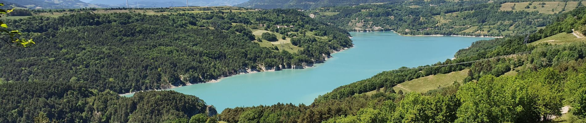
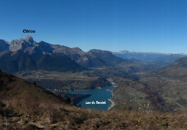
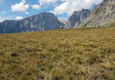
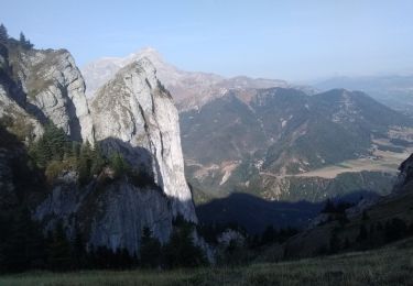
superbe panorama sur l'obiou et le grand ferrand

Elevation profile

Photos

Positioning

Country:
France
Region :
Auvergne-Rhône-Alpes
Department/Province :
Isère
Municipality :
Monestier-d'Ambel
Location:
Unknown
Start:(UTM)
731031 ; 4962868 (31T) N.

Trails nearby

Trail Walking Aspres-lès-Corps - Aspres les corps - Roche Courbe - Photo
Walking
GUIDE
R@ph

Walking

Very difficult
(1)
Aspres-lès-Corps, Provence-Alpes-Côte d'Azur, Hautes-Alpes, France
10.6 km | 24 km-effort
4h 53min
Yes
Trail Walking Pellafol - R44 Le Bénitier - Photo
Walking
GUIDE+

Walking

Medium
(1)
Pellafol, Auvergne-Rhône-Alpes, Isère, France
14 km | 25 km-effort
3h 0min
Yes
Trail Walking Pellafol - R43   Les Gillardes - Photo
Walking
GUIDE+

Walking

Very easy
(2)
Pellafol, Auvergne-Rhône-Alpes, Isère, France
6.1 km | 8.5 km-effort
1h 48min
Yes
Trail Walking Pellafol - la grande tête de l Obiou  - Photo
Walking
tchoua

Walking

Very difficult
Pellafol, Auvergne-Rhône-Alpes, Isère, France
11.3 km | 28 km-effort
3h 50min
Yes
Trail Walking Pellafol - 38 source gaillarde internet ch fée - Photo
Walking
himba26100

Walking

Medium
Pellafol, Auvergne-Rhône-Alpes, Isère, France
13.3 km | 19.9 km-effort
6h 32min
No
Trail Walking Aspres-lès-Corps - Roche Courbe en circuit - Photo
Walking
Emelle

Walking

Medium
Aspres-lès-Corps, Provence-Alpes-Côte d'Azur, Hautes-Alpes, France
9.9 km | 23 km-effort
5h 57min
Yes
Trail Walking Le Dévoluy - Le Faraut. Pic pierroux - Photo
Walking
nadd73

Walking

Medium
Le Dévoluy, Provence-Alpes-Côte d'Azur, Hautes-Alpes, France
10.3 km | 25 km-effort
7h 10min
Yes
Trail Walking Pellafol - Cime de l'Obiou - Photo
Walking
Dervalmarc

Walking

Very difficult
Pellafol, Auvergne-Rhône-Alpes, Isère, France
13.3 km | 31 km-effort
5h 27min
Yes
Trail Walking Aspres-lès-Corps - Le Grand Journal - Jonquilles  - Photo
Walking
PapouBertrand

Walking

Very difficult
Aspres-lès-Corps, Provence-Alpes-Côte d'Azur, Hautes-Alpes, France
9.6 km | 22 km-effort
5h 19min
Yes


Close
My subscriptions