Trail Walking Conques-en-Rouergue - Étape 11 Conques a  Decazeville - Photo

Étape 11 Conques a Decazeville

 lesduj
lesduj

User

© OpenStreetMap contributors
Length
Length
18.2 km
Max alt
Max alt
638 m
Uphill gradient
Uphill gradient
588 m
Km-Effort
Km-Effort  
26 km
Min alt
Min alt
207 m
Downhill gradient
Downhill gradient
649 m
Boucle
Boucle
No
Creation date :
2022-06-01 06:15:03.0
Updated on :
2022-06-01 19:45:32.595

(0 Reviews)

Walking
Walking
4h30
Difficulty : Difficult

Scan this QR Code to open this trail in the SityTrail application

FREE GPS app for hiking

Logo SityTrail SityTrail

IGN / Geographical institutes

Download SityTrail from the App Store Download SityTrail from Google Play

Logo SityTrail SityTrail World

The world is yours!

Download SityTrail from the App Store Download SityTrail from Google Play Download SityTrail on Huawei AppGallery

About

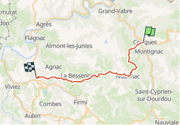
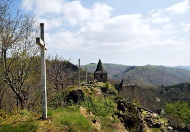
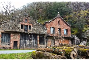
Trail Walking of 18.2 km to be discovered at Occitania, Aveyron, Conques-en-Rouergue. This trail is proposed by lesduj.

Description

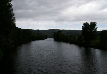
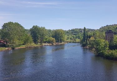
Cette étape de 20 kms démarre par un début difficile avec la sortie du village de Conques(très connu par les pèlerins du GR65).Attention sur ce tracé,une partie n’a pas été prise en compte(dans la première montée très sportive) donc le dénivelé positif est plus important😉 Très belle randonnée à tous

Elevation profile

Photos

Positioning

Country:
France
Region :
Occitania
Department/Province :
Aveyron
Municipality :
Conques-en-Rouergue
Location:
Conques
Start:(UTM)
452019 ; 4938555 (31T) N.

Trails nearby

Trail Walking Conques-en-Rouergue - Les Pelies La Vinzelle : boucle rapide - Photo
Walking
lullaby92

Walking

Easy
(1)
Conques-en-Rouergue, Occitania, Aveyron, France
5.4 km | 8.8 km-effort
3h 19min
Yes
Trail Walking Conques-en-Rouergue - La Vinzelle - Grand Vabre - Photo
Walking
tracegps

Walking

Medium
(3)
Conques-en-Rouergue, Occitania, Aveyron, France
6.7 km | 11.1 km-effort
3h 30min
Yes
Trail Walking Conques-en-Rouergue - Noailhac - Livinhac le Haut - Chemin de St-Jacques de Compostelle - Photo
Walking
tracegps

Walking

Difficult
(1)
Conques-en-Rouergue, Occitania, Aveyron, France
16.8 km | 23 km-effort
3h 0min
No
Trail On foot Conques-en-Rouergue - TerraTrail 7 - Photo
On foot
PRO

On foot

Easy
Conques-en-Rouergue, Occitania, Aveyron, France
9.4 km | 15.8 km-effort
3h 36min
Yes
Trail On foot Conques-en-Rouergue - Terra trail 10 - Photo
On foot
PRO

On foot

Difficult
Conques-en-Rouergue, Occitania, Aveyron, France
22 km | 34 km-effort
7h 41min
Yes
Trail On foot Conques-en-Rouergue - Terra Trail 4 - Photo
On foot
PRO

On foot

Easy
Conques-en-Rouergue, Occitania, Aveyron, France
10.3 km | 16 km-effort
3h 38min
Yes
Trail Walking Conques-en-Rouergue - Conques Levinhac le Haut Avril 2018 - Photo
Walking
GUIDE
Kargil

Walking

Difficult
Conques-en-Rouergue, Occitania, Aveyron, France
25 km | 36 km-effort
7h 4min
No
Trail Walking Conques-en-Rouergue - Conques  - Photo
Walking
GUIDE
antignacs

Walking

Very easy
Conques-en-Rouergue, Occitania, Aveyron, France
10.9 km | 16.3 km-effort
3h 2min
Yes
Trail On foot Conques-en-Rouergue - Le Chemin de l'Oiseau - Photo
On foot
PRO

On foot

Easy
Conques-en-Rouergue, Occitania, Aveyron, France
5 km | 7.9 km-effort
1h 47min
Yes


Close
My subscriptions