Trail Walking Ota - Porto ancien - Photo

Les amis de Jean Marc

© OpenStreetMap contributors
Length
Length
3.6 km
Max alt
Max alt
56 m
Uphill gradient
Uphill gradient
72 m
Km-Effort
Km-Effort  
4.7 km
Min alt
Min alt
-2 m
Downhill gradient
Downhill gradient
97 m
Boucle
Boucle
No
Creation date :
2022-06-12 16:52:51.653
Updated on :
2022-06-12 16:52:54.483

(0 Reviews)

Walking
Walking
1h03
Difficulty : Easy

Scan this QR Code to open this trail in the SityTrail application

FREE GPS app for hiking

Logo SityTrail SityTrail

IGN / Geographical institutes

Download SityTrail from the App Store Download SityTrail from Google Play

Logo SityTrail SityTrail World

The world is yours!

Download SityTrail from the App Store Download SityTrail from Google Play Download SityTrail on Huawei AppGallery

About

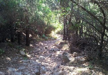
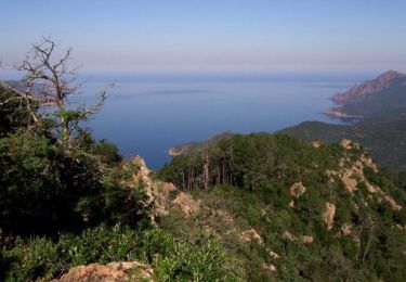
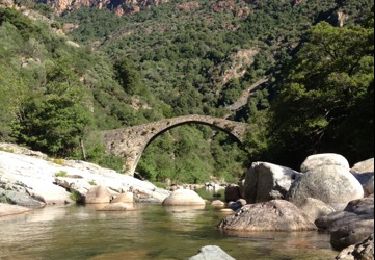
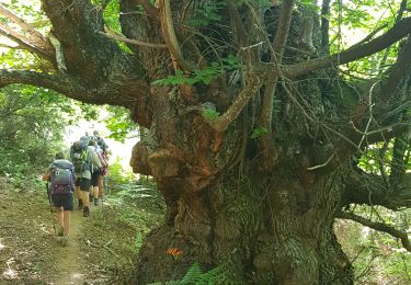
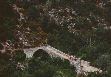
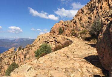
Trail Walking of 3.6 km to be discovered at Corsica, South Corsica, Ota. This trail is proposed by Corse 2022.

Elevation profile

Positioning

Country:
France
Region :
Corsica
Department/Province :
South Corsica
Municipality :
Ota
Location:
Unknown
Start:(UTM)
476038 ; 4679114 (32T) N.

Trails nearby

Trail Walking Piana - Capo d'Ortu  - Photo
Walking
z123o

Walking

Medium
(1)
Piana, Corsica, South Corsica, France
15 km | 25 km-effort
7h 13min
Yes
Trail Walking Serriera - Mare e Monti - De Serriera à Ota - Photo
Walking
tracegps

Walking

Difficult
(1)
Serriera, Corsica, South Corsica, France
11.4 km | 24 km-effort
6h 30min
No
Trail Walking Ota - gorges de la spelunca et pont, ota, corse - Photo
Walking
Bzh56

Walking

Easy
(1)
Ota, Corsica, South Corsica, France
2.9 km | 4.5 km-effort
58min
No
Trail Walking Piana - 	Chemin muletier de Ota a Piana - Photo
Walking
doryphore

Walking

Medium
(1)
Piana, Corsica, South Corsica, France
9.2 km | 16.6 km-effort
3h 0min
Yes
Trail Walking Piana - Piana - Sentier des muletiers - Photo
Walking
py.bretecher

Walking

Medium
(1)
Piana, Corsica, South Corsica, France
9.7 km | 16.8 km-effort
2h 34min
Yes
Trail Walking Ota - Ota Mariniana - Photo
Walking
avdem

Walking

Medium
Ota, Corsica, South Corsica, France
473 km | 0 m-effort
11h 45min
No
Trail Walking Serriera - Serierra  Ota - Photo
Walking
avdem

Walking

Difficult
Serriera, Corsica, South Corsica, France
13.6 km | 27 km-effort
4h 44min
No
Trail On foot Ota - Ota canyons - Photo
On foot
PRO

On foot

Medium
Ota, Corsica, South Corsica, France
13.5 km | 27 km-effort
6h 5min
Yes
Trail Walking Piana - Calanques piana les roches bleues  - Photo
Walking
GUIDE
antignacs

Walking

Very easy
Piana, Corsica, South Corsica, France
5.3 km | 9.8 km-effort
2h 46min
Yes


Close
My subscriptions