


GR10U Gourette 2022

LouisROGER
User GUIDE
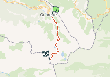

Length
6.4 km

Max alt
2472 m

Uphill gradient
1092 m
Km-Effort
17.3 km

Min alt
1372 m

Downhill gradient
6 m
Boucle
No
Creation date :
2022-06-25 05:19:49.628
Updated on :
2022-06-26 12:47:55.421
5h12
Difficulty : Difficult

FREE GPS app for hiking
 SityTrail
IGN / Geographical institutes
SityTrail Plus
The world is yours!
About
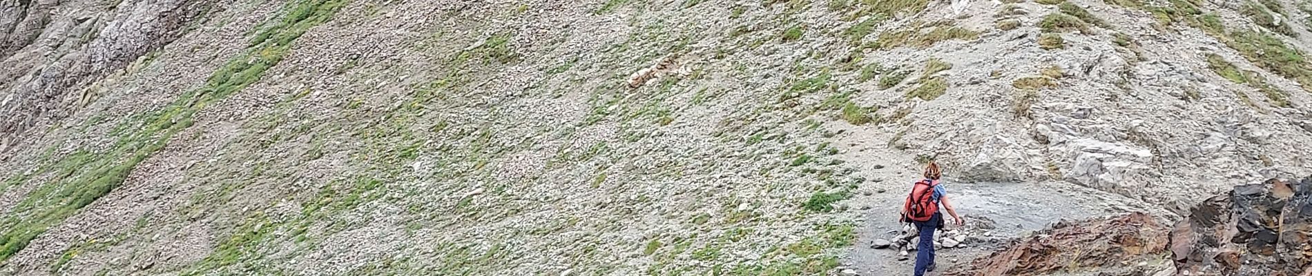
Trail Walking of 6.4 km to be discovered at New Aquitaine, Pyrénées-Atlantiques, Eaux-Bonnes. This trail is proposed by LouisROGER.
Photos


Positioning
Country:
France
Region :
New Aquitaine
Department/Province :
Pyrénées-Atlantiques
Municipality :
Eaux-Bonnes
Location:
Unknown
Start:(Dec)
Start:(UTM)
717889 ; 4759450 (30T) N.
Comments