


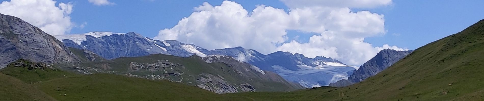
lacs Merlet depuis vallon des Avals

bymarc26
User

Length
18.4 km

Max alt
2502 m

Uphill gradient
953 m
Km-Effort
31 km

Min alt
1735 m

Downhill gradient
954 m
Boucle
Yes
Creation date :
2022-07-17 07:01:21.484
Updated on :
2022-07-17 13:49:21.647
5h05
Difficulty : Medium

FREE GPS app for hiking
 SityTrail
IGN / Geographical institutes
SityTrail Plus
The world is yours!
About
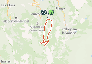
Trail Walking of 18.4 km to be discovered at Auvergne-Rhône-Alpes, Savoy, Courchevel. This trail is proposed by bymarc26.
Description
A faire dans ce sens. Très belles vues.
Facile malgré la longueur.
Photos


Positioning
Country:
France
Region :
Auvergne-Rhône-Alpes
Department/Province :
Savoy
Municipality :
Courchevel
Location:
Saint-Bon-Tarentaise
Start:(Dec)
Start:(UTM)
317109 ; 5030733 (32T) N.
Comments