


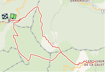

15.1 km | 34 km-effort


User


FREE GPS app for hiking
 SityTrail
IGN / Geographical institutes
SityTrail World
The world is yours!
Trail Walking of 14.3 km to be discovered at Auvergne-Rhône-Alpes, Isère, Saint-Michel-en-Beaumont. This trail is proposed by Maryma.
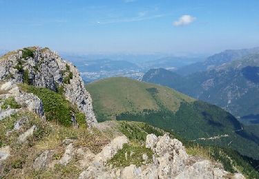
Très beau chemin en balcon menant au col d'Hurtières, chemin aussi appelé chemin des tunnels ;-))
Walking
Walking
Touring skiing
Walking
Touring skiing
Walking
Walking
Walking
Mountain bike