Trail Walking Bléré - Bléré - Fonds de Bout Ferré - 14.2km 145m 3h30 - 2022 08 15 - Photo

Bléré - Fonds de Bout Ferré - 14.2km 145m 3h30 - 2022 08 15

 Orcal37
Orcal37

User

© OpenStreetMap contributors
Length
Length
14.2 km
Max alt
Max alt
112 m
Uphill gradient
Uphill gradient
147 m
Km-Effort
Km-Effort  
16.2 km
Min alt
Min alt
64 m
Downhill gradient
Downhill gradient
147 m
Boucle
Boucle
Yes
Creation date :
2022-08-15 12:18:09.739
Updated on :
2022-08-16 17:23:22.317

(0 Reviews)

Walking
Walking
3h30
Difficulty : Easy

Scan this QR Code to open this trail in the SityTrail application

FREE GPS app for hiking

Logo SityTrail SityTrail

IGN / Geographical institutes

Download SityTrail from the App Store Download SityTrail from Google Play

Logo SityTrail SityTrail World

The world is yours!

Download SityTrail from the App Store Download SityTrail from Google Play Download SityTrail on Huawei AppGallery

About

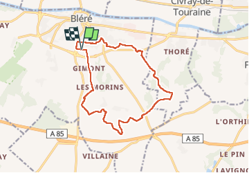
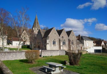
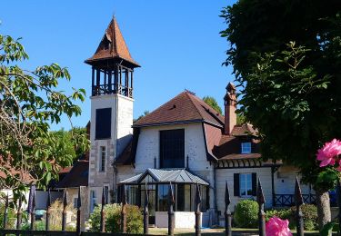
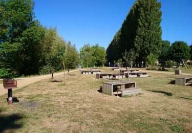
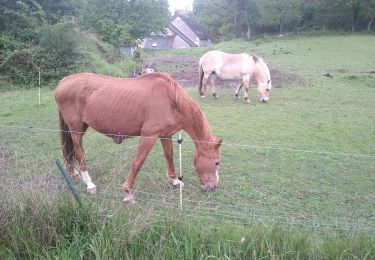
Trail Walking of 14.2 km to be discovered at Centre-Loire Valley, Indre-et-Loire, Bléré. This trail is proposed by Orcal37.

Description

Bléré - Fonds de Bout Ferré - le Vaugerin - 14.2km 145m 3h30 - 2022 08 15

Elevation profile

Photos

Positioning

Country:
France
Region :
Centre-Loire Valley
Department/Province :
Indre-et-Loire
Municipality :
Bléré
Location:
Unknown
Start:(UTM)
348254 ; 5242407 (31T) N.

Trails nearby

Trail Walking Luzillé - les petits gars - Photo
Walking
jeepee93

Walking

Very easy
(1)
Luzillé, Centre-Loire Valley, Indre-et-Loire, France
6.7 km | 7.3 km-effort
2h 13min
Yes
Trail Walking Civray-de-Touraine - Civray-de-Touraine - boucle Thoré de 12.6km et boucle Civray de 6km - 18.6km 190m 4h25 - 2023 08 16 - Photo
Walking
Orcal37

Walking

Easy
Civray-de-Touraine, Centre-Loire Valley, Indre-et-Loire, France
18.4 km | 21 km-effort
4h 25min
Yes
Trail Walking La Croix-en-Touraine - la Croix-en-Touraine - 16.4km 150m 3h50 (30mn) - 2023 07 08 - Photo
Walking
Orcal37

Walking

Difficult
La Croix-en-Touraine, Centre-Loire Valley, Indre-et-Loire, France
16.4 km | 18.5 km-effort
4h 11min
Yes
Trail Walking Dierre - Dierre - St-Martin-le-Beau - 15.9km 230m 3h35 - 2023 02 26 - Photo
Walking
Orcal37

Walking

Easy
Dierre, Centre-Loire Valley, Indre-et-Loire, France
15.9 km | 19 km-effort
3h 35min
Yes
Trail Walking Bléré - Bléré - Fontenay - 15.9km 145m 3h45 - 2022 07 31 - Photo
Walking
Orcal37

Walking

Easy
Bléré, Centre-Loire Valley, Indre-et-Loire, France
15.9 km | 17.8 km-effort
3h 45min
Yes
Trail Walking Civray-de-Touraine - chissay chenonceaux - Photo
Walking
dporcher

Walking

Very easy
Civray-de-Touraine, Centre-Loire Valley, Indre-et-Loire, France
9.8 km | 10.9 km-effort
2h 2min
Yes
Trail Walking Bléré - Bléré - la Fontaine aux Oiseaux - 17.6km 150m 3h30 - 2007 10 13 - Photo
Walking
Orcal37

Walking

Easy
Bléré, Centre-Loire Valley, Indre-et-Loire, France
17.6 km | 19.6 km-effort
3h 30min
Yes
Trail Walking Bléré - Octobre rose - Photo
Walking
jeepee93

Walking

Easy
Bléré, Centre-Loire Valley, Indre-et-Loire, France
8.1 km | 9.1 km-effort
1h 33min
Yes
Trail Walking Bléré - Bléré - Photo
Walking
fustier

Walking

Very easy
Bléré, Centre-Loire Valley, Indre-et-Loire, France
21 km | 24 km-effort
5h 7min
Yes


Close
My subscriptions