Trail Walking Colombes - Les parcs Lagravère et Chantereines - Photo

Les parcs Lagravère et Chantereines

© OpenStreetMap contributors
Length
Length
16.1 km
Max alt
Max alt
40 m
Uphill gradient
Uphill gradient
130 m
Km-Effort
Km-Effort  
17.8 km
Min alt
Min alt
22 m
Downhill gradient
Downhill gradient
126 m
Boucle
Boucle
No
Creation date :
2022-08-28 14:30:51.819
Updated on :
2022-09-05 08:09:38.653

(0 Reviews)

Walking
Walking
4h04
Difficulty : Easy

Scan this QR Code to open this trail in the SityTrail application

FREE GPS app for hiking

Logo SityTrail SityTrail

IGN / Geographical institutes

Download SityTrail from the App Store Download SityTrail from Google Play

Logo SityTrail SityTrail World

The world is yours!

Download SityTrail from the App Store Download SityTrail from Google Play Download SityTrail on Huawei AppGallery

About

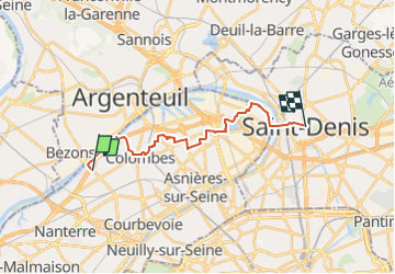
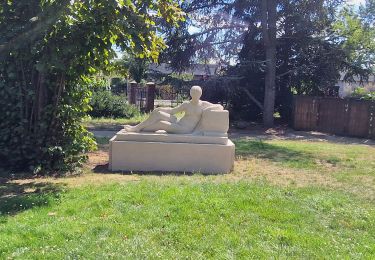
Trail Walking of 16.1 km to be discovered at Ile-de-France, Hauts-de-Seine, Colombes. This trail is proposed by c.chehere.

Description

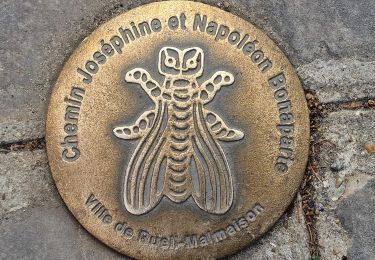
De la station T2 "Parc Lagravère" à la station M13"Basilique St Denis"

Elevation profile

Positioning

Country:
France
Region :
Ile-de-France
Department/Province :
Hauts-de-Seine
Municipality :
Colombes
Location:
Unknown
Start:(UTM)
443217 ; 5418563 (31U) N.

Trails nearby

Trail Walking Paris - DP75-19 de Porte-Maillot à Europe - Photo
Walking
clalaur

Walking

Easy
(1)
Paris, Ile-de-France, Paris, France
4.2 km | 4.8 km-effort
1h 5min
No
Trail Walking Argenteuil - Les Buttes du Parisis - Photo
Walking
tracegps

Walking

Medium
(2)
Argenteuil, Ile-de-France, Val-d'Oise, France
18.1 km | 24 km-effort
4h 0min
Yes
Trail Walking Paris - GR1 Tour de Paris. De la Porte Maillot (Paris) à Nesles-la-Vallée (Val-d'Oise) - Photo
Walking
grinfos

Walking

Very easy
(1)
Paris, Ile-de-France, Paris, France
237 km | 288 km-effort
Unknown
No
Trail On foot Rueil-Malmaison - SityTrail - 3850997 - rando-chatou (1) - Photo
On foot
chessyca

On foot

Medium
Rueil-Malmaison, Ile-de-France, Hauts-de-Seine, France
32 km | 37 km-effort
8h 22min
No
Trail Walking Neuilly-sur-Seine - Le bois de Boulogne - Photo
Walking
c.chehere

Walking

Easy
Neuilly-sur-Seine, Ile-de-France, Hauts-de-Seine, France
14.8 km | 16.6 km-effort
4h 33min
No
Trail Walking Levallois-Perret - LEVALLOIS PERRET BOUCLE 10 KM - Photo
Walking
gemau77

Walking

Easy
(1)
Levallois-Perret, Ile-de-France, Hauts-de-Seine, France
8.7 km | 9.6 km-effort
15min
Yes
Trail Walking Rueil-Malmaison - De Rueil Malmaison aux Serres d'Auteuil via Suresnes - Photo
Walking
chessyca

Walking

Very easy
Rueil-Malmaison, Ile-de-France, Hauts-de-Seine, France
22 km | 26 km-effort
5h 3min
No
Trail Walking Rueil-Malmaison - Domaine Malmaison - Cité jardin Suresnes - Boulogne - Serres d'Auteuil - Photo
Walking
chessyca

Walking

Easy
Rueil-Malmaison, Ile-de-France, Hauts-de-Seine, France
22 km | 27 km-effort
4h 54min
No
Trail Walking Rueil-Malmaison - De rueil Malmaison à St Germain en Laye - Photo
Walking
chessyca

Walking

Medium
Rueil-Malmaison, Ile-de-France, Hauts-de-Seine, France
28 km | 32 km-effort
5h 56min
No


Close
My subscriptions