


les portes de montmelian frettes

Louna
User
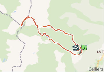

Length
10.1 km

Max alt
2497 m

Uphill gradient
773 m
Km-Effort
20 km

Min alt
1767 m

Downhill gradient
771 m
Boucle
Yes
Creation date :
2022-09-13 07:17:15.889
Updated on :
2022-09-13 14:15:45.655
4h10
Difficulty : Very difficult

FREE GPS app for hiking
 SityTrail
IGN / Geographical institutes
SityTrail Plus
The world is yours!
About
Trail Walking of 10.1 km to be discovered at Auvergne-Rhône-Alpes, Savoy, La Léchère. This trail is proposed by Louna .
Positioning
Country:
France
Region :
Auvergne-Rhône-Alpes
Department/Province :
Savoy
Municipality :
La Léchère
Location:
Celliers
Start:(Dec)
Start:(UTM)
297677 ; 5040128 (32T) N.
Comments