Trail Walking Venanson - la boucle du Conquet - Photo
 franquen
franquen

User

© OpenStreetMap contributors
Length
Length
11.9 km
Max alt
Max alt
1755 m
Uphill gradient
Uphill gradient
873 m
Km-Effort
Km-Effort  
24 km
Min alt
Min alt
1003 m
Downhill gradient
Downhill gradient
881 m
Boucle
Boucle
No
Creation date :
2014-12-10 00:00:00.0
Updated on :
2014-12-10 00:00:00.0

(0 Reviews)

Walking
Walking
5h07
Difficulty : Difficult

Scan this QR Code to open this trail in the SityTrail application

FREE GPS app for hiking

Logo SityTrail SityTrail

IGN / Geographical institutes

Download SityTrail from the App Store Download SityTrail from Google Play

Logo SityTrail SityTrail World

The world is yours!

Download SityTrail from the App Store Download SityTrail from Google Play Download SityTrail on Huawei AppGallery

About

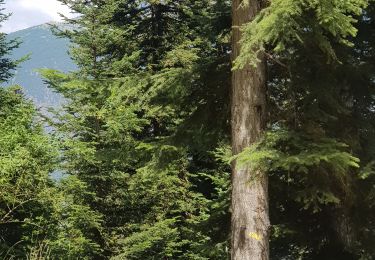
Trail Walking of 11.9 km to be discovered at Provence-Alpes-Côte d'Azur, Maritime Alps, Venanson. This trail is proposed by franquen.

Description

randonnée un peu décevante :
assailli par mouches et fourmis à ailes au sommet du Conquet et retour par le bénitier et le trou du diable longue et inintéressante.
conseil aller au col de Veraire un fois au col de la Colmiane (après un A/R au Conquet) et revenir sur ses pas.

Elevation profile

Positioning

Country:
France
Region :
Provence-Alpes-Côte d'Azur
Department/Province :
Maritime Alps
Municipality :
Venanson
Location:
Unknown
Start:(UTM)
360075 ; 4879215 (32T) N.

Trails nearby

Trail Walking Venanson - La Malouna - Photo
Walking
Benteux

Walking

Medium
(1)
Venanson, Provence-Alpes-Côte d'Azur, Maritime Alps, France
10.7 km | 17.9 km-effort
5h 20min
Yes
Trail On foot Valdeblore - Le Caïre Gros - Photo
On foot
PRO

On foot

Medium
Valdeblore, Provence-Alpes-Côte d'Azur, Maritime Alps, France
9.8 km | 20 km-effort
4h 38min
Yes
Trail On foot Venanson - Circuit du Conquet - Photo
On foot
PRO

On foot

Medium
Venanson, Provence-Alpes-Côte d'Azur, Maritime Alps, France
10.2 km | 21 km-effort
4h 45min
Yes
Trail On foot Lantosque - Circuit du Tournairet - Photo
On foot
PRO

On foot

Easy
Lantosque, Provence-Alpes-Côte d'Azur, Maritime Alps, France
9.6 km | 16.2 km-effort
3h 41min
Yes
Trail Walking Valdeblore - St Dalmas Valdeblore  - Photo
Walking
Daniel Benteux

Walking

Easy
Valdeblore, Provence-Alpes-Côte d'Azur, Maritime Alps, France
8.7 km | 12.3 km-effort
2h 26min
Yes
Trail Walking Venanson - Venanson - Photo
Walking
Jean-François Thibaud

Walking

Easy
Venanson, Provence-Alpes-Côte d'Azur, Maritime Alps, France
5.3 km | 9.1 km-effort
2h 48min
Yes
Trail Walking Valdeblore - La Colmiane : Mont Peipori - Photo
Walking
ETMU5496

Walking

Difficult
Valdeblore, Provence-Alpes-Côte d'Azur, Maritime Alps, France
16 km | 32 km-effort
5h 0min
Yes
Trail Walking Valdeblore - tour du pic de colmiane - Photo
Walking
PhilB24

Walking

Medium
Valdeblore, Provence-Alpes-Côte d'Azur, Maritime Alps, France
8 km | 14.7 km-effort
2h 24min
Yes
Trail Walking Valdeblore - Le Caire gros - Photo
Walking
PhilB24

Walking

Medium
Valdeblore, Provence-Alpes-Côte d'Azur, Maritime Alps, France
10.4 km | 21 km-effort
3h 24min
Yes


Close
My subscriptions