Trail Walking Villeneuve-Saint-Georges - Tour lac creteil - Photo
© OpenStreetMap contributors
Length
Length
8.4 km
Max alt
Max alt
64 m
Uphill gradient
Uphill gradient
85 m
Km-Effort
Km-Effort  
9.5 km
Min alt
Min alt
28 m
Downhill gradient
Downhill gradient
85 m
Boucle
Boucle
Yes
Creation date :
2022-11-23 12:52:22.0
Updated on :
2022-11-23 15:05:29.503

(0 Reviews)

Walking
Walking
2h12
Difficulty : Medium

Scan this QR Code to open this trail in the SityTrail application

FREE GPS app for hiking

Logo SityTrail SityTrail

IGN / Geographical institutes

Download SityTrail from the App Store Download SityTrail from Google Play

Logo SityTrail SityTrail World

The world is yours!

Download SityTrail from the App Store Download SityTrail from Google Play Download SityTrail on Huawei AppGallery

About

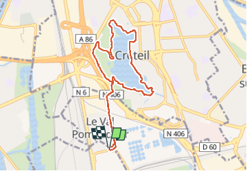
Trail Walking of 8.4 km to be discovered at Ile-de-France, Val-de-Marne, Villeneuve-Saint-Georges. This trail is proposed by 001185.1a411e07e05844e0b21535b8a6fe40df.0829.

Elevation profile

Positioning

Country:
France
Region :
Ile-de-France
Department/Province :
Val-de-Marne
Municipality :
Villeneuve-Saint-Georges
Location:
Unknown
Start:(UTM)
459376 ; 5401101 (31U) N.

Trails nearby

Trail Walking Yerres - BM Foret Regionale de Grobois 10km - Photo
Walking
GUIDE
jeanmarcMasson

Walking

Medium
(1)
Yerres, Ile-de-France, Essonne, France
10.4 km | 11 km-effort
2h 30min
Yes
Trail Walking Yerres - BM Foret Regionale Grosbois 10km - Photo
Walking
GUIDE
jeanmarcMasson

Walking

Medium
(1)
Yerres, Ile-de-France, Essonne, France
9.8 km | 10.5 km-effort
2h 23min
Yes
Trail On foot Créteil - JC 84 - La Végétale - 18,2 km - Photo
On foot

On foot

Difficult
(1)
Créteil, Ile-de-France, Val-de-Marne, France
18.3 km | 21 km-effort
4h 40min
No
Trail Walking Créteil - Parc départemental et tour lac Créteil 15 km - Photo
Walking
GUIDE
jeanmarcMasson

Walking

Difficult
(1)
Créteil, Ile-de-France, Val-de-Marne, France
14.4 km | 16.2 km-effort
3h 41min
Yes
Trail Walking Yerres - randogps91-61 - Photo
Walking

Walking

Very easy
(3)
Yerres, Ile-de-France, Essonne, France
6.9 km | 8 km-effort
1h 49min
Yes
Trail On foot Sucy-en-Brie - 8228189-track-1571238544-580 - Photo
On foot
gemau77

On foot

Easy
(1)
Sucy-en-Brie, Ile-de-France, Val-de-Marne, France
10.1 km | 11.3 km-effort
2h 34min
No
Trail Walking Saint-Maur-des-Fossés - Boucle de la Marne Saint MAUR des Fosses - Photo
Walking
Prala

Walking

Easy
(2)
Saint-Maur-des-Fossés, Ile-de-France, Val-de-Marne, France
13 km | 14.1 km-effort
2h 12min
Yes
Trail Walking Saint-Maur-des-Fossés - Randopolitain les bords de Marne 18 km - Photo
Walking
chessyca

Walking

Easy
Saint-Maur-des-Fossés, Ile-de-France, Val-de-Marne, France
17.2 km | 18.8 km-effort
4h 2min
No
Trail Walking Yerres - 2022-12-05_16h42m19_SF_INBOX_46138_0c98ca_SityTrail - 3474160 - rando-12-km-07x12-pour-gilles - Photo
Walking
GTarenne

Walking

Difficult
(1)
Yerres, Ile-de-France, Essonne, France
11.7 km | 13.1 km-effort
2h 54min
Yes


Close
My subscriptions