Trail Walking Marignac-en-Diois - 26 Marignac desse zel - Photo
© OpenStreetMap contributors
Length
Length
14.3 km
Max alt
Max alt
1013 m
Uphill gradient
Uphill gradient
588 m
Km-Effort
Km-Effort  
22 km
Min alt
Min alt
574 m
Downhill gradient
Downhill gradient
583 m
Boucle
Boucle
Yes
Creation date :
2023-01-12 08:00:26.444
Updated on :
2023-01-12 14:23:20.236

(1 Reviews)

Walking
Walking
6h21
Difficulty : Medium

Scan this QR Code to open this trail in the SityTrail application

FREE GPS app for hiking

Logo SityTrail SityTrail

IGN / Geographical institutes

Download SityTrail from the App Store Download SityTrail from Google Play

Logo SityTrail SityTrail World

The world is yours!

Download SityTrail from the App Store Download SityTrail from Google Play Download SityTrail on Huawei AppGallery

About

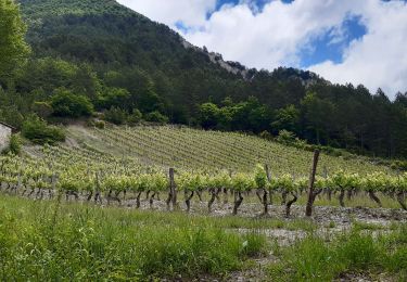
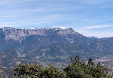
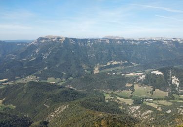
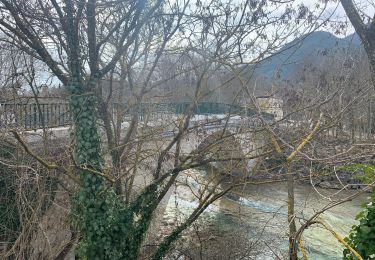
Trail Walking of 14.3 km to be discovered at Auvergne-Rhône-Alpes, Drôme, Marignac-en-Diois. This trail is proposed by randodyssée.

Description

12.01.22

Elevation profile

Photos

Positioning

Country:
France
Region :
Auvergne-Rhône-Alpes
Department/Province :
Drôme
Municipality :
Marignac-en-Diois
Location:
Unknown
Start:(UTM)
684559 ; 4963554 (31T) N.

Comments

Please log in to post a review or rate the element


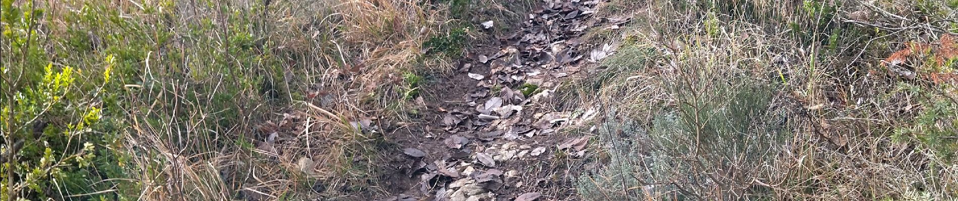
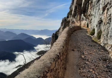
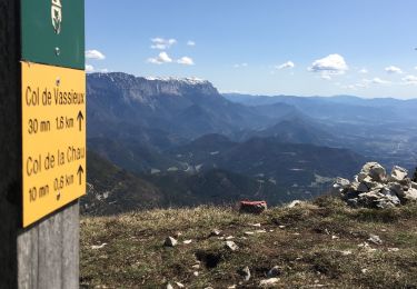
bjr rando facile je pense que l'on a pas les mêmes critères d'appréciation après le col de Marignac vers le pas des Versannes, la progression est difficile et c'est un peu accrobatique on a fait demi tour ce serai sympa de le signaler dans un commentaire merci


Trails nearby

Trail Snowshoes Vassieux-en-Vercors - Col de Vassieux - Photo
Snowshoes
tracegps

Snowshoes

Easy
(1)
Vassieux-en-Vercors, Auvergne-Rhône-Alpes, Drôme, France
7.6 km | 10.8 km-effort
3h 0min
Yes
Trail Nordic walking Ponet-et-Saint-Auban - 20/12/2015 Pierre plats  - Photo
Nordic walking
fiorano

Nordic walking

Easy
(1)
Ponet-et-Saint-Auban, Auvergne-Rhône-Alpes, Drôme, France
6.9 km | 11.1 km-effort
1h 46min
Yes
Trail Mountain bike Chamaloc - Chamaloc - Hauteurs de Die - Photo
Mountain bike
tracegps

Mountain bike

Difficult
(1)
Chamaloc, Auvergne-Rhône-Alpes, Drôme, France
36 km | 50 km-effort
3h 0min
Yes
Trail Walking Chamaloc - Col de Chirone et refuge de Vassieux  - Photo
Walking
GUIDE
thonyc

Walking

Very difficult
Chamaloc, Auvergne-Rhône-Alpes, Drôme, France
13.7 km | 21 km-effort
4h 52min
Yes
Trail Walking Die - Col de Bergu  - Photo
Walking
Fky78

Walking

Medium
Die, Auvergne-Rhône-Alpes, Drôme, France
6.2 km | 10.2 km-effort
2h 15min
Yes
Trail Walking Sainte-Croix - 26 Sainte Croix Crêtes de Ramiat - Photo
Walking
Maryma

Walking

Very difficult
Sainte-Croix, Auvergne-Rhône-Alpes, Drôme, France
17.5 km | 30 km-effort
6h 42min
Yes
Trail Walking Saint-Julien-en-Quint - pas de bouillanain st julien en Quint  - Photo
Walking
alinetpierre

Walking

Difficult
Saint-Julien-en-Quint, Auvergne-Rhône-Alpes, Drôme, France
17 km | 29 km-effort
5h 6min
Yes
Trail Walking Die - Autour de Die balade - Photo
Walking
jll7513

Walking

Easy
Die, Auvergne-Rhône-Alpes, Drôme, France
8.9 km | 11.7 km-effort
1h 56min
Yes
Trail Walking Marignac-en-Diois - But st genis - Photo
Walking
ajd26

Walking

Very difficult
Marignac-en-Diois, Auvergne-Rhône-Alpes, Drôme, France
11.7 km | 25 km-effort
4h 46min
Yes


Close
My subscriptions