Trail Walking Villars-sur-Var - La Meute Chapelle St Jean Villars/Var - Photo

La Meute Chapelle St Jean Villars/Var

© OpenStreetMap contributors
Length
Length
5.5 km
Max alt
Max alt
771 m
Uphill gradient
Uphill gradient
365 m
Km-Effort
Km-Effort  
10.4 km
Min alt
Min alt
415 m
Downhill gradient
Downhill gradient
368 m
Boucle
Boucle
Yes
Creation date :
2014-12-10 00:00:00.0
Updated on :
2014-12-10 00:00:00.0

(1 Reviews)

Walking
Walking
2h15
Difficulty : Easy

Scan this QR Code to open this trail in the SityTrail application

FREE GPS app for hiking

Logo SityTrail SityTrail

IGN / Geographical institutes

Download SityTrail from the App Store Download SityTrail from Google Play

Logo SityTrail SityTrail World

The world is yours!

Download SityTrail from the App Store Download SityTrail from Google Play Download SityTrail on Huawei AppGallery

About

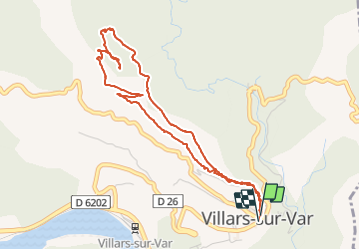
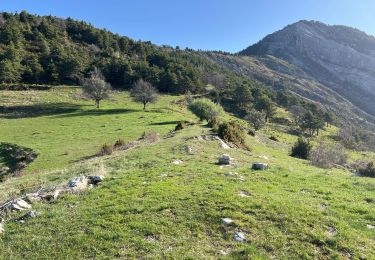
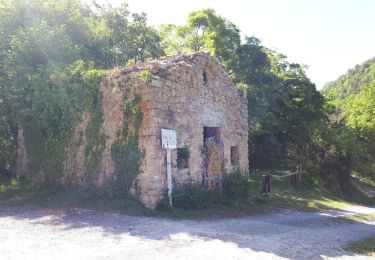
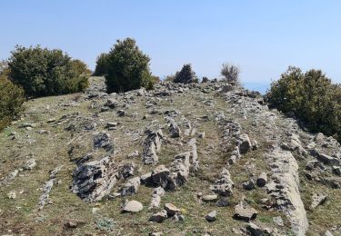
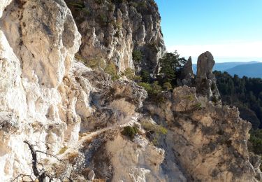
Trail Walking of 5.5 km to be discovered at Provence-Alpes-Côte d'Azur, Maritime Alps, Villars-sur-Var. This trail is proposed by DIDIERLESERT.

Description

Montée puis descente pas de plat
Dans la descente passage longeant des ravins (vertige)
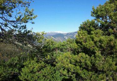
Très belle vue de la croix

Elevation profile

Positioning

Country:
France
Region :
Provence-Alpes-Côte d'Azur
Department/Province :
Maritime Alps
Municipality :
Villars-sur-Var
Location:
Unknown
Start:(UTM)
347325 ; 4866630 (32T) N.

Comments

Please log in to post a review or rate the element


Trails nearby

Trail On foot Toudon - Cime des Collettes - Photo
On foot
PRO

On foot

Easy
Toudon, Provence-Alpes-Côte d'Azur, Maritime Alps, France
7 km | 13.4 km-effort
3h 3min
Yes
Trail On foot Massoins - Plateau du Lac - Photo
On foot
PRO

On foot

Medium
Massoins, Provence-Alpes-Côte d'Azur, Maritime Alps, France
10.7 km | 22 km-effort
4h 54min
Yes
Trail Walking Toudon - cime des Colettes - Photo
Walking
franquen

Walking

Medium
(1)
Toudon, Provence-Alpes-Côte d'Azur, Maritime Alps, France
7.7 km | 14.6 km-effort
3h 40min
No
Trail Walking Thiéry - Brec d’ Ilonse - Photo
Walking
bozo1970

Walking

Easy
Thiéry, Provence-Alpes-Côte d'Azur, Maritime Alps, France
9.6 km | 17.5 km-effort
2h 49min
Yes
Trail Walking Thiéry - Pointe de Chavanette  Par chapelle Ste Madeleine/Thiery - Photo
Walking
GrouGary

Walking

Medium
Thiéry, Provence-Alpes-Côte d'Azur, Maritime Alps, France
14.4 km | 26 km-effort
4h 47min
Yes
Trail Walking Pierrefeu - mont brune  - Photo
Walking
Mariephil

Walking

Difficult
Pierrefeu, Provence-Alpes-Côte d'Azur, Maritime Alps, France
8 km | 13.7 km-effort
3h 13min
Yes
Trail Walking Thiéry - mont fracha et brec d illons  - Photo
Walking
Mariephil

Walking

Very difficult
(1)
Thiéry, Provence-Alpes-Côte d'Azur, Maritime Alps, France
10.3 km | 19.3 km-effort
4h 25min
Yes
Trail On foot Villars-sur-Var - Chapelle Saint-Jean - Photo
On foot
PRO

On foot

Easy
Villars-sur-Var, Provence-Alpes-Côte d'Azur, Maritime Alps, France
5 km | 9.7 km-effort
2h 12min
Yes
Trail Walking Toudon - Baisse des Colettes et Mt Brune de Toudon - Photo
Walking
GrouGary

Walking

Medium
(1)
Toudon, Provence-Alpes-Côte d'Azur, Maritime Alps, France
13.3 km | 24 km-effort
4h 39min
Yes


Close
My subscriptions