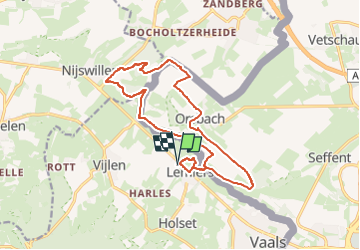
Trail Walking Vaals - 2023-04-07_19h07m33_235 - Photo

2023-04-07_19h07m33_235

© OpenStreetMap contributors
Length
Length
14.7 km
Max alt
Max alt
226 m
Uphill gradient
Uphill gradient
264 m
Km-Effort
Km-Effort  
18.3 km
Min alt
Min alt
121 m
Downhill gradient
Downhill gradient
264 m
Boucle
Boucle
Yes
Creation date :
07/04/2023 17:07
Updated on :
07/05/2023 15:21

(1 Reviews)

Walking
Walking
4h09
Difficulty : Medium

Scan this QR Code to open this trail in the SityTrail application

FREE GPS app for hiking

Logo SityTrail SityTrail

IGN / Geographical institutes

Download SityTrail from the App Store Download SityTrail from Google Play

Logo SityTrail SityTrail Plus

The world is yours!

Download SityTrail from the App Store Download SityTrail from Google Play Download SityTrail on Huawei AppGallery

About

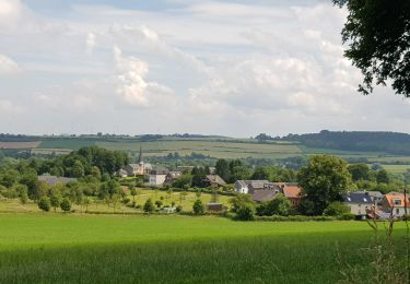
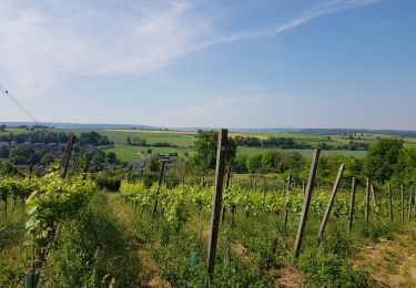
Trail Walking of 14.7 km to be discovered at Limburg, Unknown, Vaals. This trail is proposed by mumu.larandonneuse.

Description

www.wandelgidszuidlimburg.com n° 235.
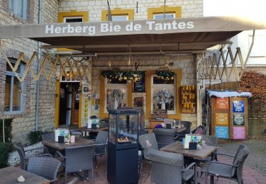
➡️ Cette randonnée d'altitude avec des dénivelés traverse le territoire allemand. Via le Schneeberg, vous marchez jusqu'à Orsbach. Puis via le Plattebos et le Colmonderbos jusqu'à Mamelis. Apportez vos propres provisions, il y a une aire de pique-nique à mi-chemin.  

Elevation profile

Photos

Positioning

Country:
Netherlands
Region :
Limburg
Department/Province :
Unknown
Municipality :
Vaals
Location:
Unknown
Start:(UTM)
710613 ; 5630490 (31U) N.

Comments

Please log in to post a review or rate the element


Superbe rando 🇳🇱🇩🇪 avec de belles vues panoramiques. ℹ n° 235.


Close
My subscriptions