Trail Walking Vallon-Pont-d'Arc - Vallon pont d'arc au bivouac du gournier  - Photo

Vallon pont d'arc au bivouac du gournier

 nadd73
nadd73

User

© OpenStreetMap contributors
Length
Length
18.8 km
Max alt
Max alt
299 m
Uphill gradient
Uphill gradient
964 m
Km-Effort
Km-Effort  
31 km
Min alt
Min alt
59 m
Downhill gradient
Downhill gradient
775 m
Boucle
Boucle
No
Creation date :
2023-05-08 08:55:50.102
Updated on :
2023-05-08 17:15:32.091

(0 Reviews)

Walking
Walking
3h45
Difficulty : Medium

Scan this QR Code to open this trail in the SityTrail application

FREE GPS app for hiking

Logo SityTrail SityTrail

IGN / Geographical institutes

Download SityTrail from the App Store Download SityTrail from Google Play

Logo SityTrail SityTrail World

The world is yours!

Download SityTrail from the App Store Download SityTrail from Google Play Download SityTrail on Huawei AppGallery

About

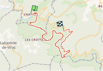
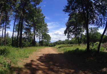
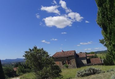
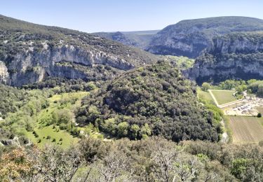
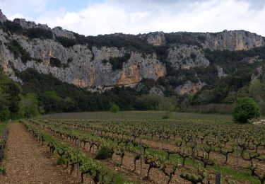
Trail Walking of 18.8 km to be discovered at Auvergne-Rhône-Alpes, Ardèche, Vallon-Pont-d'Arc. This trail is proposed by nadd73.
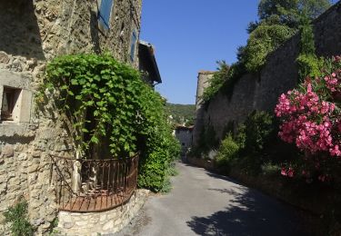
Description

Départ de Chames.
Les kilomètres sont faux car j'ai fait du stop pour revenir et j'ai oublié d'arrêter le GPS.Donc c'est plutôt 15 km.
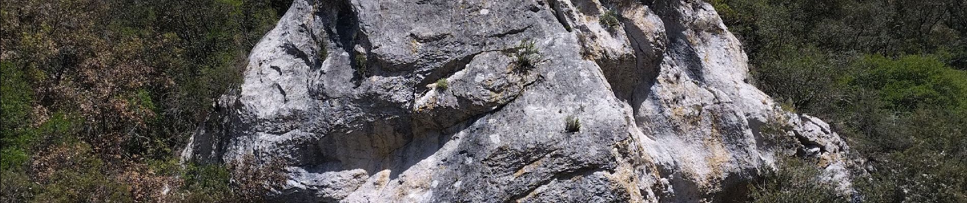
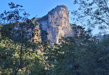
Sinon pas trop difficile à mon goût. Tous les endroits aériens sont sécurisés (1 échelle. Barre pour se tenir...) Pour traverser les guets c'est bien d'avoir des bâtons et pourquoi pas des chaussures d'eau !
Pleins d'endroits pour se baigner.

Elevation profile

Photos

Positioning

Country:
France
Region :
Auvergne-Rhône-Alpes
Department/Province :
Ardèche
Municipality :
Vallon-Pont-d'Arc
Location:
Unknown
Start:(UTM)
613779 ; 4914850 (31T) N.

Trails nearby

Trail Walking Vallon-Pont-d'Arc - vallon-chastelas - Photo
Walking
GUIDE
HERRY

Walking

Easy
(2)
Vallon-Pont-d'Arc, Auvergne-Rhône-Alpes, Ardèche, France
4.5 km | 6.2 km-effort
1h 19min
Yes
Trail Walking Saint-Remèze - Rapide de Gournier - Dolmen du Chanet - Photo
Walking
tracegps

Walking

Difficult
(3)
Saint-Remèze, Auvergne-Rhône-Alpes, Ardèche, France
5.9 km | 9.4 km-effort
2h 30min
Yes
Trail Mountain bike Vallon-Pont-d'Arc - SityTrail - 2433385 - vtt-vallon-pont-arc-xpont-romain-et-dolmen-25-km - Photo
Mountain bike
GUIDE
pascalou73

Mountain bike

Difficult
Vallon-Pont-d'Arc, Auvergne-Rhône-Alpes, Ardèche, France
24 km | 33 km-effort
Unknown
No
Trail Mountain bike Vallon-Pont-d'Arc - vallon pont arc au col de la cize - Photo
Mountain bike
GUIDE
pascalou73

Mountain bike

Difficult
Vallon-Pont-d'Arc, Auvergne-Rhône-Alpes, Ardèche, France
27 km | 36 km-effort
Unknown
No
Trail Mountain bike Vallon-Pont-d'Arc - VTT des bois des bruyères - Photo
Mountain bike
GUIDE
pascalou73

Mountain bike

Medium
(1)
Vallon-Pont-d'Arc, Auvergne-Rhône-Alpes, Ardèche, France
15.5 km | 20 km-effort
1h 21min
No
Trail Walking Vallon-Pont-d'Arc - 07_Pont_d'Arc_14km515 - Photo
Walking
SyMA

Walking

Medium
Vallon-Pont-d'Arc, Auvergne-Rhône-Alpes, Ardèche, France
14.4 km | 21 km-effort
5h 7min
Yes
Trail Walking Labastide-de-Virac - les gorges de l'Ardèche  - Photo
Walking
loca.yves

Walking

Medium
Labastide-de-Virac, Auvergne-Rhône-Alpes, Ardèche, France
8.9 km | 14.1 km-effort
5h 14min
Yes
Trail Road bike Vallon-Pont-d'Arc - 2023-05-30_20h05m07_corniches_de_lardeche-16881544-1685463110-624 - Photo
Road bike
GuySimonin

Road bike

Very difficult
(1)
Vallon-Pont-d'Arc, Auvergne-Rhône-Alpes, Ardèche, France
74 km | 92 km-effort
5h 35min
Yes
Trail Walking Vallon-Pont-d'Arc - grotte louoi et derocd - Photo
Walking
bymarc26

Walking

Difficult
Vallon-Pont-d'Arc, Auvergne-Rhône-Alpes, Ardèche, France
10.3 km | 16.4 km-effort
3h 37min
Yes


Close
My subscriptions