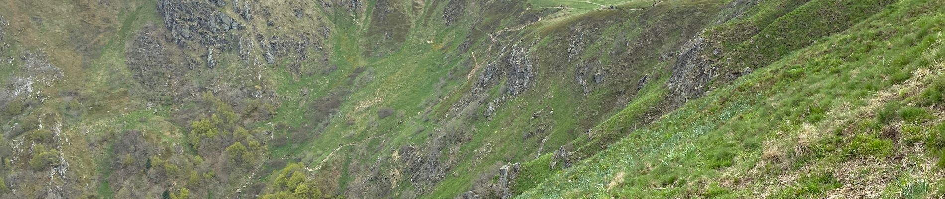
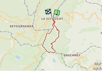
Sentier des roches

stef54
User

Length
10.1 km

Max alt
1355 m

Uphill gradient
479 m
Km-Effort
16.5 km

Min alt
947 m

Downhill gradient
482 m
Boucle
Yes
Creation date :
2023-05-18 09:46:47.0
Updated on :
2023-05-18 17:50:20.288
2h52
Difficulty : Difficult

FREE GPS app for hiking
 SityTrail
IGN / Geographical institutes
SityTrail Plus
The world is yours!
About
Trail Walking of 10.1 km to be discovered at Grand Est, Haut-Rhin, Stosswihr. This trail is proposed by stef54.
Photos


Positioning
Country:
France
Region :
Grand Est
Department/Province :
Haut-Rhin
Municipality :
Stosswihr
Location:
Unknown
Start:(Dec)
Start:(UTM)
352775 ; 5325262 (32U) N.
Comments