


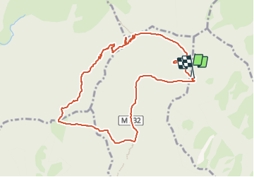

10.7 km | 17.9 km-effort


User


FREE GPS app for hiking
 SityTrail
IGN / Geographical institutes
SityTrail World
The world is yours!
Trail of 10.9 km to be discovered at Provence-Alpes-Côte d'Azur, Maritime Alps, Lantosque. This trail is proposed by rando1952.
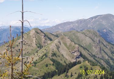
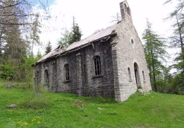
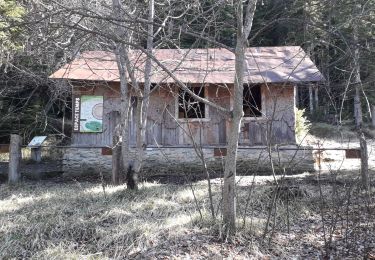
Montée au Tournairet depuis les Granges de la Brasque et retour par le col d\'Andrion

Walking

On foot
On foot

Walking
On foot
Walking
Walking

On foot
Walking