Trail On foot Saint-Quirin - Le Canceley, le Grand Rommelstein et le Rocher du Calice - Photo

Le Canceley, le Grand Rommelstein et le Rocher du Calice

© OpenStreetMap contributors
Length
Length
12.5 km
Max alt
Max alt
609 m
Uphill gradient
Uphill gradient
540 m
Km-Effort
Km-Effort  
19.7 km
Min alt
Min alt
335 m
Downhill gradient
Downhill gradient
542 m
Boucle
Boucle
Yes
Creation date :
2023-06-17 18:07:30.54
Updated on :
2023-06-18 16:36:32.488

(0 Reviews)

On foot
On foot
4h29
Difficulty : Easy

Scan this QR Code to open this trail in the SityTrail application

FREE GPS app for hiking

Logo SityTrail SityTrail

IGN / Geographical institutes

Download SityTrail from the App Store Download SityTrail from Google Play

Logo SityTrail SityTrail World

The world is yours!

Download SityTrail from the App Store Download SityTrail from Google Play Download SityTrail on Huawei AppGallery

About

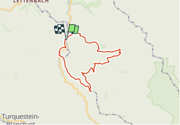
Trail On foot of 12.5 km to be discovered at Grand Est, Moselle, Saint-Quirin. This trail is proposed by Mich&Agnès.

Description

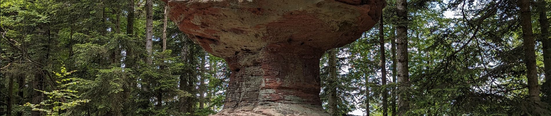
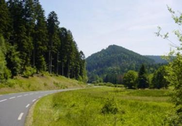
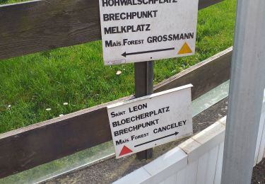
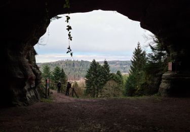
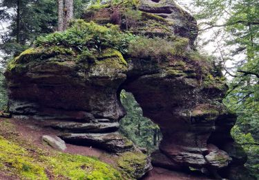
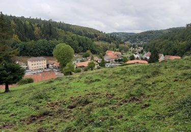
Balade sympathique qui démarre le long de la Sarre rouge, puis monte dans la forêt vers le Canceley et redescend pour traverser le ruisseau de la vallée d'Abreschwiller (bon endroit pour la pause les pieds dans l'eau fraîche). On repart vers le Rommelstein (belle montée surtout après manger :( ) . Enfin nous finissons cette randonnée quasiment entièrement ombragée par le rocher surprenant du Calice pour replonger au départ (là les jambes en prennent un coup)

Elevation profile

Photos

Points of interest

Point of interest Saint-Quirin - Parking Les Deux Rivières - Photo
Mich&Agnès
Point of interest Saint-Quirin - Pont sur la Sarre Rouge - Photo
Mich&Agnès
Point of interest Saint-Quirin - Chemin vers la passerelle et la D44 - Photo
Mich&Agnès
Point of interest Saint-Quirin - Patte d'oie - Photo
Mich&Agnès
SAINT-QUIRIN 
Point of interest Abreschviller - Panneau
Mich&Agnès
Point of interest Abreschviller - Rocher du Canceley - Photo
Mich&Agnès
ABRESCHVILLER 
Point of interest Abreschviller - Route forestière de la Gorge aux Sangliers - Photo
Mich&Agnès
Point of interest Abreschviller - Ancienne Maison Forestière du Canceley - Photo
Mich&Agnès
Point of interest Abreschviller - Croisement - Photo
Mich&Agnès
ABRESCHVILLER 
Point of interest Abreschviller - Place du Bon Dieu - Photo
Mich&Agnès
ABRESCHVILLER 
Point of interest Abreschviller - Rocher du Calice - Photo
Mich&Agnès
ABRESCHVILLER 
Point of interest Abreschviller - Route forestière - Photo
Mich&Agnès
ABRESCHVILLER 
Point of interest Saint-Quirin - Parking Les Deux Rivières - Photo
Mich&Agnès

Positioning

Country:
France
Region :
Grand Est
Department/Province :
Moselle
Municipality :
Saint-Quirin
Location:
Unknown
Start:(UTM)
361947 ; 5385364 (32U) N.

Trails nearby

Trail Cycle Abreschviller - Circuit du Donon - Photo
Cycle
tracegps

Cycle

Very difficult
(1)
Abreschviller, Grand Est, Moselle, France
52 km | 67 km-effort
3h 0min
Yes
Trail Mountain bike Abreschviller - sortie VTT du 01092019 Abreschwiller - Photo
Mountain bike
GUIDE
fabwin

Mountain bike

Difficult
Abreschviller, Grand Est, Moselle, France
33 km | 45 km-effort
2h 42min
Yes
Trail Walking Abreschviller - Circulaire de la Roche du Diable - Abreschviller - Photo
Walking
xtislair

Walking

Difficult
(1)
Abreschviller, Grand Est, Moselle, France
10.1 km | 14.7 km-effort
3h 20min
Yes
Trail Walking Saint-Quirin - St Quirin et ses 6 roses - Photo
Walking
Bart2015

Walking

Very difficult
Saint-Quirin, Grand Est, Moselle, France
18.7 km | 25 km-effort
5h 41min
Yes
Trail Walking Walscheid - walscheid club vosgien - Photo
Walking
Dorlene.mehl

Walking

Medium
Walscheid, Grand Est, Moselle, France
16.2 km | 22 km-effort
4h 17min
Yes
Trail Walking Walscheid - 2022-03-13 09:09 - Photo
Walking
nfranche

Walking

Very difficult
Walscheid, Grand Est, Moselle, France
16.4 km | 23 km-effort
5h 16min
Yes
Trail Walking Abreschviller - 20210909_rando_MCA_Abreschwiller_Walscheid - Photo
Walking
nfranche

Walking

Very difficult
Abreschviller, Grand Est, Moselle, France
15.6 km | 24 km-effort
5h 23min
Yes
Trail Walking Saint-Quirin - st Quirin  - Photo
Walking
JJG54

Walking

Medium
Saint-Quirin, Grand Est, Moselle, France
9.9 km | 13.8 km-effort
2h 26min
No
Trail Mountain bike Abreschviller - VTT Abreshwiller 01/09/19 circuit N° 1 avec Fabrice - Photo
Mountain bike
vathi54

Mountain bike

Difficult
Abreschviller, Grand Est, Moselle, France
33 km | 45 km-effort
3h 27min
Yes


Close
My subscriptions