Trail Walking Storckensohn - Storckensohn Gazon Vert - Photo

Storckensohn Gazon Vert

 helmut68
helmut68

User

© OpenStreetMap contributors
Length
Length
13 km
Max alt
Max alt
956 m
Uphill gradient
Uphill gradient
592 m
Km-Effort
Km-Effort  
21 km
Min alt
Min alt
482 m
Downhill gradient
Downhill gradient
591 m
Boucle
Boucle
Yes
Creation date :
2023-06-25 08:57:15.654
Updated on :
2023-07-09 09:21:06.648

(0 Reviews)

Walking
Walking
4h40
Difficulty : Difficult

Scan this QR Code to open this trail in the SityTrail application

FREE GPS app for hiking

Logo SityTrail SityTrail

IGN / Geographical institutes

Download SityTrail from the App Store Download SityTrail from Google Play

Logo SityTrail SityTrail World

The world is yours!

Download SityTrail from the App Store Download SityTrail from Google Play Download SityTrail on Huawei AppGallery

About

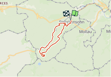
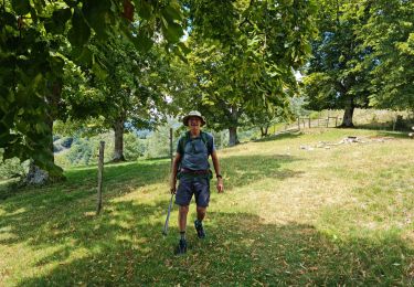
Trail Walking of 13 km to be discovered at Grand Est, Haut-Rhin, Storckensohn. This trail is proposed by helmut68.

Description

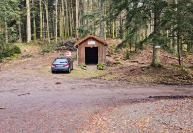
Très belle randonnée au départ et arrivée au centre du Torrent à Storckensohn près d'Urbès . Boucle en empruntant les sentiers balisés  " triangle Jaune " pour l'aller et " rectangle rouge blanc rouge " au retour  ( au départ comme pour l'arrivée le balisage est commun " rectangle rouge blanc rouge ).
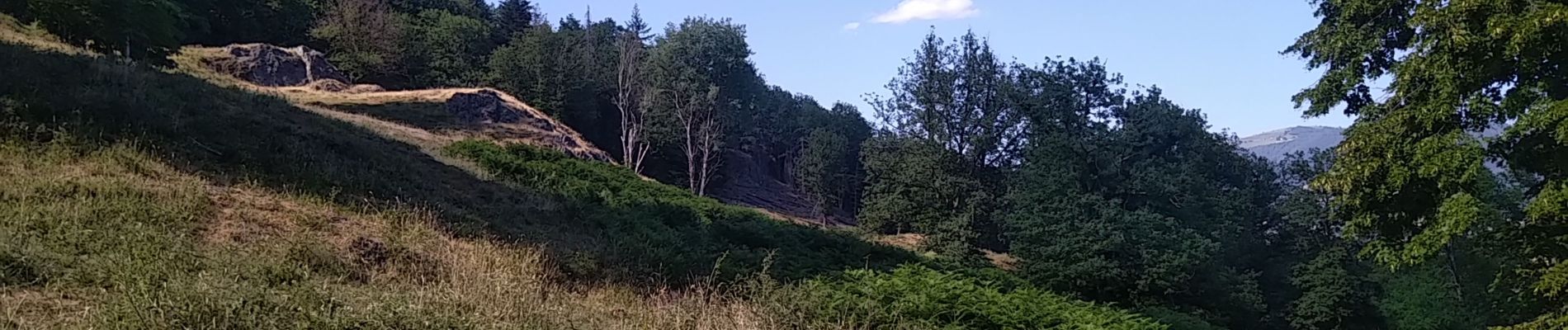
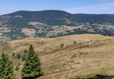
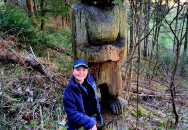
Parcours essentiellement en forêt  , à l'abri du soleil , qui présente de supers points de vue sur la vallée de la Thur ,  le Grand Ballon , le Treh ....etc.
Pique nique possible à la Ferme du Gazon Vert ( barbecue, fontaine , abri ...) ou se restaurer , un peu plus loin , à la ferme auberge du Gazon Vert ( fermée le lundi ) .
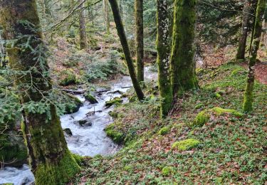
Pour le retour une belle cascade vous attend le  long d'une descente en zigzag , puis  le ruisseau du Gazon Vert vous accompagne à travers la forêt avec son bruit paisible
et éventuellement vous  rafraîchir ....
Alors à vos chaussures

Elevation profile

Photos

29 photos in total. Please click on a photo to see them all in the gallery.

Positioning

Country:
France
Region :
Grand Est
Department/Province :
Haut-Rhin
Municipality :
Storckensohn
Location:
Unknown
Start:(UTM)
347274 ; 5304903 (32T) N.

Trails nearby

Trail Walking Bussang - Col de Bussang - Rouge Gazon - Séchenat - Photo
Walking
VacheKiri67

Walking

Difficult
(1)
Bussang, Grand Est, Vosges, France
15 km | 24 km-effort
6h 0min
No
Trail Walking Storckensohn - lac des perches marchettes - Photo
Walking
lacote

Walking

Medium
(1)
Storckensohn, Grand Est, Haut-Rhin, France
11.9 km | 20 km-effort
4h 8min
Yes
Trail Walking Storckensohn - 2022-07-16 Marche Auberge Gazon Vert Chapelle des Ves - Photo
Walking
GUIDE
holtzv

Walking

Very difficult
Storckensohn, Grand Est, Haut-Rhin, France
21 km | 37 km-effort
6h 11min
No
Trail Walking Oderen - 6146369-Chapelle St Nicolas 2 - Photo
Walking

Walking

Medium
(1)
Oderen, Grand Est, Haut-Rhin, France
10.9 km | 17.9 km-effort
3h 41min
Yes
Trail Walking Oderen - trek alsacien (1ère étape) - Photo
Walking
Godasses et Grosses Pattes

Walking

Medium
Oderen, Grand Est, Haut-Rhin, France
9.2 km | 18.1 km-effort
4h 0min
No
Trail Walking Ventron - Rando des Marcheurs..22/02/2024... - Photo
Walking
boubou68

Walking

Very difficult
Ventron, Grand Est, Vosges, France
19.5 km | 31 km-effort
5h 4min
Yes
Trail Walking Ventron - Rando les Marcheurs..Col d'Oderen.18 km..715m D+/- - Photo
Walking
boubou68

Walking

Very difficult
Ventron, Grand Est, Vosges, France
18.6 km | 28 km-effort
4h 38min
Yes
Trail Walking Ranspach - Rando des Marcheurs 20/07/2023 - Photo
Walking
boubou68

Walking

Very difficult
Ranspach, Grand Est, Haut-Rhin, France
23 km | 38 km-effort
5h 31min
Yes
Trail Walking Oderen - Trek alsacien (2ème boucle, Odin) - Photo
Walking
Godasses et Grosses Pattes

Walking

Medium
Oderen, Grand Est, Haut-Rhin, France
8.5 km | 12.9 km-effort
2h 56min
Yes


Close
My subscriptions