Trail Walking La Motte-en-Champsaur - Jas de Jartier - Photo
 Marco05
Marco05

User

© OpenStreetMap contributors
Length
Length
13.7 km
Max alt
Max alt
1873 m
Uphill gradient
Uphill gradient
747 m
Km-Effort
Km-Effort  
24 km
Min alt
Min alt
1223 m
Downhill gradient
Downhill gradient
749 m
Boucle
Boucle
Yes
Creation date :
2023-07-15 18:13:49.545
Updated on :
2023-07-18 12:20:00.677

(0 Reviews)

Walking
Walking
5h22
Difficulty : Difficult

Scan this QR Code to open this trail in the SityTrail application

FREE GPS app for hiking

Logo SityTrail SityTrail

IGN / Geographical institutes

Download SityTrail from the App Store Download SityTrail from Google Play

Logo SityTrail SityTrail World

The world is yours!

Download SityTrail from the App Store Download SityTrail from Google Play Download SityTrail on Huawei AppGallery

About

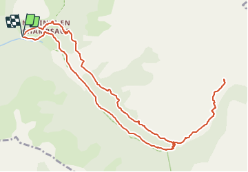
Trail Walking of 13.7 km to be discovered at Provence-Alpes-Côte d'Azur, Hautes-Alpes, La Motte-en-Champsaur. This trail is proposed by Marco05.

Description

Randonnée au départ de Molines en Champsaur.
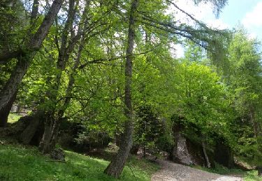
Traverser le village pour prendre le chemine qui domine la piste de retour.
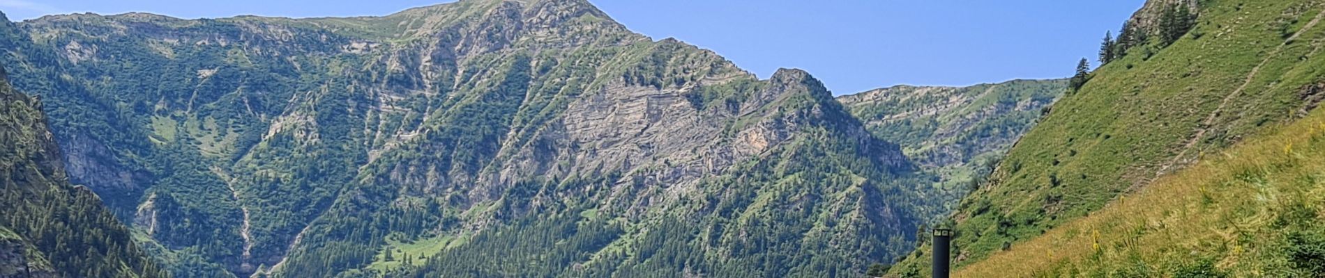
Quelques passages exposés, mais en passant avec précaution il n'y a aucun risque.
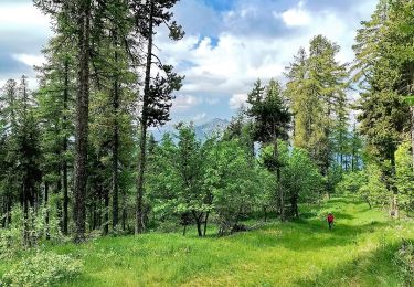
Le final monte un peu raide, surtout après la sortie de la forêt.
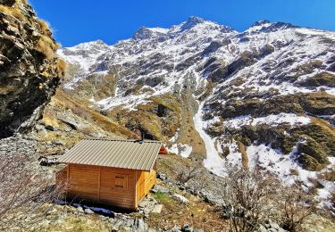
A la descente, passer les ruines de Sellon, puis prendre le chemin à gauche 500m plus loin.
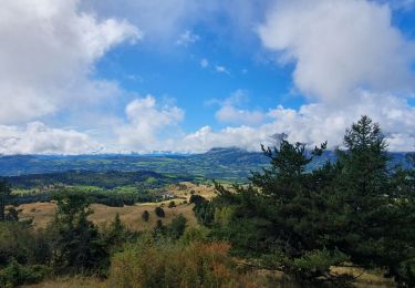
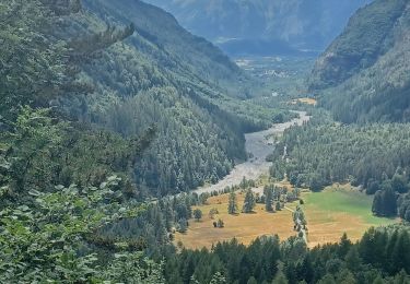
Après la descente sur le torrent, suivre la piste jusqu'au village.
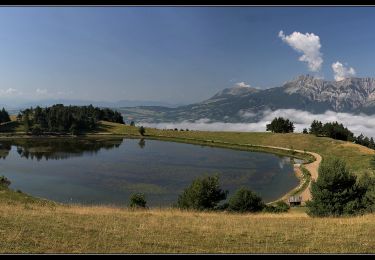
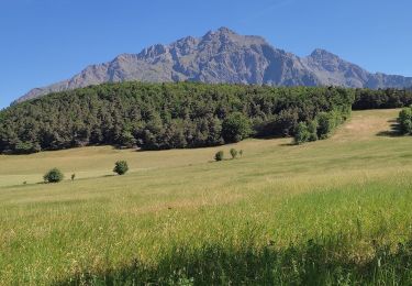
Cette randonnée reste très physique.

Elevation profile

Photos

Positioning

Country:
France
Region :
Provence-Alpes-Côte d'Azur
Department/Province :
Hautes-Alpes
Municipality :
La Motte-en-Champsaur
Location:
Unknown
Start:(UTM)
271785 ; 4958775 (32T) N.

Trails nearby

Trail Walking Saint-Bonnet-en-Champsaur - Les infournas  -  Lac des Barbeyroux 22/09/23 - Photo
Walking
GUIDE
R@ph

Walking

Difficult
Saint-Bonnet-en-Champsaur, Provence-Alpes-Côte d'Azur, Hautes-Alpes, France
10.1 km | 16 km-effort
3h 38min
Yes
Trail Walking Saint-Bonnet-en-Champsaur - Col de l'Escalier - Photo
Walking
flip38

Walking

Medium
Saint-Bonnet-en-Champsaur, Provence-Alpes-Côte d'Azur, Hautes-Alpes, France
19.6 km | 33 km-effort
6h 3min
Yes
Trail Walking Saint-Jacques-en-Valgodemard - 20190409_Lac de Roaffan - Photo
Walking
PapouBertrand

Walking

Easy
Saint-Jacques-en-Valgodemard, Provence-Alpes-Côte d'Azur, Hautes-Alpes, France
12.3 km | 18 km-effort
5h 47min
Yes
Trail Walking La Motte-en-Champsaur - 01-06-14 Chemin de Ronde de Molines - Photo
Walking
Dervalmarc

Walking

Medium
La Motte-en-Champsaur, Provence-Alpes-Côte d'Azur, Hautes-Alpes, France
17.5 km | 31 km-effort
6h 22min
No
Trail Walking La Motte-en-Champsaur - 2023 Molines en champsaur - Photo
Walking
mimimartine

Walking

Very difficult
La Motte-en-Champsaur, Provence-Alpes-Côte d'Azur, Hautes-Alpes, France
12.2 km | 19.3 km-effort
4h 0min
No
Trail Walking La Motte-en-Champsaur - La Motte le Col de la Blache  - Photo
Walking
sereton

Walking

Medium
La Motte-en-Champsaur, Provence-Alpes-Côte d'Azur, Hautes-Alpes, France
12.8 km | 19.3 km-effort
4h 8min
Yes
Trail Walking La Motte-en-Champsaur - jas de jartier - Photo
Walking
gibello

Walking

Medium
La Motte-en-Champsaur, Provence-Alpes-Côte d'Azur, Hautes-Alpes, France
12.8 km | 23 km-effort
5h 25min
Yes
Trail Walking La Motte-en-Champsaur - Jas de Jartier - Photo
Walking
PapouBertrand

Walking

Very difficult
La Motte-en-Champsaur, Provence-Alpes-Côte d'Azur, Hautes-Alpes, France
13.6 km | 24 km-effort
5h 30min
Yes
Trail Walking Saint-Bonnet-en-Champsaur - Crête Le Barry Via Les Infournas Hauts - Photo
Walking
PapouBertrand

Walking

Very difficult
Saint-Bonnet-en-Champsaur, Provence-Alpes-Côte d'Azur, Hautes-Alpes, France
14.1 km | 26 km-effort
5h 47min
No


Close
My subscriptions