


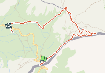

13.1 km | 23 km-effort

User


FREE GPS app for hiking
 SityTrail
IGN / Geographical institutes
SityTrail World
The world is yours!
Trail Walking of 5.9 km to be discovered at Piemont, Cuneo, Pontechianale. This trail is proposed by Youcef Atallah.
Départ Col Agnel


Walking

Walking

Walking

Walking

Walking

Walking
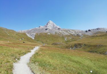
Walking
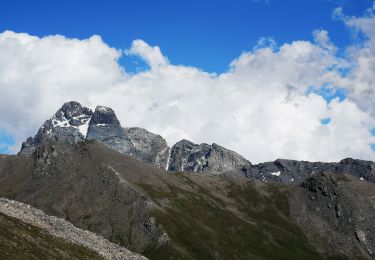
Walking

Walking